
Fitxer:Earth map with 180th meridian.jpg

Mida d'aquesta previsualització: 800 × 400 píxels. Altres resolucions: 320 × 160 píxels | 640 × 320 píxels | 1.024 × 512 píxels.
Fitxer original (1.024 × 512 píxels, mida del fitxer: 102 Ko, tipus MIME: image/jpeg)
| Aquest fitxer i la informació mostrada a continuació provenen del dipòsit multimèdia lliure Wikimedia Commons. |
Resum
| Descripció |
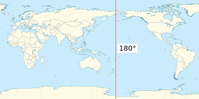
English: Earth map centered on the Pacific ocean, with the 180th meridian highlighted. |
| Data | |
| Font | Treball propi |
| Autor | Edgar Bonet |
| Altres versions | Earthmap1000x500compac.jpg: File:Earthmap1000x500compac.jpg |
This file is derived from Earthmap1000x500compac.jpg (public domain). I rotated the map to have the cut through the Atlantic ocean, instead of the Pacific, then added the 180th meridian.
Llicència
Jo, el titular dels drets d'autor d'aquest treball, el public sota la següent llicència:
| L'ús d'aquest fitxer és regulat sota les condicions de Creative Commons de CC0 1.0 lliurament al domini públic universal. | |
| La persona que ha associat un treball amb aquest document ha dedicat l'obra domini públic, renunciant en tot el món a tots els seus drets de d'autor i a tots els drets legals relacionats que tenia en l'obra, en la mesura permesa per la llei. Podeu copiar, modificar, distribuir i modificar l'obra, fins i tot amb fins comercials, tot sense demanar permís.
|
Historial del fitxer
Cliqueu una data/hora per veure el fitxer tal com era aleshores.
| Data/hora | Miniatura | Dimensions | Usuari/a | Comentari | |
|---|---|---|---|---|---|
| actual | 14:35, 20 jul 2020 | | 1.024 × 512 (102 Ko) | Edgar.bonet | Re-created on the basis of {{F|World location map (equirectangular 180).svg}}, as the previous version was based on a file mislabeled as public domain. |
Ús del fitxer
La pàgina següent utilitza aquest fitxer:
Ús global del fitxer
Utilització d'aquest fitxer en altres wikis:
- Utilització a ar.wikipedia.org
- Utilització a bn.wikipedia.org
- Utilització a el.wikipedia.org
- Utilització a en.wikipedia.org
- Utilització a en.wiktionary.org
- Utilització a he.wikipedia.org
- Utilització a hi.wikipedia.org
- Utilització a ja.wikipedia.org
- Utilització a ko.wikipedia.org
- Utilització a ms.wikipedia.org
- Utilització a th.wikipedia.org
- Utilització a www.wikidata.org