
Fitxer:Gr-triple-occupation.png
Mida d'aquesta previsualització: 588 × 600 píxels. Altres resolucions: 235 × 240 píxels | 471 × 480 píxels | 899 × 917 píxels.
Fitxer original (899 × 917 píxels, mida del fitxer: 82 Ko, tipus MIME: image/png)
| Aquest fitxer i la informació mostrada a continuació provenen del dipòsit multimèdia lliure Wikimedia Commons. |
| Descripció |
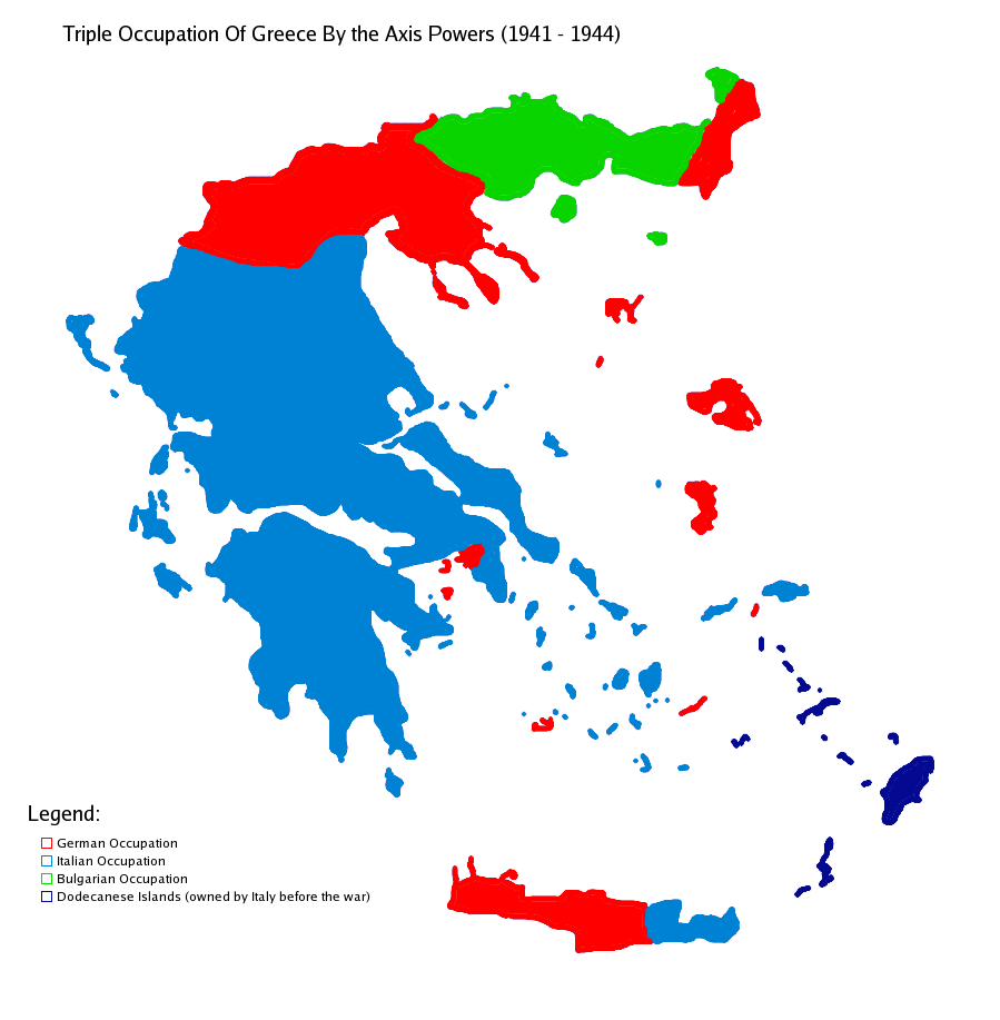
Map showning the zones of control of the three occupying powers in Greece during WW2, from 1941 to 1944. English: Map of Occupied Greece showing the German and Italian occupation zones on Crete.
Svenska: Axelmakternas ockupationszoner under andra världskriget: blått Italien, grönt Bulgarien och rött Tyskland
Türkçe: Üçlü işgâl sürecinde Yunanistan |
||||||||
| Data | |||||||||
| Font | Treball propi | ||||||||
| Autor | Michalis Famelis | ||||||||
| Permís (Com reutilitzar aquest fitxer) |
|
||||||||
| Altres versions |
Derivative works of this file: OcupaciónDeGreciaPorElEje.svg
[]
|


_-fr.png)


The image was created by me using another map as a template. This image was created using the Gimp.
Historial del fitxer
Cliqueu una data/hora per veure el fitxer tal com era aleshores.
| Data/hora | Miniatura | Dimensions | Usuari/a | Comentari | |
|---|---|---|---|---|---|
| actual | 17:48, 22 maig 2006 | | 899 × 917 (82 Ko) | GhePeU | slightly reworked image |
| 18:06, 2 jul 2005 |  | 899 × 917 (107 Ko) | Michalis Famelis | Map showning the zones of control of the three occupying powers in Greece during WW2, from 1941 to 1944. The image was created by me using another map as a template. This image was created using the Gimp. {{GFDL}} |
Ús del fitxer
La pàgina següent utilitza aquest fitxer:
Ús global del fitxer
Utilització d'aquest fitxer en altres wikis:
- Utilització a de.wikipedia.org
- Utilització a en.wikipedia.org
- Utilització a hu.wikipedia.org
- Utilització a ku.wikipedia.org
- Utilització a lv.wikipedia.org
- Utilització a ro.wikipedia.org
- Utilització a sv.wikipedia.org
- Utilització a tr.wikipedia.org
- Utilització a zh.wikipedia.org