
Fitxer:Isle of Thanet.jpg
Mida d'aquesta previsualització: 782 × 600 píxels. Altres resolucions: 313 × 240 píxels | 626 × 480 píxels | 1.001 × 768 píxels | 1.168 × 896 píxels.
Fitxer original (1.168 × 896 píxels, mida del fitxer: 76 Ko, tipus MIME: image/jpeg)
| Aquest fitxer i la informació mostrada a continuació provenen del dipòsit multimèdia lliure Wikimedia Commons. |
Resum
| Descripció |
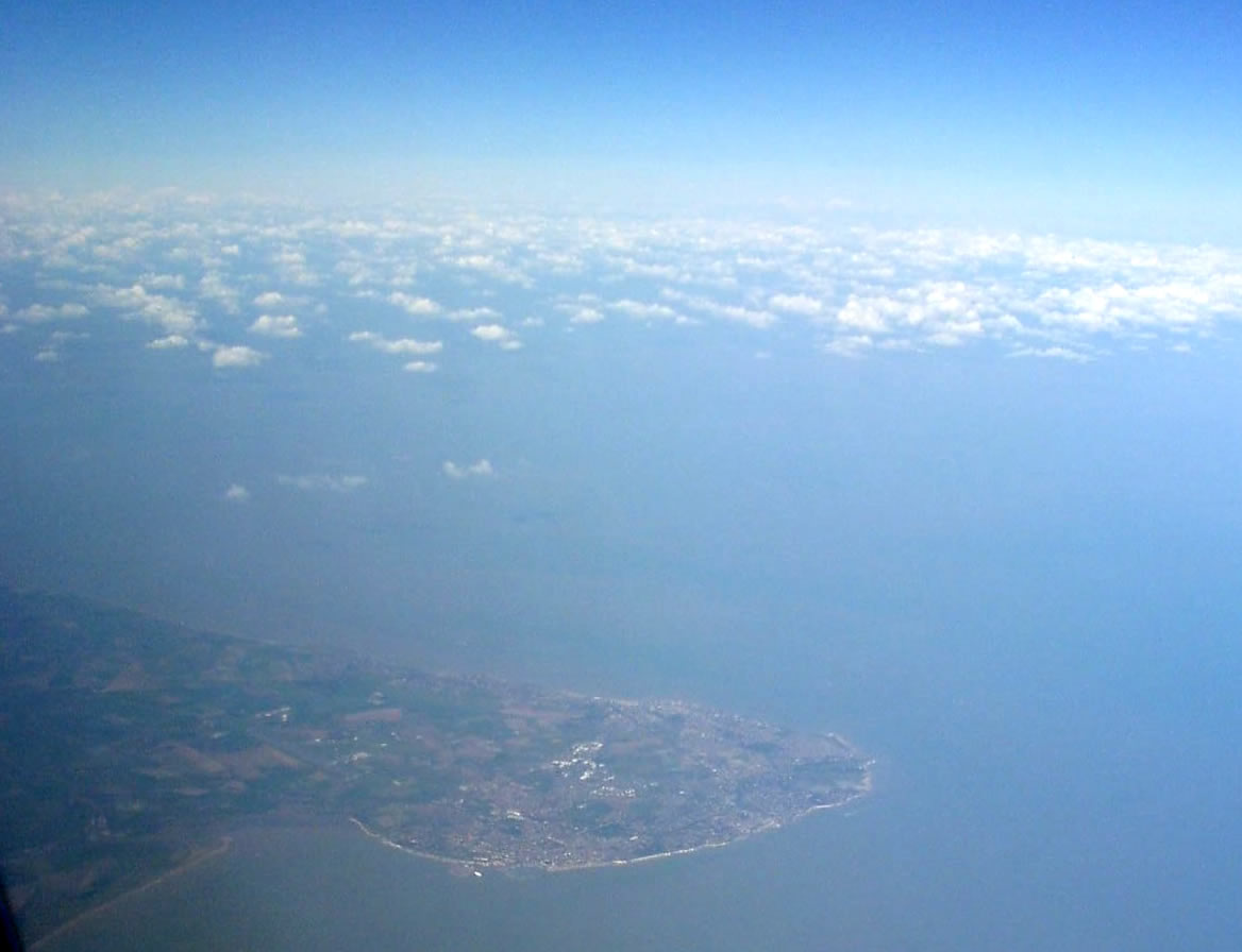
En route to Venice, I happened to look up from my book just as we were passing over Dover. It was a clear day, so I got this snap of Broadstairs and the rest of the Isle of Thanet (an island no longer). You wouldn't believe it from the photo, but it was so clear I was able to pick out individual boats in Ramsgate harbour. I'm not sure how many dozens of times I've flown out this way, but this is the first time that a window seat, the flight path, a book's break between chapters and a clear sky have combined to give me a view of my old home town from space. |
| Data | |
| Font | Isle of Thanet from space |
| Autor | Matt Boulton from London, England |
| Posició de la càmera | | Aquesta i altres imatges properes a: OpenStreetMap |
|---|
Llicència
Aquest fitxer està publicat sota la llicència de Creative Commons Reconeixement i Compartir Igual 2.0 Genèrica.
- Sou lliure de:
- compartir – copiar, distribuir i comunicar públicament l'obra
- adaptar – fer-ne obres derivades
- Amb les condicions següents:
- reconeixement – Heu de donar la informació adequada sobre l'autor, proporcionar un enllaç a la llicència i indicar si s'han realitzat canvis. Podeu fer-ho amb qualsevol mitjà raonable, però de cap manera no suggereixi que l'autor us dóna suport o aprova l'ús que en feu.
- compartir igual – Si modifiqueu, transformeu, o generareu amb el material, haureu de distribuir les vostres contribucions sota una llicència similar o una de compatible com l'original
| This image was originally posted to Flickr by Mafue at https://www.flickr.com/photos/51035822698@N01/419832550. It was reviewed on 10 d'octubre de 2007 by FlickreviewR and was confirmed to be licensed under the terms of the cc-by-sa-2.0. |
Historial del fitxer
Cliqueu una data/hora per veure el fitxer tal com era aleshores.
| Data/hora | Miniatura | Dimensions | Usuari/a | Comentari | |
|---|---|---|---|---|---|
| actual | 00:27, 10 oct 2007 | | 1.168 × 896 (76 Ko) | File Upload Bot (Magnus Manske) | {{Information |Description= En route to Venice, I happened to look up from my book just as we were passing over Dover. It was a clear day, so I got this snap of Broadstairs and the rest of the Isle of Thanet (an island no longer). You wouldn't believe it |
Ús del fitxer
La pàgina següent utilitza aquest fitxer:
Ús global del fitxer
Utilització d'aquest fitxer en altres wikis:
- Utilització a bg.wikipedia.org
- Utilització a cs.wikipedia.org
- Utilització a en.wikipedia.org
- Utilització a fr.wikipedia.org
- Utilització a nl.wikipedia.org
- Utilització a nn.wikipedia.org
- Utilització a no.wikipedia.org