
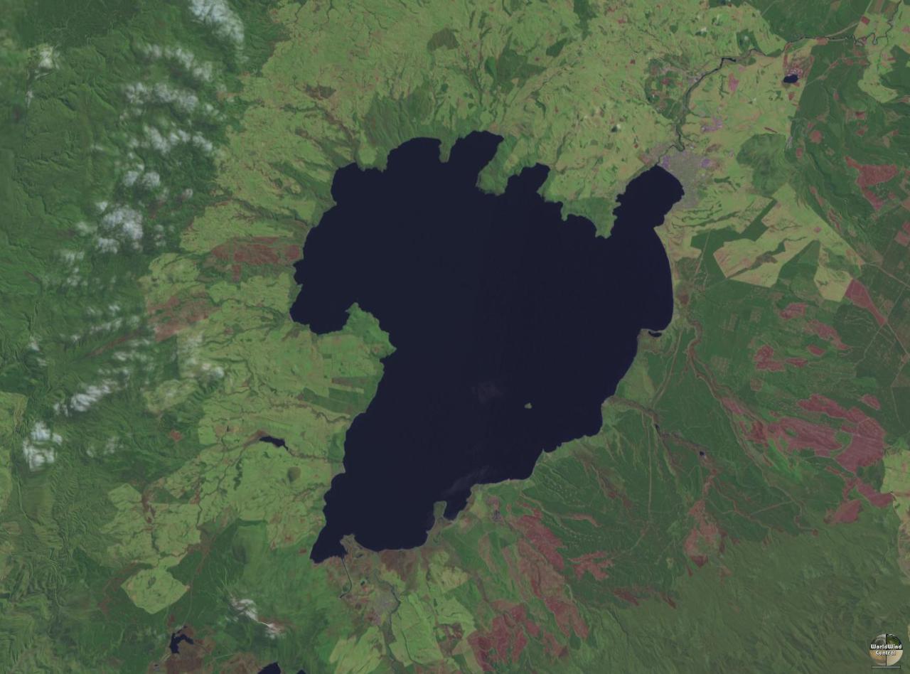
Fitxer:Lake taupo landsat.jpg
Mida d'aquesta previsualització: 800 × 593 píxels. Altres resolucions: 320 × 237 píxels | 640 × 474 píxels | 1.024 × 758 píxels | 1.280 × 948 píxels.
Fitxer original (1.280 × 948 píxels, mida del fitxer: 125 Ko, tipus MIME: image/jpeg)
| Aquest fitxer i la informació mostrada a continuació provenen del dipòsit multimèdia lliure Wikimedia Commons. |
| Descripció | ||||
| Data | 26 de març de 2005 (original upload date) | |||
| Font | Transferred from File:Lake taupo landsat.jpg (log) at English Wikipedia to Commons by Centic. The original uploader was John Fader at English Wikipedia. | |||
| Autor | NASA | |||
| Permís (Com reutilitzar aquest fitxer) |
|
|||
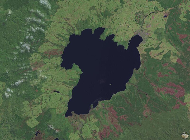
| Altres versions | Derivative works of this file: Lake Taupo landsat -square crop.jpg |

| Posició de la càmera | | Aquesta i altres imatges properes a: OpenStreetMap |
|---|
Historial del fitxer
Cliqueu una data/hora per veure el fitxer tal com era aleshores.
| Data/hora | Miniatura | Dimensions | Usuari/a | Comentari | |
|---|---|---|---|---|---|
| actual | 15:08, 27 jul 2005 | | 1.280 × 948 (125 Ko) | Centic | Lake Taupo showing some rock carvings from the 1970's. Photographed by Philo Vivero and placed into GFDL to help out Wikipedia. Moved from en-wiki, original edit-history: 08:46, 28 March 2004 . . PhiloVivero (56161 bytes) (Lake Taupo showing some rock c |
Ús del fitxer
Les 3 pàgines següents utilitzen aquest fitxer:
Ús global del fitxer
Utilització d'aquest fitxer en altres wikis:
- Utilització a ang.wikipedia.org
- Utilització a ar.wikipedia.org
- Utilització a az.wikipedia.org
- Utilització a bg.wikipedia.org
- Utilització a cs.wikipedia.org
- Utilització a de.wikipedia.org
- Utilització a de.wikivoyage.org
- Utilització a el.wikipedia.org
- Utilització a en.wikipedia.org
- Utilització a eo.wikipedia.org
- Utilització a es.wikipedia.org
- Utilització a et.wikipedia.org
- Utilització a eu.wikipedia.org
- Utilització a fi.wikipedia.org
- Utilització a fr.wikipedia.org
- Utilització a fr.wikivoyage.org
- Utilització a ga.wikipedia.org
- Utilització a gl.wikipedia.org
- Utilització a he.wikipedia.org
- Utilització a hi.wikipedia.org
- Utilització a hu.wikipedia.org
- Utilització a hy.wikipedia.org
- Utilització a it.wikipedia.org
Vegeu més usos globals d'aquest fitxer.