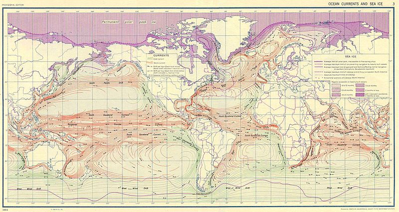
Fitxer:Ocean currents 1943.jpg

Mida d'aquesta previsualització: 800 × 426 píxels. Altres resolucions: 320 × 170 píxels | 640 × 341 píxels | 1.024 × 546 píxels | 1.280 × 682 píxels | 2.639 × 1.406 píxels.
Fitxer original (2.639 × 1.406 píxels, mida del fitxer: 5,14 Mo, tipus MIME: image/jpeg)
Historial del fitxer
Cliqueu una data/hora per veure el fitxer tal com era aleshores.
| Data/hora | Miniatura | Dimensions | Usuari/a | Comentari | |
|---|---|---|---|---|---|
| actual | 12:58, 6 set 2016 |  | 2.639 × 1.406 (5,14 Mo) | Dencey | new |
| 22:20, 31 març 2005 |  | 2.639 × 1.406 (582 Ko) | SEWilco | '''Ocean Currents and Sea Ice from Atlas of World Maps.''' United States Army Service Forces, Army Specialized Training Division. Army Service Forces Manual M-101. 1943 {{PD-PCL}} Source: http://www.lib.utexas.edu/maps/world_maps/ocean_currents_ |
Ús del fitxer
No hi ha pàgines que utilitzin aquest fitxer.
Ús global del fitxer
Utilització d'aquest fitxer en altres wikis:
- Utilització a bn.wikipedia.org
- Utilització a cs.wikipedia.org
- Utilització a de.wikipedia.org
- Utilització a en.wikipedia.org
- Utilització a eo.wikipedia.org
- Utilització a es.wikipedia.org
- Utilització a eu.wikipedia.org
- Utilització a fr.wikipedia.org
- Utilització a fr.wiktionary.org
- Utilització a hu.wikipedia.org
- Utilització a it.wikipedia.org
- Utilització a ja.wikipedia.org
- Utilització a lt.wikipedia.org
- Utilització a nn.wikipedia.org
- Utilització a oc.wikipedia.org
- Utilització a pt.wiktionary.org
- Utilització a sk.wikipedia.org
- Utilització a sl.wikipedia.org
- Utilització a sv.wikipedia.org
- Utilització a tr.wikipedia.org
- Utilització a vi.wikipedia.org
- Utilització a zh.wikipedia.org


