
Fitxer:Rome carthage 218.jpg

Mida d'aquesta previsualització: 800 × 594 píxels. Altres resolucions: 320 × 237 píxels | 640 × 475 píxels | 1.024 × 760 píxels | 1.108 × 822 píxels.
Fitxer original (1.108 × 822 píxels, mida del fitxer: 190 Ko, tipus MIME: image/jpeg)
| Aquest fitxer i la informació mostrada a continuació provenen del dipòsit multimèdia lliure Wikimedia Commons. |

|
File:Map of Rome and Carthage at the start of the Second Punic War.svg és una versió vectorial (SVG) d'aquest fitxer. En cas de ser millor, hauria de ser emprada en lloc d'aquesta imatge tramada.
File:Rome carthage 218.jpg → File:Map of Rome and Carthage at the start of the Second Punic War.svg
Per a més informació pel que fa als gràfics vectorials, llegiu la transició a SVG en Commons. També hi ha informació quant a la compatibilitat del MediaWiki amb les imatges SVG. |
 |
Resum
| Descripció |
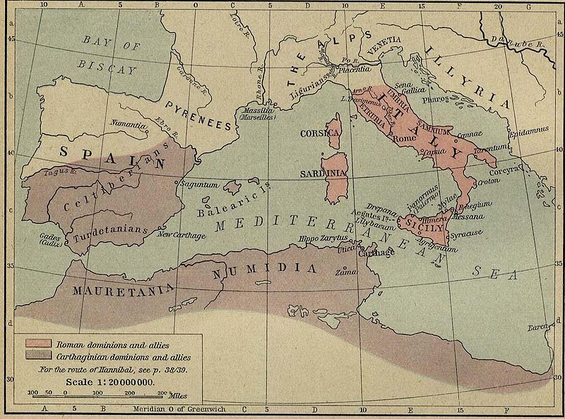
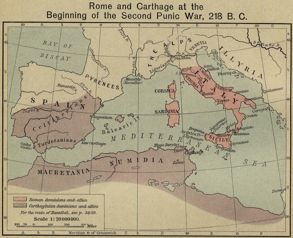
English: Rome and Carthage at the Beginning of the Second Punic War, 218 B.C. |
||||||||||||||||||||||
| Font |
|
||||||||||||||||||||||
| Autor |
|
||||||||||||||||||||||
| Permís (Com reutilitzar aquest fitxer) |
FAQ:
|
||||||||||||||||||||||
| Altres versions | Shepherd-c-032.jpg: Non-cropped image from the 1911 edition of the Historical Atlas | ||||||||||||||||||||||
Llicència
Aquest fitxer és en el domini públic en els Estats Units. Això és aplicable a obres dels EUA on el copyright ha expirat, sovint perquè la seva primera publicació va ser abans de l'1 de gener de 1929. Vegeu aquesta pàgina per a més detalls.
|
 | |
 |
Podria ser que aquesta imatge no estigui en el domini públic fora dels Estats Units (especialment on no s'aplica la regla del termini més curt per obres dels EUA, com Canada, la Xina continental (no a Hong Kong ni Macau), Alemanya, Mèxic i Suïssa). El creador i any de publicació són informació essencial i s'han de proporcionar. Vegeu Viquipèdia:Drets d'autor per a més detalls.
|
derivative works
Derivative works of this file:
- Map of Rome and Carthage at the start of the First Punic War.svg
- Map of Rome and Carthage at the start of the Second Punic War.svg
- Rome carthage 218-ar.png
|
|
File:Map of Rome and Carthage at the start of the Second Punic War.svg és una versió vectorial (SVG) d'aquest fitxer. En cas de ser millor, hauria de ser emprada en lloc d'aquesta imatge tramada.
File:Rome carthage 218.jpg → File:Map of Rome and Carthage at the start of the Second Punic War.svg
Per a més informació pel que fa als gràfics vectorials, llegiu la transició a SVG en Commons. També hi ha informació quant a la compatibilitat del MediaWiki amb les imatges SVG. |
|
Historial del fitxer
Cliqueu una data/hora per veure el fitxer tal com era aleshores.
| Data/hora | Miniatura | Dimensions | Usuari/a | Comentari | |
|---|---|---|---|---|---|
| actual | 17:51, 17 nov 2006 | | 1.108 × 822 (190 Ko) | Rune X2 | == Summary == '''Rome and Carthage at the Beginning of the Second Punic War, 218 B.C.''' Scan from "Historical Atlas" by William R. Shepherd, New York, Henry Holt and Company, 1923. Original image at the [http://www.lib.utexas.edu/maps/ Perry-Castañed |
Ús del fitxer
No hi ha pàgines que utilitzin aquest fitxer.
Ús global del fitxer
Utilització d'aquest fitxer en altres wikis:
- Utilització a en.wikipedia.org
- Utilització a es.wikipedia.org
- Utilització a he.wikipedia.org
- Utilització a sr.wikipedia.org
- Utilització a sv.wikipedia.org
- Utilització a zh.wikipedia.org