
Fitxer:Gulf of Thailand.svg

Mida d'aquesta previsualització PNG del fitxer SVG: 488 × 479 píxels. Altres resolucions: 245 × 240 píxels | 489 × 480 píxels | 782 × 768 píxels | 1.043 × 1.024 píxels | 2.086 × 2.048 píxels.
Fitxer original (fitxer SVG, nominalment 488 × 479 píxels, mida del fitxer: 387 Ko)
| Aquest fitxer i la informació mostrada a continuació provenen del dipòsit multimèdia lliure Wikimedia Commons. |
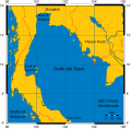
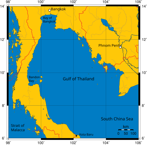
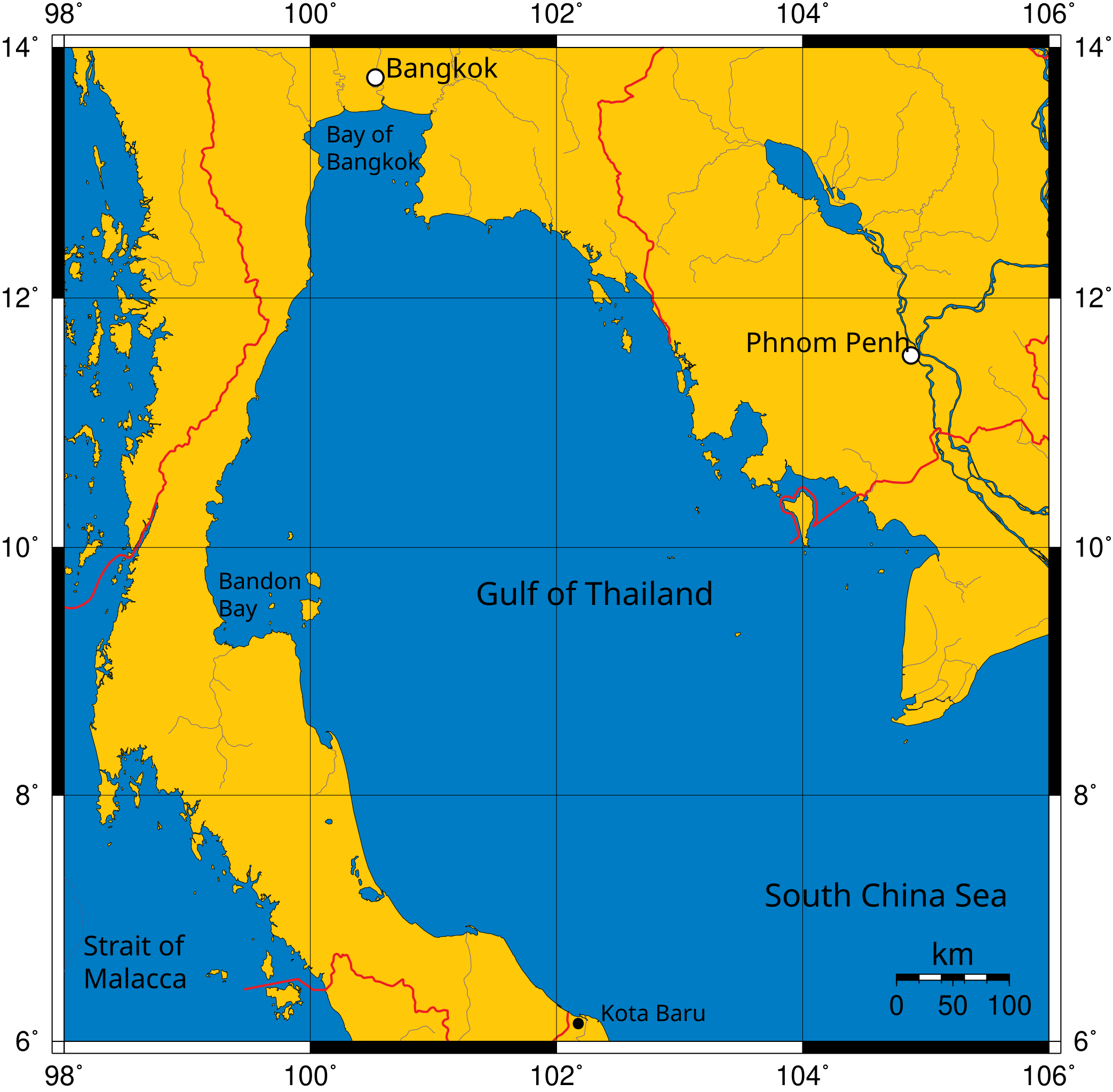
Mercator projection of Gulf of Thailand.
Public Domain map created by Online Map Creation:
http://www.aquarius.geomar.de/omc/omc_intro.html archive copy at the Wayback Machine
Modified by me (User:Feydey).
Other versions
-
 Italiano
 -
 Македонски
 -
 বাংলা
বাংলা


| S'ha alliberat aquesta obra al domini públic pel seu autor User:Feydey. Això s'aplica a tot el món. En alguns països això pot no ser legalment possible, en tal cas: User:Feydey concedeix a tothom el dret d'usar aquesta obra per a qualsevol propòsit, sense cap condició llevat d'aquelles requerides per la llei.
|
derivative works
Derivative works of this file:
Historial del fitxer
Cliqueu una data/hora per veure el fitxer tal com era aleshores.
| Data/hora | Miniatura | Dimensions | Usuari/a | Comentari | |
|---|---|---|---|---|---|
| actual | 13:06, 16 gen 2020 | | 488 × 479 (387 Ko) | Paul 012 | The label "Andaman Sea" was in the area officially defined as the Strait of Malacca. |
| 19:53, 27 juny 2007 |  | 488 × 479 (387 Ko) | Feydey | Mercator projection of Gulf of Thailand. Public Domain map created by Online Map Creation: http://www.aquarius.geomar.de/omc/omc_intro.html Modified by me (User:Feydey). {{PD}} Category:Maps of seas |
Ús del fitxer
La pàgina següent utilitza aquest fitxer:
Ús global del fitxer
Utilització d'aquest fitxer en altres wikis:
- Utilització a af.wikipedia.org
- Utilització a azb.wikipedia.org
- Utilització a br.wikipedia.org
- Utilització a ckb.wikipedia.org
- Utilització a da.wikipedia.org
- Utilització a de.wikinews.org
- Utilització a el.wikipedia.org
- Utilització a en.wikipedia.org
- Utilització a fa.wikipedia.org
- Utilització a fi.wikipedia.org
- Utilització a fr.wikipedia.org
- Utilització a hi.wikipedia.org
- Utilització a hu.wikipedia.org
- Utilització a ilo.wikipedia.org
- Utilització a io.wikipedia.org
- Utilització a ja.wikipedia.org
- Utilització a ka.wikipedia.org
- Utilització a km.wikipedia.org
- Utilització a ko.wikipedia.org
- Utilització a la.wikipedia.org
- Utilització a lo.wikipedia.org
- Utilització a min.wikipedia.org
- Utilització a ml.wikipedia.org
- Utilització a mr.wikipedia.org
- Utilització a ms.wikipedia.org
- Utilització a mt.wikipedia.org
- Utilització a my.wikipedia.org
- Utilització a nn.wikipedia.org
- Utilització a pa.wikipedia.org
- Utilització a pnb.wikipedia.org
- Utilització a simple.wikipedia.org
- Utilització a sr.wikipedia.org
- Utilització a sv.wikipedia.org
- Utilització a sw.wikipedia.org
- Utilització a ta.wikipedia.org
- Utilització a th.wikipedia.org
- Utilització a tl.wikipedia.org
- Utilització a tr.wikipedia.org
- Utilització a uk.wikipedia.org
- Utilització a ur.wikipedia.org
- Utilització a vi.wikipedia.org
- Utilització a war.wikipedia.org
- Utilització a xmf.wikipedia.org
Vegeu més usos globals d'aquest fitxer.