Fitxer:Map of Leusden.png

El contingut de la pàgina no s'admet en altres llengües.
De la Viquipèdia, l'enciclopèdia lliure

Map_of_Leusden.png(540 × 390 píxels, mida del fitxer: 7 Ko, tipus MIME: image/png)

Descripció a Commons

Resum

Descripció
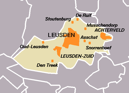
English: Map of Leusden, the Netherlands, created by User:Eugene van der Pijll
Data entre 2001 i 2006
date QS:P,+2001-00-00T00:00:00Z/8,P1319,+2001-00-00T00:00:00Z/9,P1326,+2006-00-00T00:00:00Z/9
Font Centraal Bureau voor de Statistiek
Autor Centraal Bureau voor de Statistiek

Llicència

© El titular dels drets d'autor d'aquest arxiu, Centraal Bureau voor de Statistiek, permet que qualsevol pugui usar-lo per a qualsevol propòsit, sempre que el titular dels drets d'autor sigui reconegut correctament. La redistribució, les obres derivades, l'ús comercial, i qualsevol altre ús està permès.

VRT Wikimedia

El permís per utilitzar aquesta obra ha estat verificat i arxivat en el sistema VRT de Wikimedia.
Està disponible en el ticket #2007041210008226 per a usuaris registrats a VRTS. Per confirmar el permís, podeu posar-vos en contacte amb algú amb accés a VRTS.

Enllaç al ticket: https://ticket.wikimedia.org/otrs/index.pl?Action=AgentTicketZoom&TicketNumber=2007041210008226
Find other files from the same ticket: SDC query (SPARQL)

This image is (in part or entirely) based on geographical data from Statistics Netherlands (Centraal Bureau voor de Statistiek). Digital geometry files in ESRI format can be downloaded from their website [1].

In particular, boundary data of statistical districts is based on either the Wijk- en buurtkaart 2005, or the Wijk- en buurtkaart 2003 ("CBS/TOPgrenzen"). Data on localities (bevolkingskernen) are from the publication Bevolkingskernen in Nederland 2001.

Conditions of use (in Dutch):

  • Bij visualisering van gegevens met behulp van het digitale bestand Wijk- en buurtkaart 2005 dient te worden vermeld:
Bron: © 2006, Centraal Bureau voor de Statistiek / Topografische Dienst Kadaster
  • Bij visualisering van gegevens met behulp van het digitale bestand CBS/TOPgrenzen dient te worden vermeld:
Grenzen ondergrond: © 2003, Centraal Bureau voor de Statistiek/Topografische Dienst Kadaster
  • Bij visualisering van gegevens met behulp van het digitale bestand "Bevolkingskernen 2001" dient te worden vermeld:
Bron: © 2005, Centraal Bureau voor de Statistiek

Unless otherwise specified, data on waterways and lakes are from the public domain Digital Chart of the World.

Llegendes

Afegeix una explicació d'una línia del que representa aquest fitxer

Elements representats en aquest fitxer

representa l'entitat

Historial del fitxer

Cliqueu una data/hora per veure el fitxer tal com era aleshores.

Data/horaMiniaturaDimensionsUsuari/aComentari
actual01:46, 6 gen 2006Miniatura per a la versió del 01:46, 6 gen 2006540 × 390 (7 Ko)Eugene van der PijllMap of Leusden, the Netherlands, created by User:Eugene van der Pijll. Based on boundary data: (c) 2003, Centraal Bureau voor de Statistiek/Topografische Dienst Kadaster. Category:Maps of Utrecht

La pàgina següent utilitza aquest fitxer:

Ús global del fitxer

Utilització d'aquest fitxer en altres wikis:

  • Utilització a de.wikipedia.org
  • Utilització a en.wikipedia.org
  • Utilització a eo.wikipedia.org
  • Utilització a es.wikipedia.org
  • Utilització a fr.wikipedia.org
  • Utilització a nl.wikipedia.org
  • Utilització a sl.wikipedia.org
  • Utilització a vi.wikipedia.org