
Fitxer:Zayyanids1300-1500.png

Mida d'aquesta previsualització: 800 × 490 píxels. Altres resolucions: 320 × 196 píxels | 640 × 392 píxels | 858 × 526 píxels.
Fitxer original (858 × 526 píxels, mida del fitxer: 18 Ko, tipus MIME: image/png)
| Aquest fitxer i la informació mostrada a continuació provenen del dipòsit multimèdia lliure Wikimedia Commons. |
Resum
| Descripció |
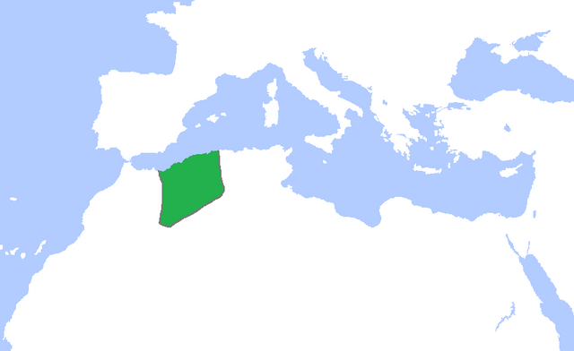
English: Locator map of the lands ruled by the Zayyanid/Abdalwadid dynasty, c. 1300-1500.
(Partially based on Atlas of World History (2007) - The World 1200-1300, 1300-1400, 1400-1500 map) |
| Data | |
| Font | Treball propi |
| Autor | Gabagool |
Llicència
Jo, el titular dels drets d'autor d'aquest treball, el public sota la següent llicència:
Aquest fitxer està subjecte a la llicència de Creative Commons Reconeixement 3.0 No adaptada.
- Sou lliure de:
- compartir – copiar, distribuir i comunicar públicament l'obra
- adaptar – fer-ne obres derivades
- Amb les condicions següents:
- reconeixement – Heu de donar la informació adequada sobre l'autor, proporcionar un enllaç a la llicència i indicar si s'han realitzat canvis. Podeu fer-ho amb qualsevol mitjà raonable, però de cap manera no suggereixi que l'autor us dóna suport o aprova l'ús que en feu.
Historial del fitxer
Cliqueu una data/hora per veure el fitxer tal com era aleshores.
| Data/hora | Miniatura | Dimensions | Usuari/a | Comentari | |
|---|---|---|---|---|---|
| actual | 02:24, 7 nov 2022 | | 858 × 526 (18 Ko) | Mouath14 | Editor claims this is a fixed version, no where does it indicate this map is wrong. please refrain from making further changes to this map. |
| 23:23, 27 oct 2022 |  | 2.417 × 1.674 (136 Ko) | Takiva | fix | |
| 17:14, 24 maig 2009 |  | 858 × 526 (18 Ko) | Gabagool | cropped | |
| 17:55, 8 maig 2009 |  | 1.481 × 902 (46 Ko) | Gabagool | {{Information |Description={{en|1=Locator map of the lands ruled by the Zayyanid/Abdalwadid dynasty, c. 1300-1500. (Partially based on ''Atlas of World History'' (2007) - The World 1200-1300, 1300-1400, 1400-1500 map)}} |Source=Own work by uploader |Aut |
Ús del fitxer
No hi ha pàgines que utilitzin aquest fitxer.
Ús global del fitxer
Utilització d'aquest fitxer en altres wikis:
- Utilització a ar.wikipedia.org
- Utilització a de.wikipedia.org
- Utilització a en.wikipedia.org
- Utilització a eu.wikipedia.org
- Utilització a fr.wikipedia.org
- Utilització a ja.wikipedia.org
- Utilització a oc.wikipedia.org
- Utilització a pt.wikipedia.org
- Utilització a ru.wikipedia.org
- Utilització a sk.wikipedia.org
- Utilització a sl.wikipedia.org
- Utilització a tr.wikipedia.org
- Utilització a uk.wikipedia.org
- Utilització a www.wikidata.org