
Fitxer:Greece in 1210.svg

Mida d'aquesta previsualització PNG del fitxer SVG: 800 × 456 píxels. Altres resolucions: 320 × 182 píxels | 640 × 365 píxels | 1.024 × 584 píxels | 1.280 × 730 píxels | 2.560 × 1.460 píxels | 3.508 × 2.000 píxels.
Fitxer original (fitxer SVG, nominalment 3.508 × 2.000 píxels, mida del fitxer: 1,12 Mo)
| Aquest fitxer i la informació mostrada a continuació provenen del dipòsit multimèdia lliure Wikimedia Commons. |
Resum
| Descripció |
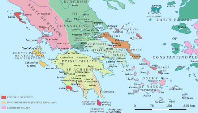
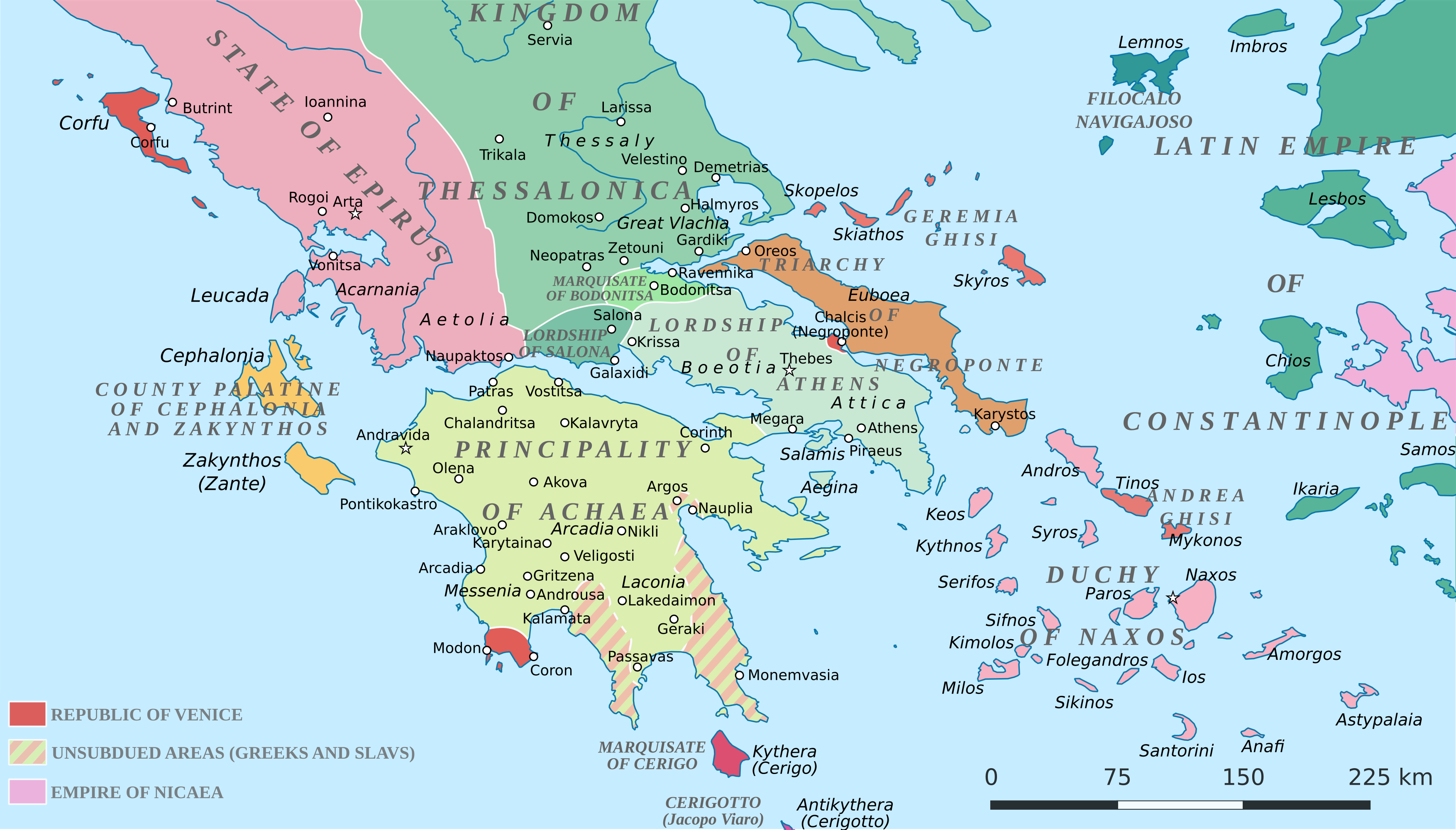
English: Political map of southern Greece in c. 1210, after the establishment of the Crusader states following the Fourth Crusade. |
| Data | |
| Font |
SVG base from File:Greece in 1210V1.svg; based on the original political map by William Miller (1908), with changes and corrections to account for newer scholarship:
|
| Autor | Cplakidas |
| Altres versions |
|


Llicència
Jo, el titular dels drets d'autor d'aquest treball, el public sota la següent llicència:
This file is licensed under the Creative Commons Attribution-Share Alike 4.0 International license.
- Sou lliure de:
- compartir – copiar, distribuir i comunicar públicament l'obra
- adaptar – fer-ne obres derivades
- Amb les condicions següents:
- reconeixement – Heu de donar la informació adequada sobre l'autor, proporcionar un enllaç a la llicència i indicar si s'han realitzat canvis. Podeu fer-ho amb qualsevol mitjà raonable, però de cap manera no suggereixi que l'autor us dóna suport o aprova l'ús que en feu.
- compartir igual – Si modifiqueu, transformeu, o generareu amb el material, haureu de distribuir les vostres contribucions sota una llicència similar o una de compatible com l'original
Historial del fitxer
Cliqueu una data/hora per veure el fitxer tal com era aleshores.
| Data/hora | Miniatura | Dimensions | Usuari/a | Comentari | |
|---|---|---|---|---|---|
| actual | 21:59, 23 juny 2017 | | 3.508 × 2.000 (1,12 Mo) | Cplakidas | fixed three names to paths |
| 14:08, 11 abr 2017 |  | 3.508 × 2.000 (1,1 Mo) | Cplakidas | colour changes | |
| 13:48, 11 abr 2017 |  | 3.508 × 2.000 (1,11 Mo) | Cplakidas | tweak around Coron | |
| 12:39, 11 feb 2017 |  | 3.508 × 2.000 (1,11 Mo) | Cplakidas | tweaks in Negroponte, unsubdued areas | |
| 19:57, 8 feb 2017 |  | 3.508 × 2.000 (1,11 Mo) | Cplakidas | tweaking the Morea | |
| 15:40, 8 feb 2017 |  | 3.508 × 2.000 (1,11 Mo) | Cplakidas | slight tweaks | |
| 15:14, 8 feb 2017 |  | 3.508 × 2.000 (1,11 Mo) | Cplakidas | User created page with UploadWizard |
Ús del fitxer
Les 3 pàgines següents utilitzen aquest fitxer:
Ús global del fitxer
Utilització d'aquest fitxer en altres wikis:
- Utilització a ar.wikipedia.org
- Utilització a az.wikipedia.org
- Utilització a bg.wikipedia.org
- Utilització a da.wikipedia.org
- Utilització a de.wikipedia.org
- Utilització a el.wikipedia.org
- Utilització a en.wikipedia.org
- Utilització a eo.wikipedia.org
- Utilització a eu.wikipedia.org
- Utilització a fa.wikipedia.org
- Utilització a fr.wikipedia.org
- Utilització a gl.wikipedia.org
- Utilització a hr.wikipedia.org
- Utilització a id.wikipedia.org
- Utilització a it.wikipedia.org
- Utilització a ja.wikipedia.org
- Utilització a ko.wikipedia.org
- Utilització a ro.wikipedia.org
- Utilització a ru.wikipedia.org
- Utilització a sk.wikipedia.org
- Utilització a sr.wikipedia.org
- Utilització a tr.wikipedia.org
Vegeu més usos globals d'aquest fitxer.