
Fitxer:Kalmykia 1720.jpg
Mida d'aquesta previsualització: 800 × 560 píxels. Altres resolucions: 320 × 224 píxels | 640 × 448 píxels | 1.024 × 717 píxels | 1.280 × 897 píxels | 2.004 × 1.404 píxels.
Fitxer original (2.004 × 1.404 píxels, mida del fitxer: 1 Mo, tipus MIME: image/jpeg)
| Aquest fitxer i la informació mostrada a continuació provenen del dipòsit multimèdia lliure Wikimedia Commons. |
Resum
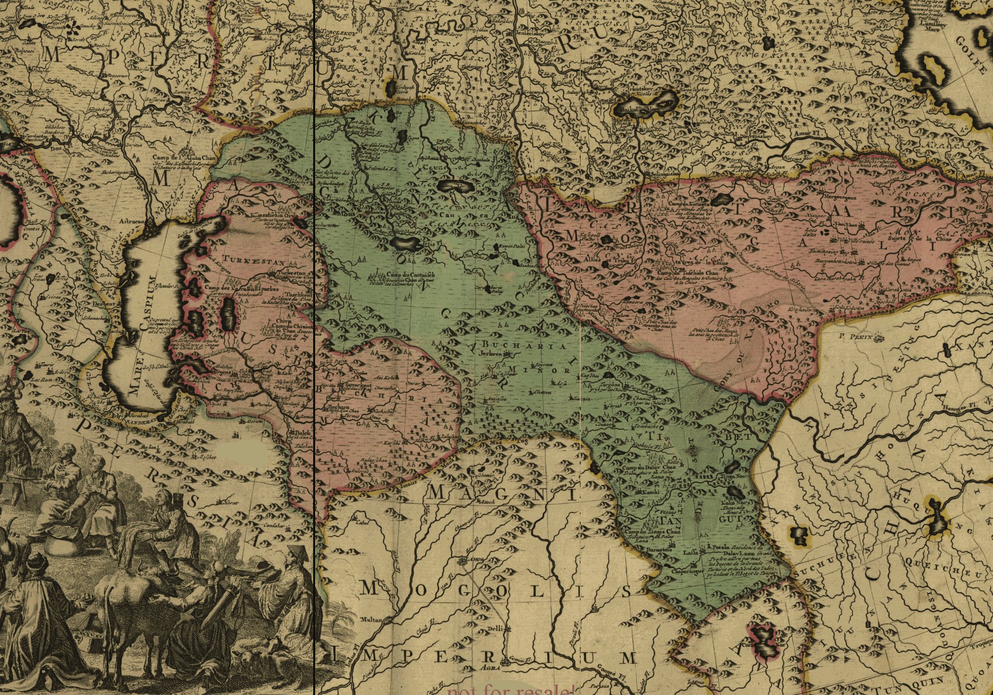
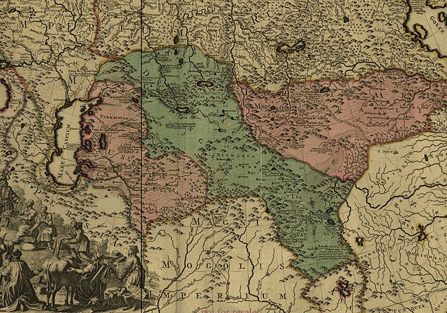
English: This is a fragment of the map of Russian Empire of Peter The Great. This map was created by Sweden POWs approximately in 1725. Among other neighbouring states shown Empire of Kalmyks, the Dzungaria (highlighted by green color).
Français : Fragment de la carte de l'Empire Russe de Pierre le Grand. Cette carte à été crée par l'armée suédoises approximativement en 1725. Parmi le s autres autres états voisins sont affichés l'Empire des Kalmouls ou Dzoungarie (colorié en vert).
Llicència
|
Això és una mera fotografia d'una obra d'art bidimensional en domini públic. L'obra d'art original és en domini públic pel següent motiu:
La posició oficial de la Fundació Wikimedia és que «les reproduccions fidels d'obres d'art bidimensionals de domini públic són en domini públic».
Per tant, aquesta reproducció fotogràfica també es considera en domini públic als Estats Units. En altres jurisdiccions la reutilització d'aquest contingut pot estar restringida; vegeu Reuse of PD-Art photographs per a més informació. | ||||
Historial del fitxer
Cliqueu una data/hora per veure el fitxer tal com era aleshores.
| Data/hora | Miniatura | Dimensions | Usuari/a | Comentari | |
|---|---|---|---|---|---|
| actual | 05:30, 8 abr 2006 | | 2.004 × 1.404 (1 Mo) | Calmouk | This is a fragment of the map of Russian Empire of Peter The Great. This map was created by Sweden POWs approximately in 1725. |
Ús del fitxer
Les 3 pàgines següents utilitzen aquest fitxer:
Ús global del fitxer
Utilització d'aquest fitxer en altres wikis:
- Utilització a ar.wikipedia.org
- Utilització a azb.wikipedia.org
- Utilització a cs.wikipedia.org
- Utilització a de.wikipedia.org
- Utilització a en.wikipedia.org
- Utilització a fr.wikipedia.org
- Utilització a he.wikipedia.org
- Utilització a id.wikipedia.org
- Utilització a it.wikipedia.org
- Utilització a ky.wikipedia.org
- Utilització a mn.wikipedia.org
- Utilització a nl.wikipedia.org
- Utilització a oc.wikipedia.org
- Utilització a pt.wikipedia.org
- Utilització a ru.wikipedia.org
- Utilització a sr.wikipedia.org
- Utilització a tt.wikipedia.org
- Utilització a uk.wikipedia.org
- Utilització a uz.wikipedia.org
- Utilització a vi.wikipedia.org
- Utilització a xal.wikipedia.org