
Fitxer:Liverpool Bay.png

Mida d'aquesta previsualització: 800 × 593 píxels. Altres resolucions: 320 × 237 píxels | 640 × 474 píxels | 1.024 × 759 píxels | 1.278 × 947 píxels.
Fitxer original (1.278 × 947 píxels, mida del fitxer: 1,84 Mo, tipus MIME: image/png)
| Aquest fitxer i la informació mostrada a continuació provenen del dipòsit multimèdia lliure Wikimedia Commons. |
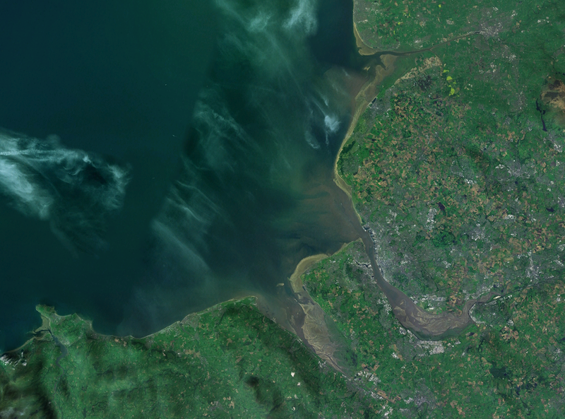
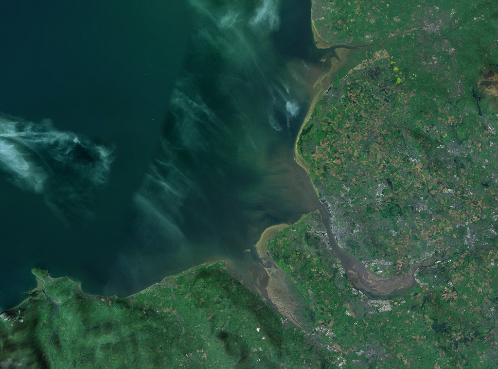
| Descripció | A satellite photograph of Liverpool Bay, showing the West Lancashire Coastal Plain River Ribble at the top (north), the River Alt (hardly visble), River Mersey (centre) River Dee and the River Conwy in the south west. |
| Data | |
| Font | NASA World Wind - Landsat 7 |
| Autor | Smurrayinchester |
| This image is in the public domain because it is a screenshot from NASA’s globe software World Wind using a public domain layer, such as Blue Marble, MODIS, Landsat, SRTM, USGS or GLOBE.
|
 |
| Posició de la càmera | | Aquesta i altres imatges properes a: OpenStreetMap |
|---|

Historial del fitxer
Cliqueu una data/hora per veure el fitxer tal com era aleshores.
| Data/hora | Miniatura | Dimensions | Usuari/a | Comentari | |
|---|---|---|---|---|---|
| actual | 16:06, 28 abr 2007 | | 1.278 × 947 (1,84 Mo) | Smurrayinchester | {{Information |Description=A satellite photograph of w:Liverpool Bay, showing the Rivers Dee and Mersey (centre), the River Alt (north) and the River Conwy (west). |Source=NASA World Wind - Landsat 7 |Date=28 April 2007 |Author= [[User:Smurrayincheste |
Ús del fitxer
La pàgina següent utilitza aquest fitxer:
Ús global del fitxer
Utilització d'aquest fitxer en altres wikis:
- Utilització a ceb.wikipedia.org
- Utilització a cy.wikipedia.org
- Utilització a en.wikipedia.org
- Utilització a eo.wikipedia.org
- Utilització a es.wikipedia.org
- Utilització a et.wikipedia.org
- Utilització a it.wikipedia.org
- Utilització a nl.wikipedia.org
- Utilització a nn.wikipedia.org
- Utilització a no.wikipedia.org
- Utilització a pl.wikipedia.org
- Utilització a pl.wiktionary.org
- Utilització a ru.wikipedia.org
- Utilització a sr.wikipedia.org
- Utilització a sv.wikipedia.org
- Utilització a vi.wikipedia.org
- Utilització a www.wikidata.org