
Fitxer:Strait tiran 83.jpg
Mida d'aquesta previsualització: 472 × 599 píxels. Altres resolucions: 189 × 240 píxels | 378 × 480 píxels | 996 × 1.264 píxels.
Fitxer original (996 × 1.264 píxels, mida del fitxer: 198 Ko, tipus MIME: image/jpeg)
| Aquest fitxer i la informació mostrada a continuació provenen del dipòsit multimèdia lliure Wikimedia Commons. |
| Descripció |
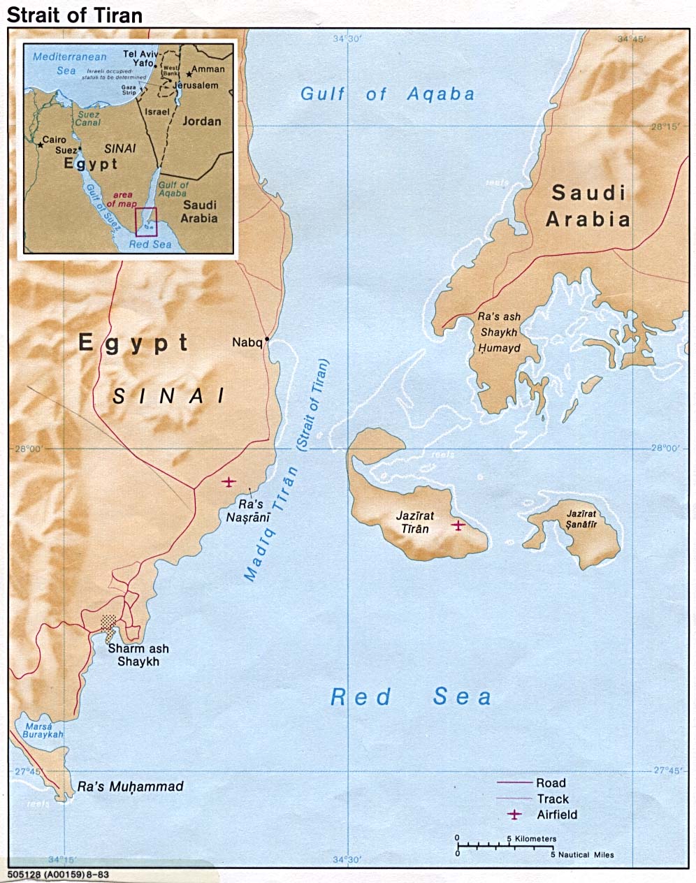
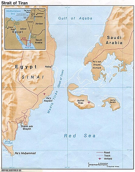
English: Strait of Tiran between Gulf of Aqaba and Red Sea |
|||
| Data | ||||
| Font | http://www.lib.utexas.edu/maps/middle_east_and_asia/strait_tiran_83.jpg | |||
| Autor | "The following maps were produced by the U.S. Central Intelligence Agency, unless otherwise indicated." | |||
| Permís (Com reutilitzar aquest fitxer) |
|
|||
| Altres versions | العربيَّة |

Historial del fitxer
Cliqueu una data/hora per veure el fitxer tal com era aleshores.
| Data/hora | Miniatura | Dimensions | Usuari/a | Comentari | |
|---|---|---|---|---|---|
| actual | 18:46, 23 feb 2007 | | 996 × 1.264 (198 Ko) | Monack | {{Information |Description = {{en|Strait of Tiran between Gulf of Aqaba and Red Sea}} |Source = http://www.lib.utexas.edu/maps/middle_east_and_asia/strait_tiran_83.jpg |Date = 1983 |Author = "The following maps were produced by the U.S. Central Intellige |
Ús del fitxer
Les 2 pàgines següents utilitzen aquest fitxer:
Ús global del fitxer
Utilització d'aquest fitxer en altres wikis:
- Utilització a af.wikipedia.org
- Utilització a als.wikipedia.org
- Utilització a ar.wikipedia.org
- Utilització a arz.wikipedia.org
- Utilització a az.wikipedia.org
- Utilització a be.wikipedia.org
- Utilització a bg.wikipedia.org
- Utilització a bn.wikipedia.org
- Utilització a cs.wikipedia.org
- Utilització a da.wikipedia.org
- Utilització a de.wikipedia.org
- Utilització a el.wikipedia.org
- Utilització a en.wikipedia.org
- Utilització a en.wikivoyage.org
- Utilització a es.wikipedia.org
- Utilització a eu.wikipedia.org
- Utilització a fa.wikipedia.org
- Utilització a fi.wikipedia.org
- Utilització a fr.wikipedia.org
- Utilització a he.wikipedia.org
- Utilització a hy.wikipedia.org
- Utilització a id.wikipedia.org
- Utilització a it.wikipedia.org
Vegeu més usos globals d'aquest fitxer.