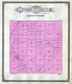
Fitxer:Township 135N Range 76W Emmons County 1916.png

El contingut de la pàgina no s'admet en altres llengües.
De la Viquipèdia, l'enciclopèdia lliure

Fitxer original(2.256 × 2.653 píxels, mida del fitxer: 5,59 Mo, tipus MIME: image/png)

Descripció a Commons

Resum

Descripció
English: Image of p.32 of the atlas, showing Township 135, Range 76W
Data
Font Standard Atlas of Emmons County, North Dakota, 1916
Autor George A. Ogle & Co. Publishers and Engravers

Llicència

Public domain
This work is in the public domain in the United States because it was published (or registered with the U.S. Copyright Office) before January 1, 1929.

Public domain works must be out of copyright in both the United States and in the source country of the work in order to be hosted on the Commons. If the work is not a U.S. work, the file must have an additional copyright tag indicating the copyright status in the source country.
Note: This tag should not be used for sound recordings.PD-1923Public domain in the United States//commons.wikimedia.org/wiki/File:Township_135N_Range_76W_Emmons_County_1916.png

Llegendes

Afegeix una explicació d'una línia del que representa aquest fitxer

Elements representats en aquest fitxer

representa l'entitat

1 gen 1916Gregorià

Historial del fitxer

Cliqueu una data/hora per veure el fitxer tal com era aleshores.

Data/horaMiniaturaDimensionsUsuari/aComentari
actual22:13, 25 juny 2021Miniatura per a la versió del 22:13, 25 juny 20212.256 × 2.653 (5,59 Mo)BurnhamandrootUploaded a work by George A. Ogle & Co. Publishers and Engravers from Standard Atlas of Emmons County, North Dakota, 1916 with UploadWizard

La pàgina següent utilitza aquest fitxer:

Ús global del fitxer

Utilització d'aquest fitxer en altres wikis:

Metadades