
Fitxer:Uruk Archaeological site at Warka.jpg

Mida d'aquesta previsualització: 800 × 531 píxels. Altres resolucions: 320 × 213 píxels | 640 × 425 píxels | 1.024 × 680 píxels | 1.280 × 850 píxels | 3.000 × 1.993 píxels.
Fitxer original (3.000 × 1.993 píxels, mida del fitxer: 4,55 Mo, tipus MIME: image/jpeg)
| Aquest fitxer i la informació mostrada a continuació provenen del dipòsit multimèdia lliure Wikimedia Commons. |
Resum
| Descripció |
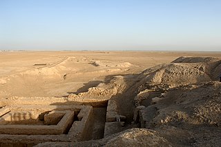
English: Uruk Archaeological site at Warka |
| Data | |
| Font | |
| Autor | SAC Andy Holmes (RAF) |

| Posició de la càmera | | Aquesta i altres imatges properes a: OpenStreetMap |
|---|
Llicència
_(St_Edwards_Crown).svg)
|
This file is licensed under the Open Government Licence version 1.0 (OGL v1.0).
|
|---|---|
| Reconeixement:Photo: SAC Andy Holmes (RAF)/MOD | |
|
You are free to:
See the Open Government Licence page on Meta-Wiki for more information.
|

|
This file was generated using equipment from Wikimedia UK, a Wikimedia local chapter.
|
Historial del fitxer
Cliqueu una data/hora per veure el fitxer tal com era aleshores.
| Data/hora | Miniatura | Dimensions | Usuari/a | Comentari | |
|---|---|---|---|---|---|
| actual | 21:37, 7 ago 2020 | | 3.000 × 1.993 (4,55 Mo) | पाटलिपुत्र | Uploaded a work by SAC Andy Holmes (RAF) from {{extracted from|File:Uruk Archaealogical site at Warka, Iraq MOD 45156521.jpg}} with UploadWizard |
Ús del fitxer
La pàgina següent utilitza aquest fitxer:
Ús global del fitxer
Utilització d'aquest fitxer en altres wikis:
- Utilització a af.wikipedia.org
- Utilització a be.wikipedia.org
- Utilització a bg.wikipedia.org
- Utilització a diq.wikipedia.org
- Utilització a el.wikipedia.org
- Utilització a en.wikipedia.org
- Utilització a en.wikivoyage.org
- Utilització a eo.wikipedia.org
- Utilització a fi.wikipedia.org
- Utilització a he.wikipedia.org
- Utilització a hu.wikipedia.org
- Utilització a it.wikipedia.org
- Utilització a ku.wikipedia.org
- Utilització a pt.wikipedia.org
- Utilització a ro.wikipedia.org
- Utilització a ru.wikipedia.org
- Utilització a sh.wikipedia.org
- Utilització a sk.wikipedia.org
- Utilització a uk.wikipedia.org
- Utilització a www.wikidata.org
- Utilització a xmf.wikipedia.org