
Fitxer:125.39255E 38.73470N Port of Nampho.png

Mida d'aquesta previsualització: 800 × 543 píxels. Altres resolucions: 320 × 217 píxels | 640 × 435 píxels | 1.022 × 694 píxels.
Fitxer original (1.022 × 694 píxels, mida del fitxer: 1,28 Mo, tipus MIME: image/png)
| Aquest fitxer i la informació mostrada a continuació provenen del dipòsit multimèdia lliure Wikimedia Commons. |
| Descripció |
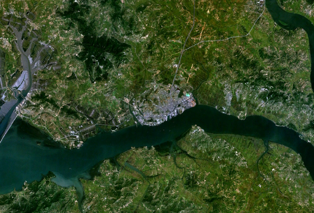
English: Satellite shot showing the port of Nampho, North Korea (the gray mass near the center of the image), from an altitude of 17.5 km. |
|||
| Data | date of dataset | |||
| Font | Created with NASA WorldWind by User:Oaktree_b using Landsat 7 (Visible Color) satellite image. | |||
| Autor | NASA | |||
| Permís (Com reutilitzar aquest fitxer) |
|

| Posició de l'objecte | | Aquesta i altres imatges properes a: OpenStreetMap |
|---|
Historial del fitxer
Cliqueu una data/hora per veure el fitxer tal com era aleshores.
| Data/hora | Miniatura | Dimensions | Usuari/a | Comentari | |
|---|---|---|---|---|---|
| actual | 04:55, 25 jul 2011 | | 1.022 × 694 (1,28 Mo) | Oaktree b | {{Information |Description ={{en|1=Satellite shot showing the port of Nampho, North Korea (the gray mass near the center of the image), from an altitude of 17.5 km. }} |Source =Created with NASA WorldWind by User:Oaktree_b using Landsat 7 ( |
Ús del fitxer
La pàgina següent utilitza aquest fitxer:
Ús global del fitxer
Utilització d'aquest fitxer en altres wikis: