
Fitxer:Map of Christmas Island 1976.jpg

Mida d'aquesta previsualització: 657 × 600 píxels. Altres resolucions: 263 × 240 píxels | 526 × 480 píxels | 839 × 766 píxels.
Fitxer original (839 × 766 píxels, mida del fitxer: 692 Ko, tipus MIME: image/jpeg)
| Aquest fitxer i la informació mostrada a continuació provenen del dipòsit multimèdia lliure Wikimedia Commons. |
Resum
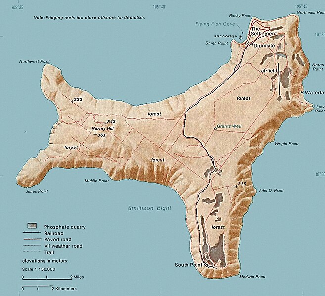
| Descripció | Map of Christmas. This map was produced by the U.S. Central Intelligence Agency, unless otherwise indicated. Maps dated 1976 were taken from The Indian Ocean Atlas, published by the Central Intelligence Agency. |
| Data | dated 1976 |
| Font | http://www.lib.utexas.edu/maps/islands_oceans_poles/christmas_island_76.jpg |
| Autor | Desconegut |
Llicència
| This image is a work of a Central Intelligence Agency employee, taken or made as part of that person's official duties. As a Work of the United States Government, this image or media is in the public domain in the United States.
|

|
Historial del fitxer
Cliqueu una data/hora per veure el fitxer tal com era aleshores.
| Data/hora | Miniatura | Dimensions | Usuari/a | Comentari | |
|---|---|---|---|---|---|
| actual | 17:24, 3 feb 2018 | | 839 × 766 (692 Ko) | Hohum | Cleanup |
| 22:33, 18 des 2010 |  | 839 × 766 (365 Ko) | Ras67 | cropped | |
| 21:15, 11 feb 2006 |  | 839 × 774 (128 Ko) | Walden69 | Map of Christmas. This map were produced by the U.S. Central Intelligence Agency, unless otherwise indicated. Maps dated 1976 were taken from The Indian Ocean Atlas, published by the Central Intelligence Agency. {{PD-USGov-CIA}} |
Ús del fitxer
La pàgina següent utilitza aquest fitxer:
Ús global del fitxer
Utilització d'aquest fitxer en altres wikis:
- Utilització a ar.wikipedia.org
- Utilització a arz.wikipedia.org
- Utilització a ast.wikipedia.org
- Utilització a bs.wikipedia.org
- Utilització a ceb.wikipedia.org
- Utilització a de.wikipedia.org
- Utilització a el.wikipedia.org
- Utilització a en.wikipedia.org
- Christmas Island
- Christmas Island Airport
- Christmas imperial pigeon
- Postage stamps and postal history of Christmas Island
- List of butterflies of Australia
- Murray Hill, Christmas Island
- List of moths of Christmas Island
- Christmas Island Phosphate Co.'s Railway
- Christmas Island flying fox
- Wildlife of Christmas Island
- Utilització a en.wikiversity.org
- Utilització a en.wikivoyage.org
- Utilització a eo.wikipedia.org
- Utilització a es.wikipedia.org
- Utilització a et.wikipedia.org
- Utilització a eu.wikipedia.org
- Utilització a fa.wikipedia.org
- Utilització a fr.wikipedia.org
- Utilització a gl.wikipedia.org
- Utilització a gu.wikipedia.org
- Utilització a hi.wikipedia.org
- Utilització a hi.wiktionary.org
- Utilització a hu.wikipedia.org
- Utilització a it.wikipedia.org
- Utilització a ja.wikipedia.org
- Utilització a kk.wikipedia.org
- Utilització a la.wikipedia.org
- Utilització a lld.wikipedia.org
- Utilització a ml.wikipedia.org
- Utilització a ms.wikipedia.org
- Utilització a nn.wikipedia.org
Vegeu més usos globals d'aquest fitxer.