
Fitxer:Willem Blaeu - Tabula Magellanica 1635.jpg
Mida d'aquesta previsualització: 774 × 600 píxels. Altres resolucions: 310 × 240 píxels | 619 × 480 píxels | 991 × 768 píxels | 1.280 × 992 píxels | 2.037 × 1.579 píxels.
Fitxer original (2.037 × 1.579 píxels, mida del fitxer: 3,2 Mo, tipus MIME: image/jpeg)
| Aquest fitxer i la informació mostrada a continuació provenen del dipòsit multimèdia lliure Wikimedia Commons. |
Resum
| Descripció |
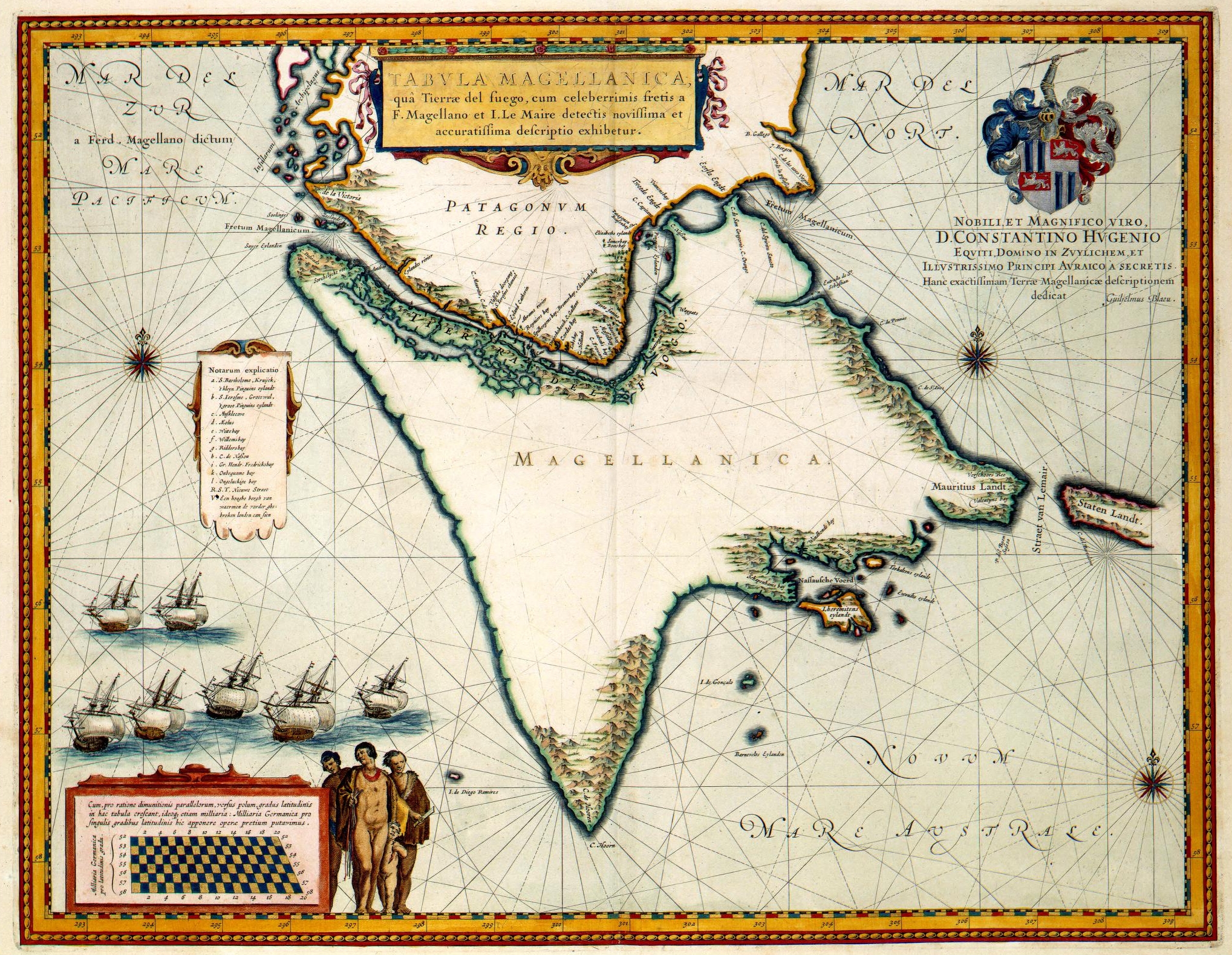
"Tabula Magellanica" (1635).
|
||||||||||||||||||||||||||
| Data | |||||||||||||||||||||||||||
| Font | Het geheugen van Nederland | ||||||||||||||||||||||||||
| Autor |
|
||||||||||||||||||||||||||
| Permís (Com reutilitzar aquest fitxer) |
PD-old | ||||||||||||||||||||||||||

Llicència
|
Aquest material està en domini públic als Estats Units i als altres països on el dret d'autor s'estén per 100 anys (o menys) després de la mort de l'autor. | |
| Aquest fitxer està identificat com a lliure de restriccions conegudes sota la llei de drets d'autor, inclosos els drets veïns. | |
This digital media file - and/or the physical objects depicted on it - originates from the digital and/or physical collections of the Koninklijke Bibliotheek, national library of the Netherlands.
|
| Anotacions | Aquesta imatge té anotacions: Vegeu-les a Commons |
Historial del fitxer
Cliqueu una data/hora per veure el fitxer tal com era aleshores.
| Data/hora | Miniatura | Dimensions | Usuari/a | Comentari | |
|---|---|---|---|---|---|
| actual | 09:42, 22 juny 2006 | | 2.037 × 1.579 (3,2 Mo) | Jan Arkesteijn | {{Information |Description=Willem Blaeu: Tabula Magellanica |Source=[http://www.geheugenvannederland.nl/gvn/search/titelpresentatie.xsp?recordid=439&onlineid=KONB01_1049B13_090&dbcode=KONB01 Het geheugen van Nederland |Date=1635 |Author=Willem Blaeu |Per |
Ús del fitxer
La pàgina següent utilitza aquest fitxer:
Ús global del fitxer
Utilització d'aquest fitxer en altres wikis:
- Utilització a ast.wikipedia.org
- Utilització a bg.wikipedia.org
- Utilització a es.wikipedia.org
- Utilització a fr.wikipedia.org
- Utilització a hy.wikipedia.org
- Utilització a it.wikipedia.org
- Utilització a nl.wikipedia.org
- Utilització a pt.wikipedia.org
- Utilització a ru.wikipedia.org
- Utilització a uk.wikipedia.org