
Odala: diferència entre les revisions
Contingut suprimit Contingut afegit
m Enllaços a Google Llibres en català |
m neteja i estandardització de codi |
||
| Línia 13: | Línia 13: | ||
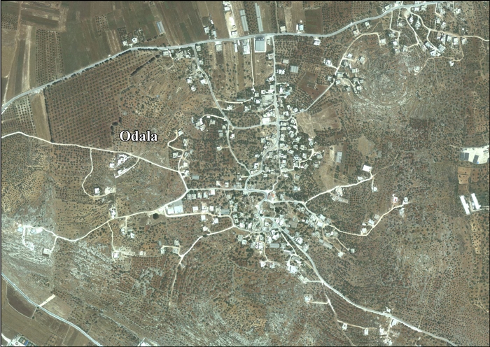
'''Odala''' —en [[àrab]] '''اودلة''', ''Ūdala''— és un [[Consell de vila (Palestina)|vila]] [[palestina]] de la [[governació de Nablus]], a [[Cisjordània]], al nord de la [[vall del Jordà]], 10 kilòmetres al sud de [[Nablus]]. Segons l'[[Oficina Central Palestina d'Estadístiques]] tenia una població de 1.082 habitants en 2006.<ref>[http://www.pcbs.gov.ps/Portals/_pcbs/populati/pop06.aspx Projected Mid -Year Population for Nablus Governorate by Locality 2004- 2006] [[Palestinian Central Bureau of Statistics]]</ref> |
'''Odala''' —en [[àrab]] '''اودلة''', ''Ūdala''— és un [[Consell de vila (Palestina)|vila]] [[palestina]] de la [[governació de Nablus]], a [[Cisjordània]], al nord de la [[vall del Jordà]], 10 kilòmetres al sud de [[Nablus]]. Segons l'[[Oficina Central Palestina d'Estadístiques]] tenia una població de 1.082 habitants en 2006.<ref>[http://www.pcbs.gov.ps/Portals/_pcbs/populati/pop06.aspx Projected Mid -Year Population for Nablus Governorate by Locality 2004- 2006] [[Palestinian Central Bureau of Statistics]]</ref> |
||
== Història == |
== Història == |
||
Segons el [[cens de Palestina de 1931]], ordenat per les autoritats del [[Mandat Britànic de Palestina]], Udala tenia 17 cases ocupades i una població de 73 musulmans.<ref name="Census1931">Mills, 1932, p. [https://archive.org/details/CensusOfPalestine1931.PopulationOfVillagesTownsAndAdministrativeAreas 66]</ref> |
Segons el [[cens de Palestina de 1931]], ordenat per les autoritats del [[Mandat Britànic de Palestina]], Udala tenia 17 cases ocupades i una població de 73 musulmans.<ref name="Census1931">Mills, 1932, p. [https://archive.org/details/CensusOfPalestine1931.PopulationOfVillagesTownsAndAdministrativeAreas 66]</ref> |
||
| Línia 21: | Línia 21: | ||
== Bibliografia == |
== Bibliografia == |
||
{{refbegin}} |
{{refbegin}} |
||
*{{ref-llibre| editor =Barron, J.B. |títol= Palestine: Report and General Abstracts of the Census of 1922 |url=https://archive.org/details/PalestineCensus1922 |editorial= Government of Palestine |any= 1923}} |
* {{ref-llibre| editor =Barron, J.B. |títol= Palestine: Report and General Abstracts of the Census of 1922 |url=https://archive.org/details/PalestineCensus1922 |editorial= Government of Palestine |any= 1923}} |
||
*{{ref-llibre|cognom1=Conder|nom1=Claude Reignier|authorlink1=Claude Reignier Conder|cognom2=Kitchener|nom2=H.H.|enllaçautor2=Horatio Herbert Kitchener|any=1882|url=https://archive.org/details/surveyofwesternp02conduoft|títol=The Survey of Western Palestine: Memoirs of the Topography, Orography, Hydrography, and Archaeology|lloc=Londres|editorial=[[Palestine Exploration Fund|Committee of the Palestine Exploration Fund]]|volum=2}} (p. [https://archive.org/stream/surveyofwesternp02conduoft#page/288/mode/1up 288]) |
* {{ref-llibre|cognom1=Conder|nom1=Claude Reignier|authorlink1=Claude Reignier Conder|cognom2=Kitchener|nom2=H.H.|enllaçautor2=Horatio Herbert Kitchener|any=1882|url=https://archive.org/details/surveyofwesternp02conduoft|títol=The Survey of Western Palestine: Memoirs of the Topography, Orography, Hydrography, and Archaeology|lloc=Londres|editorial=[[Palestine Exploration Fund|Committee of the Palestine Exploration Fund]]|volum=2}} (p. [https://archive.org/stream/surveyofwesternp02conduoft#page/288/mode/1up 288]) |
||
*{{ref-llibre|títol=Village Statistics, April, 1945 |url=http://web.nli.org.il/sites/nli/Hebrew/library/Pages/BookReader.aspx?pid=856390|autor=Department of Statistics|any=1945|editorial=Government of Palestine}} |
* {{ref-llibre|títol=Village Statistics, April, 1945 |url=http://web.nli.org.il/sites/nli/Hebrew/library/Pages/BookReader.aspx?pid=856390|autor=Department of Statistics|any=1945|editorial=Government of Palestine}} |
||
*{{ref-llibre|cognom=Guérin|nom=V.|enllaçautor=Victor Guérin|títol=Description Géographique Historique et Archéologique de la Palestine|url=https://archive.org/details/descriptionsam01gu|volum=2: Samarie, pt. 1|any=1874|editorial= L'Imprimerie Nationale|lloc=París|llengua=francès}} (p. [https://archive.org/stream/descriptionsam01gu#page/461/mode/1up 461]) |
* {{ref-llibre|cognom=Guérin|nom=V.|enllaçautor=Victor Guérin|títol=Description Géographique Historique et Archéologique de la Palestine|url=https://archive.org/details/descriptionsam01gu|volum=2: Samarie, pt. 1|any=1874|editorial= L'Imprimerie Nationale|lloc=París|llengua=francès}} (p. [https://archive.org/stream/descriptionsam01gu#page/461/mode/1up 461]) |
||
*{{ref-llibre|títol=Village Statistics of 1945: A Classification of Land and Area ownership in Palestine|url=http://www.palestineremembered.com/Articles/General-2/Story3150.html|nom=S.|cognom=Hadawi|enllaçautor=Sami Hadawi|any=1970|editorial=Palestine Liberation Organization Research Center}} |
* {{ref-llibre|títol=Village Statistics of 1945: A Classification of Land and Area ownership in Palestine|url=http://www.palestineremembered.com/Articles/General-2/Story3150.html|nom=S.|cognom=Hadawi|enllaçautor=Sami Hadawi|any=1970|editorial=Palestine Liberation Organization Research Center}} |
||
*{{ref-llibre|cognom1= Hütteroth |nom1=Wolf-Dieter |nom2=Kamal |cognom2=Abdulfattah |títol= Historical Geography of Palestine, Transjordan and Southern Syria in the Late 16th Century |url= https://books.google.cat/books?id=wqULAAAAIAAJ |any= 1977 |editorial= Erlanger Geographische Arbeiten, Sonderband 5. Erlangen, Germany: Vorstand der Fränkischen Geographischen Gesellschaft|isbn= 3-920405-41-2}} (p. 134) |
* {{ref-llibre|cognom1= Hütteroth |nom1=Wolf-Dieter |nom2=Kamal |cognom2=Abdulfattah |títol= Historical Geography of Palestine, Transjordan and Southern Syria in the Late 16th Century |url= https://books.google.cat/books?id=wqULAAAAIAAJ |any= 1977 |editorial= Erlanger Geographische Arbeiten, Sonderband 5. Erlangen, Germany: Vorstand der Fränkischen Geographischen Gesellschaft|isbn= 3-920405-41-2}} (p. 134) |
||
*{{ref-llibre| editor = Mills, E. |títol= Census of Palestine 1931. Population of Villages, Towns and Administrative Areas |url=https://archive.org/details/CensusOfPalestine1931.PopulationOfVillagesTownsAndAdministrativeAreas |editorial= Government of Palestine |lloc= Jerusalem |any= 1932}} |
* {{ref-llibre| editor = Mills, E. |títol= Census of Palestine 1931. Population of Villages, Towns and Administrative Areas |url=https://archive.org/details/CensusOfPalestine1931.PopulationOfVillagesTownsAndAdministrativeAreas |editorial= Government of Palestine |lloc= Jerusalem |any= 1932}} |
||
*{{ref-llibre|cognom=Palmer|nom=E.H.|enllaçautor=Edward Henry Palmer|any=1881|url=https://archive.org/details/surveyofwesternp00conduoft|títol=The Survey of Western Palestine: Arabic and English Name Lists Collected During the Survey by Lieutenants Conder and Kitchener, R. E. Transliterated and Explained by E.H. Palmer|editorial=[[Palestine Exploration Fund|Committee of the Palestine Exploration Fund]]}} (p. [https://archive.org/stream/surveyofwesternp00conduoft#page/225/mode/1up 225]) |
* {{ref-llibre|cognom=Palmer|nom=E.H.|enllaçautor=Edward Henry Palmer|any=1881|url=https://archive.org/details/surveyofwesternp00conduoft|títol=The Survey of Western Palestine: Arabic and English Name Lists Collected During the Survey by Lieutenants Conder and Kitchener, R. E. Transliterated and Explained by E.H. Palmer|editorial=[[Palestine Exploration Fund|Committee of the Palestine Exploration Fund]]}} (p. [https://archive.org/stream/surveyofwesternp00conduoft#page/225/mode/1up 225]) |
||
{{refend}} |
{{refend}} |
||
== Enllaços externs == |
== Enllaços externs == |
||
*[http://www.palestineremembered.com/GeoPoints/Udala_5095/index.html Welcome To Udala] |
* [http://www.palestineremembered.com/GeoPoints/Udala_5095/index.html Welcome To Udala] |
||
*Survey of Western Palestine, Map 14: [http://www.iaa-archives.org.il/zoom/zoom.aspx?folder_id=93&type_id=6&id=8376 IAA], [http://commons.wikimedia.org/wiki/File:Survey_of_Western_Palestine_1880.14.jpg Wikimedia commons] |
*Survey of Western Palestine, Map 14: [http://www.iaa-archives.org.il/zoom/zoom.aspx?folder_id=93&type_id=6&id=8376 IAA], [http://commons.wikimedia.org/wiki/File:Survey_of_Western_Palestine_1880.14.jpg Wikimedia commons] |
||
*[http://vprofile.arij.org/nablus/pdfs/vprofile/Odala_vp_en.pdf Odala Village Profile], [[Applied Research Institute - Jerusalem]] (ARIJ) |
* [http://vprofile.arij.org/nablus/pdfs/vprofile/Odala_vp_en.pdf Odala Village Profile], [[Applied Research Institute - Jerusalem]] (ARIJ) |
||
*[http://vprofile.arij.org/nablus/images/english/Odala_ap_en.jpg Odala, aerial photo], (ARIJ) |
* [http://vprofile.arij.org/nablus/images/english/Odala_ap_en.jpg Odala, aerial photo], (ARIJ) |
||
*[http://vprofile.arij.org/nablus/pdfs/needsfordevelopment/Odala_Needs_EN.pdf Development Priorities and Needs in Odala], (ARIJ) |
* [http://vprofile.arij.org/nablus/pdfs/needsfordevelopment/Odala_Needs_EN.pdf Development Priorities and Needs in Odala], (ARIJ) |
||
{{Governació de Nablus}} |
{{Governació de Nablus}} |
||
[[Categoria:Viles de Cisjordània]] |
[[Categoria:Viles de Cisjordània]] |
||
Revisió del 05:55, 17 ago 2020
| اودلة | ||||
| ||||
| Localització | ||||
|---|---|---|---|---|
| ||||
| Vila | ||||
| Graella palestina | 176/173 | |||
| Població humana | ||||
| Població | 1.082 | |||
| Organització política | ||||
| Governació | Nablus | |||


Odala —en àrab اودلة, Ūdala— és un vila palestina de la governació de Nablus, a Cisjordània, al nord de la vall del Jordà, 10 kilòmetres al sud de Nablus. Segons l'Oficina Central Palestina d'Estadístiques tenia una població de 1.082 habitants en 2006.[1]
Història
Segons el cens de Palestina de 1931, ordenat per les autoritats del Mandat Britànic de Palestina, Udala tenia 17 cases ocupades i una població de 73 musulmans.[2]
Referències
Bibliografia
- Barron, J.B.. Palestine: Report and General Abstracts of the Census of 1922. Government of Palestine, 1923.
- Conder, Claude Reignier; Kitchener, H.H.. The Survey of Western Palestine: Memoirs of the Topography, Orography, Hydrography, and Archaeology. 2. Londres: Committee of the Palestine Exploration Fund, 1882. (p. 288)
- Department of Statistics. Village Statistics, April, 1945. Government of Palestine, 1945.
- Guérin, V. Description Géographique Historique et Archéologique de la Palestine (en francès). 2: Samarie, pt. 1. París: L'Imprimerie Nationale, 1874. (p. 461)
- Hadawi, S. Village Statistics of 1945: A Classification of Land and Area ownership in Palestine. Palestine Liberation Organization Research Center, 1970.
- Hütteroth, Wolf-Dieter; Abdulfattah, Kamal. Historical Geography of Palestine, Transjordan and Southern Syria in the Late 16th Century. Erlanger Geographische Arbeiten, Sonderband 5. Erlangen, Germany: Vorstand der Fränkischen Geographischen Gesellschaft, 1977. ISBN 3-920405-41-2. (p. 134)
- Mills, E.. Census of Palestine 1931. Population of Villages, Towns and Administrative Areas. Jerusalem: Government of Palestine, 1932.
- Palmer, E.H.. The Survey of Western Palestine: Arabic and English Name Lists Collected During the Survey by Lieutenants Conder and Kitchener, R. E. Transliterated and Explained by E.H. Palmer. Committee of the Palestine Exploration Fund, 1881. (p. 225)
Enllaços externs
- Welcome To Udala
- Survey of Western Palestine, Map 14: IAA, Wikimedia commons
- Odala Village Profile, Applied Research Institute - Jerusalem (ARIJ)
- Odala, aerial photo, (ARIJ)
- Development Priorities and Needs in Odala, (ARIJ)
