
Fitxer:Dease and Simpson - Arctic expedition 1837.png

Mida d'aquesta previsualització: 800 × 472 píxels. Altres resolucions: 320 × 189 píxels | 640 × 378 píxels | 1.024 × 605 píxels | 1.280 × 756 píxels | 2.395 × 1.414 píxels.
Fitxer original (2.395 × 1.414 píxels, mida del fitxer: 288 Ko, tipus MIME: image/png)
| Aquest fitxer i la informació mostrada a continuació provenen del dipòsit multimèdia lliure Wikimedia Commons. |
Resum
| Descripció |
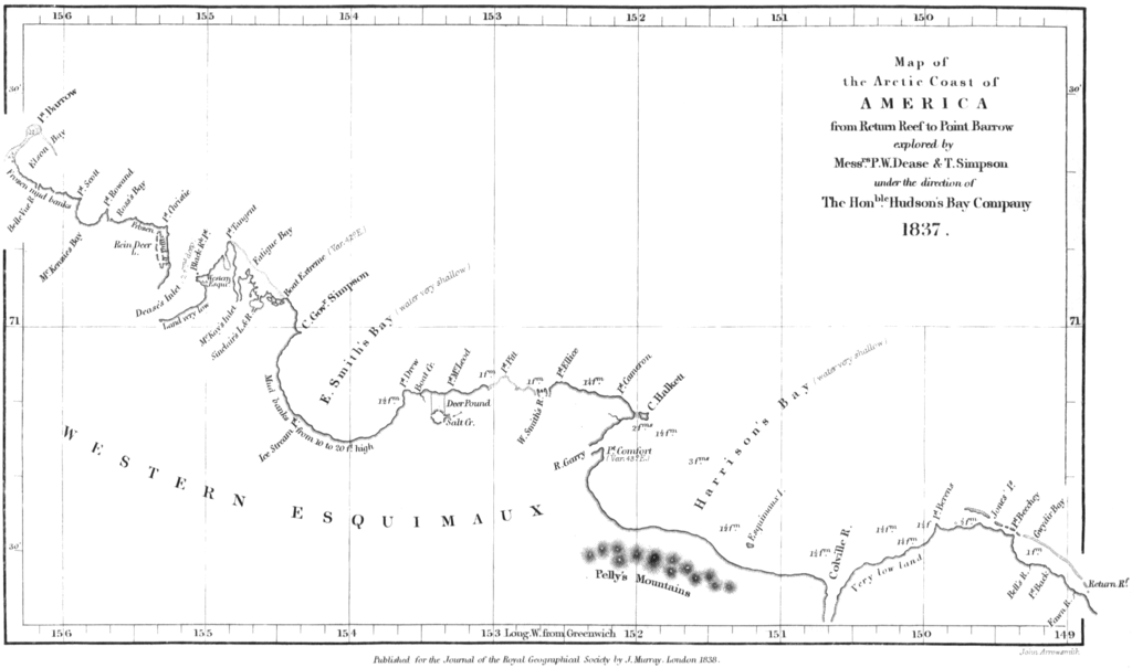
English: Map of the northern coast of Alaska, from Point Burrow on the western edge to Return Reef (just east of the Colville River) on the eastern. Mapped by Peter W. Dease and Thomas Simpson in 1837, during their Arctic expedition. |
|||||||||||||||||
| Data | ||||||||||||||||||
| Font | Peter W. Dease and Thomas Simpson, "An Account of the Recent Arctic Discoveries by Messrs. Dease and T. Simpson", Journal of the Royal Geographical Society of London 8: 213-225, 1838. | |||||||||||||||||
| Autor |
|
|||||||||||||||||

Llicència
|
Aquest material està en domini públic als Estats Units i als altres països on el dret d'autor s'estén per 100 anys (o menys) després de la mort de l'autor. Aquesta obra es troba en el domini públic als Estats Units d'Amèrica per haver estat publicada abans de l'1 de gener de 1929. | |
| Aquest fitxer està identificat com a lliure de restriccions conegudes sota la llei de drets d'autor, inclosos els drets veïns. | |
Historial del fitxer
Cliqueu una data/hora per veure el fitxer tal com era aleshores.
| Data/hora | Miniatura | Dimensions | Usuari/a | Comentari | |
|---|---|---|---|---|---|
| actual | 12:29, 18 gen 2009 | | 2.395 × 1.414 (288 Ko) | Delirium | {{Information |Description={{en|1=Map of the northern coast of Alaska, from Point Burrow on the western edge to Return Reef (just east of the Colville River) on the eastern. Mapped by Peter W. Dease and Thomas Simpson in 1837, during their Arctic expediti |
Ús del fitxer
La pàgina següent utilitza aquest fitxer:
Ús global del fitxer
Utilització d'aquest fitxer en altres wikis:
- Utilització a arz.wikipedia.org
- Utilització a bg.wikipedia.org
- Utilització a ceb.wikipedia.org
- Utilització a es.wikipedia.org
- Utilització a eu.wikipedia.org
- Utilització a fr.wikipedia.org
- Utilització a www.wikidata.org