
Fitxer:Doughoregan.jpg
No hi ha cap versió amb una resolució més gran.
Doughoregan.jpg (508 × 408 píxels, mida del fitxer: 54 Ko, tipus MIME: image/jpeg)
| Aquest fitxer i la informació mostrada a continuació provenen del dipòsit multimèdia lliure Wikimedia Commons. |
|
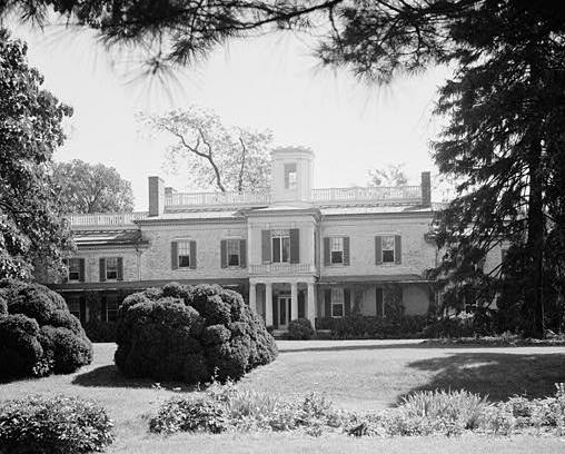
This is an image of a place or building that is listed on the National Register of Historic Places in the United States of America. Its reference number is 71000376. |
| Descripció | ||||||
| Data | ||||||
| Font |
|
|||||
| Autor | E.H. Pickering | |||||
| Permís (Com reutilitzar aquest fitxer) |
|


| Posició de l'objecte | | Aquesta i altres imatges properes a: OpenStreetMap |
|---|
| Això és una imatge retocada, cosa que vol dir que ha estat alterada digitalment de la seva versió original. Modificacions: cropped. Modificacions fetes per Eoghanacht.
|
Registre original de càrregues
La pàgina de descripció original era aquí. Els noms d'usuari a continuació es refereixen a en.wikipedia.
- 2005-08-04 13:26 Eoghanacht 508×408× (55370 bytes) [[Doughoregan Manor]] ([[Historic American Buildings Survey]], photographer E.H. Pickering, Sept. 1936, survey number HABS MD-230) {{PD-USGov-Interior-NPS}} [[Category:U.S. National Historic Landmarks]]
Historial del fitxer
Cliqueu una data/hora per veure el fitxer tal com era aleshores.
| Data/hora | Miniatura | Dimensions | Usuari/a | Comentari | |
|---|---|---|---|---|---|
| actual | 23:16, 26 març 2009 | | 508 × 408 (54 Ko) | File Upload Bot (Magnus Manske) | {{BotMoveToCommons|en.wikipedia|year={{subst:CURRENTYEAR}}|month={{subst:CURRENTMONTHNAME}}|day={{subst:CURRENTDAY}}}} {{Information |Description={{en|en:Doughoregan Manor (en:Historic American Buildings Survey, photographer E.H. Pickering, Sep |
Ús del fitxer
La pàgina següent utilitza aquest fitxer:
Ús global del fitxer
Utilització d'aquest fitxer en altres wikis:
- Utilització a azb.wikipedia.org
- Utilització a de.wikipedia.org
- Utilització a en.wikipedia.org
- Charles Carroll of Carrollton
- Doughoregan Manor
- List of National Historic Landmarks in Maryland
- National Register of Historic Places listings in Howard County, Maryland
- List of plantations in the United States
- Charles Carroll the Settler
- List of the oldest buildings in Maryland
- Charles Carroll (1865-1921)
- Utilització a fa.wikipedia.org
- Utilització a fr.wikipedia.org
- Utilització a www.wikidata.org