
Fitxer:Eaton canyon from the air.jpg
Eaton_canyon_from_the_air.jpg (688 × 457 píxels, mida del fitxer: 423 Ko, tipus MIME: image/jpeg)
| Aquest fitxer i la informació mostrada a continuació provenen del dipòsit multimèdia lliure Wikimedia Commons. |
Resum
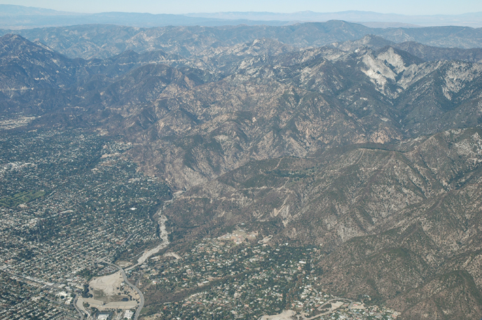
| Descripció | Eaton Canyon, reservoir and wash from the air |
| Data | Taken on 4 de desembre de 2005 |
| Font | Aerial Photography of Southern California |
| Autor | Bruce Perry |
| Altres versions | http://www.cnsm.csulb.edu/departments/geology/people/bperry//Aerial%20Photos%20for%20Alumni%20Grant/San%20Gabriel%20Mountains%20Flight%20December%202005/San%20Gabriel%20Mountains%20Flight%201%20Dec%202005/214PasadenaEatonCanyonResAndWashDec05S.jpg |
| Posició de la càmera | | Aquesta i altres imatges properes a: OpenStreetMap |
|---|
Llicència
- Sou lliure de:
- compartir – copiar, distribuir i comunicar públicament l'obra
- adaptar – fer-ne obres derivades
- Amb les condicions següents:
- reconeixement – Heu de donar la informació adequada sobre l'autor, proporcionar un enllaç a la llicència i indicar si s'han realitzat canvis. Podeu fer-ho amb qualsevol mitjà raonable, però de cap manera no suggereixi que l'autor us dóna suport o aprova l'ús que en feu.
- compartir igual – Si modifiqueu, transformeu, o generareu amb el material, haureu de distribuir les vostres contribucions sota una llicència similar o una de compatible com l'original
Errata
Credits - This web site was conceived of and produced by Bruce Perry of the Department of Geological Sciences at CSU Long Beach. If you have any questions or comments about the contents, please direct them to Mr. Perry at bperry@csulb.edu. All aerial and ground-based photographs are by Bruce Perry unless otherwise noted, and they can be used, with permission, for any nonprofit purpose.
Please credit photos to "Bruce Perry, Department of Geological Sciences, CSU Long Beach". For those wishing to use a photograph for business or other for-profit purpose, contact Mr. Perry for further information.
| Anotacions | Aquesta imatge té anotacions: Vegeu-les a Commons |
Historial del fitxer
Cliqueu una data/hora per veure el fitxer tal com era aleshores.
| Data/hora | Miniatura | Dimensions | Usuari/a | Comentari | |
|---|---|---|---|---|---|
| actual | 02:48, 12 juny 2007 | | 688 × 457 (423 Ko) | Evrik | {{Information |Description=Eaton Canyon, reservoir and wash from the air |Source=[http://www.cnsm.csulb.edu/departments/geology/people/bperry/Aerial%20Photography%20of%20Southern%20California/SanGabrielMountains.htm Aerial Photography |
Ús del fitxer
La pàgina següent utilitza aquest fitxer:
Ús global del fitxer
Utilització d'aquest fitxer en altres wikis:
- Utilització a azb.wikipedia.org
- Utilització a ceb.wikipedia.org
- Utilització a ce.wikipedia.org
- Utilització a en.wikipedia.org
- Utilització a es.wikipedia.org
- Utilització a eu.wikipedia.org
- Utilització a fa.wikipedia.org
- Utilització a fi.wikipedia.org
- Utilització a fr.wikipedia.org
- Utilització a it.wikipedia.org
- Utilització a lld.wikipedia.org
- Utilització a pl.wikipedia.org
- Utilització a pt.wikipedia.org
- Utilització a ru.wikipedia.org
- Utilització a sh.wikipedia.org
- Utilització a simple.wikipedia.org
- Utilització a sr.wikipedia.org
- Utilització a tt.wikipedia.org
- Utilització a uk.wikipedia.org
- Utilització a vo.wikipedia.org
- Utilització a www.wikidata.org
- Utilització a zh-min-nan.wikipedia.org
- Utilització a zh.wikipedia.org