
Fitxer:Fossils that helped develop the first geological map.jpg
Fitxer original (2.592 × 1.944 píxels, mida del fitxer: 1,13 Mo, tipus MIME: image/jpeg)
| Aquest fitxer i la informació mostrada a continuació provenen del dipòsit multimèdia lliure Wikimedia Commons. |
| Descripció |
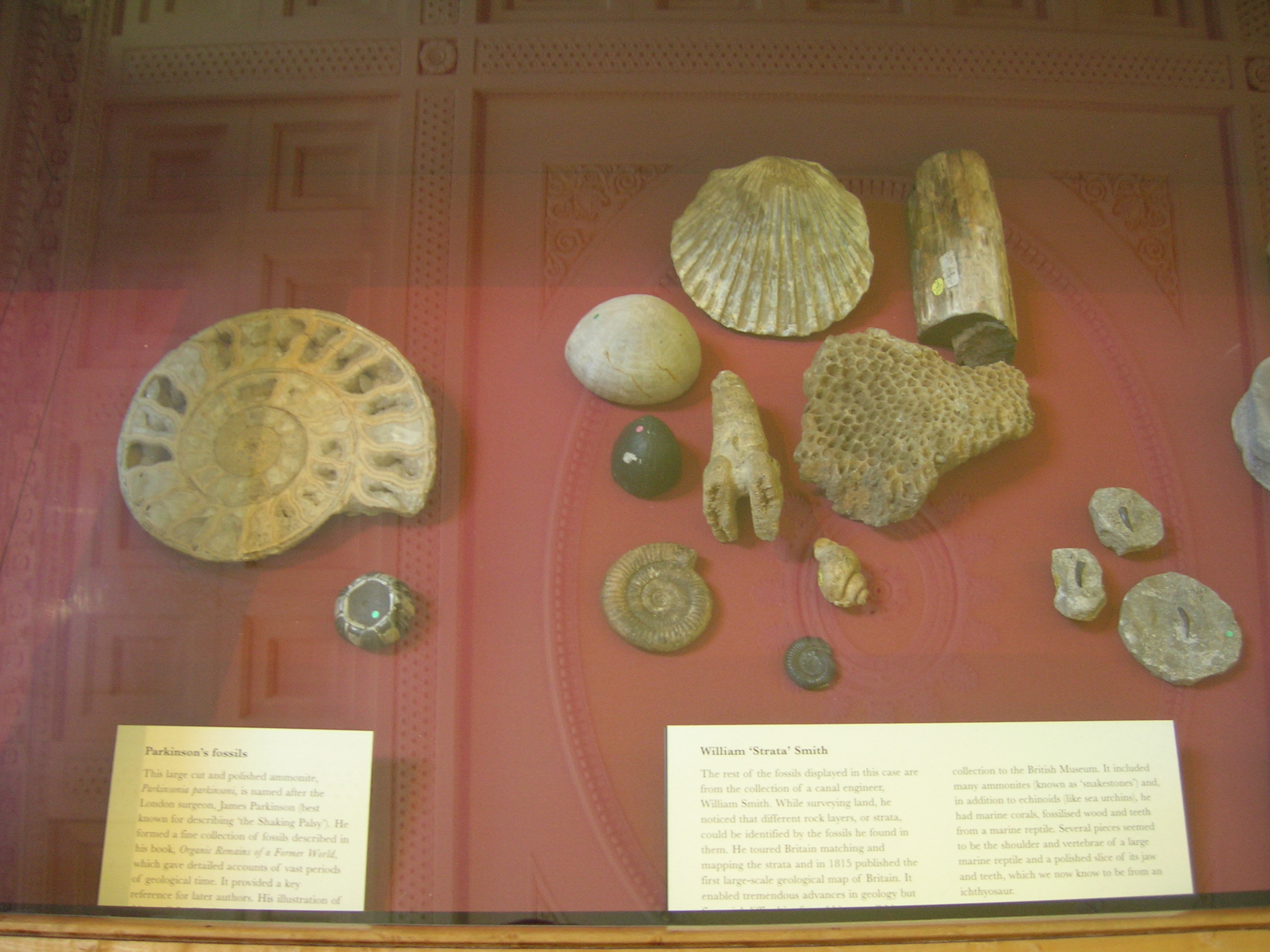
On the right: William ?Strata' Smith (geologist) The rest of the fossils displayed in this case are from the collection of a canal engineer, William Smith. While surveying land, he noticed that different rock layers, or strata, could be identified by the fossils he found in them. He toured Britain matching and mapping the strata and in 1815 published the first large-scale geological map of Britain. It enabled tremendous advances in geology? Collection to the British Museum. It included many ammonites (known as ?snakestones?) in addition to echinoids (like sea urchins); he had marine corals, fossilized wood and teeth from a marine reptile. On the left: Parkinson?s fossils This large cut and polished ammonite, Parkinsonia parkinsoni is named after James Parkinson , (best known for having described ?the Shaking Palsy? ?Parkinson?s Disease?). He formed a fine collection of fossils described in his book Organic Remains of a Former World, which gave detailed accounts of vast periods of geological time. It provided a key reference for later authors. |
| Data | |
| Font |
Fossils that helped develop the first geological map
|
| Autor | J Brew |
| Posició de la càmera | | Aquesta i altres imatges properes a: OpenStreetMap |
|---|
Llicència
- Sou lliure de:
- compartir – copiar, distribuir i comunicar públicament l'obra
- adaptar – fer-ne obres derivades
- Amb les condicions següents:
- reconeixement – Heu de donar la informació adequada sobre l'autor, proporcionar un enllaç a la llicència i indicar si s'han realitzat canvis. Podeu fer-ho amb qualsevol mitjà raonable, però de cap manera no suggereixi que l'autor us dóna suport o aprova l'ús que en feu.
- compartir igual – Si modifiqueu, transformeu, o generareu amb el material, haureu de distribuir les vostres contribucions sota una llicència similar o una de compatible com l'original
| Aquesta imatge, originalment publicada a Flickr, ha estat verificada el June 6, 2009 per l'administrador o usuari acreditat File Upload Bot (Magnus Manske), i ha confirmat que en aquella data estava disponible a Flickr sota la llicència indicada. |
Historial del fitxer
Cliqueu una data/hora per veure el fitxer tal com era aleshores.
| Data/hora | Miniatura | Dimensions | Usuari/a | Comentari | |
|---|---|---|---|---|---|
| actual | 15:42, 6 juny 2009 | | 2.592 × 1.944 (1,13 Mo) | File Upload Bot (Magnus Manske) | {{Information |Description= On the right: [http://en.wikipedia.org/wiki/William_Smith_(geologist) William ?Strata' Smith (geologist)] The rest of the fossils displayed in this case are from the collection of a canal engineer, William Smith. While survey |
Ús del fitxer
La pàgina següent utilitza aquest fitxer:
Ús global del fitxer
Utilització d'aquest fitxer en altres wikis:
- Utilització a de.wikipedia.org
- Utilització a en.wikipedia.org
- Utilització a hu.wikipedia.org
- Utilització a it.wikipedia.org