
Fitxer:Gabon location map.svg

Mida d'aquesta previsualització PNG del fitxer SVG: 646 × 600 píxels. Altres resolucions: 259 × 240 píxels | 517 × 480 píxels | 827 × 768 píxels | 1.103 × 1.024 píxels | 2.206 × 2.048 píxels | 1.200 × 1.114 píxels.
Fitxer original (fitxer SVG, nominalment 1.200 × 1.114 píxels, mida del fitxer: 206 Ko)
| Aquest fitxer i la informació mostrada a continuació provenen del dipòsit multimèdia lliure Wikimedia Commons. |
Resum
| Descripció |
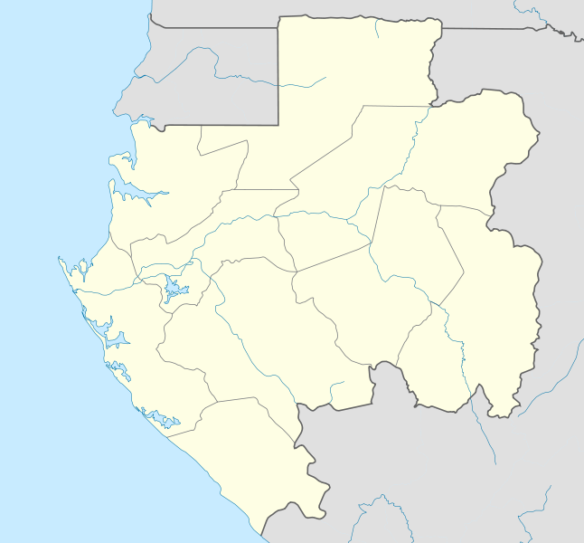
English: Location map of Gabon Equirectangular projection. Geographic limits of the map:
   * N: 2.5° N
   * S: 4° S
   * W: 8° E
   * E: 15° E
Made with Natural Earth. Free vector and raster map data @ naturalearthdata.com. |
| Data | |
| Font | Treball propi |
| Autor | Uwe Dedering |
| Altres versions |
Derivative works of this file: |
.svg)
.svg)
.svg)
.svg)
.svg)
.svg)
.svg)
.svg)
.svg)
Llicència
Jo, el titular dels drets d'autor d'aquest treball, el public sota les següents llicències:
Aquest fitxer està subjecte a la llicència de Creative Commons Reconeixement i Compartir Igual 3.0 No adaptada.
- Sou lliure de:
- compartir – copiar, distribuir i comunicar públicament l'obra
- adaptar – fer-ne obres derivades
- Amb les condicions següents:
- reconeixement – Heu de donar la informació adequada sobre l'autor, proporcionar un enllaç a la llicència i indicar si s'han realitzat canvis. Podeu fer-ho amb qualsevol mitjà raonable, però de cap manera no suggereixi que l'autor us dóna suport o aprova l'ús que en feu.
- compartir igual – Si modifiqueu, transformeu, o generareu amb el material, haureu de distribuir les vostres contribucions sota una llicència similar o una de compatible com l'original

|
S'autoritza la còpia, la distribució i la modificació d'aquest document sota els termes de la llicència de documentació lliure GNU versió 1.2 o qualsevol altra versió posterior que publiqui la Free Software Foundation; sense seccions invariants, ni textos de portada, ni textos de contraportada. S'inclou una còpia d'aquesta llicència en la secció titulada GNU Free Documentation License. |
Podeu seleccionar la llicència que vulgueu.
Historial del fitxer
Cliqueu una data/hora per veure el fitxer tal com era aleshores.
| Data/hora | Miniatura | Dimensions | Usuari/a | Comentari | |
|---|---|---|---|---|---|
| actual | 21:27, 14 feb 2010 | | 1.200 × 1.114 (206 Ko) | Uwe Dedering | North: 2.5 |
| 21:14, 14 feb 2010 |  | 1.200 × 1.200 (208 Ko) | Uwe Dedering | {{Information |Description={{en|1=English: Location map of Gabon Equirectangular projection. Geographic limits of the map: * N: 3° N * S: 4° S * W: 8° E * E: 15° E - }} |Source={{own}} |Author=Uwe Dedering |Date |
Ús del fitxer
Les 6 pàgines següents utilitzen aquest fitxer:
Ús global del fitxer
Utilització d'aquest fitxer en altres wikis:
- Utilització a af.wikipedia.org
- Utilització a am.wikipedia.org
- Utilització a an.wikipedia.org
- Utilització a ar.wikipedia.org
- Utilització a ast.wikipedia.org
- Utilització a az.wikipedia.org
- Utilització a ba.wikipedia.org
- Utilització a be-tarask.wikipedia.org
- Utilització a be.wikipedia.org
- Utilització a bg.wikipedia.org
- Utilització a bn.wikipedia.org
- Utilització a bs.wikipedia.org
- Utilització a ceb.wikipedia.org
Vegeu més usos globals d'aquest fitxer.