Fitxer:Greenland Mercator 1569.jpg

El contingut de la pàgina no s'admet en altres llengües.
De la Viquipèdia, l'enciclopèdia lliure

Fitxer original(993 × 1.500 píxels, mida del fitxer: 509 Ko, tipus MIME: image/jpeg)

Descripció a Commons
Descripció
English: Greenland on the Gerardus Mercator world map of 1569. The main part is based on Zeno 1558 like evident by the "Cenobium" settlement. How he got the northern coast as an island is a mystery. Later maps deteriorated the shape until the 18th century. This map is in the British Library as part of an atlas assembled by Mercator in the 1570s. The complete atlas may be viewed online at http://www.bl.uk/onlinegallery/ttp/mercator/accessible/introduction.html The Greenland page is itself a composite of two of the sheets of the 1569 world map. (Sheets 2,3 trimmed and joined along the prime meridian).
Data
Font
Public domain

Aquest material està en domini públic als Estats Units i als altres països on el dret d'autor s'estén per 100 anys (o menys) després de la mort de l'autor.


Cal incloure una etiqueta de domini públic als Estats Units per indicar perquè aquesta obra és en domini públic als Estats Units.
Autor
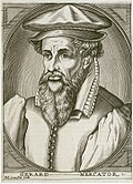
Gerardus Mercator  (1512–1594)  wikidata:Q6353 s:it:Autore:Gerardo Mercatore q:en:Gerardus Mercator
 
Gerardus Mercator
Altres noms
Gerardo Mercatore; Gerard De Kremer; Gerard de Cremere; Gerhard Mercator; Gérard Mercator
Descripció matemàtic, geògraf i cartògraf
Data de naixement i defunció 5 de març de 1512 Edita-ho a Wikidata 2 de desembre de 1594 Edita-ho a Wikidata
Lloc de naixement i defunció Rupelmonde Duisburg
Període de treball 1535 fins 1592
date QS:P,+1550-00-00T00:00:00Z/7,P580,+1535-00-00T00:00:00Z/9,P582,+1592-00-00T00:00:00Z/9
Lloc de treball
Control d'autoritats
creator QS:P170,Q6353
Reconeixement
(required by the license)
InfoField
http://en.wikipedia.org/wiki/User%3APortolanero / Wikimedia Commons / 
http://en.wikipedia.org/wiki/User%3APortolanero / Wikimedia Commons

Llegendes

Afegeix una explicació d'una línia del que representa aquest fitxer

Elements representats en aquest fitxer

representa l'entitat

Historial del fitxer

Cliqueu una data/hora per veure el fitxer tal com era aleshores.

Data/horaMiniaturaDimensionsUsuari/aComentari
actual12:49, 14 des 2011Miniatura per a la versió del 12:49, 14 des 2011993 × 1.500 (509 Ko)Portolanero{{Information |Description={{en|1=Greenland on the Gerardus Mercator world map of 1569. The main part is based on Zeno 1558 like evident by the "Cenobium" settlement. How he got the northern coast as an island is a mystery. Later maps deteriorated the sha