
Fitxer:Gulf of Finland NLT Landsat7.png

Mida d'aquesta previsualització: 800 × 371 píxels. Altres resolucions: 320 × 148 píxels | 640 × 297 píxels | 1.024 × 475 píxels | 1.280 × 593 píxels | 2.500 × 1.159 píxels.
Fitxer original (2.500 × 1.159 píxels, mida del fitxer: 4,79 Mo, tipus MIME: image/png)
| Aquest fitxer i la informació mostrada a continuació provenen del dipòsit multimèdia lliure Wikimedia Commons. |
Resum
| Descripció |
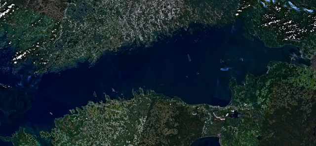
English: Visible colour satellite image of Gulf of Finland.
Русский: Финский залив.
Suomi: Suomenlahti.
Eesti: Soome laht.
Svenska: Finska viken.
Deutsch: Finnische Meerbusen. |
| Data | 16 d'abril de 2006 (upload date) |
| Font | Satellite imagery taken from NASA World Wind software (by screenshot), NLT Landsat7 layer. |
| Autor | NASA |
Llicència
| This image is in the public domain because it is a screenshot from NASA’s globe software World Wind using a public domain layer, such as Blue Marble, MODIS, Landsat, SRTM, USGS or GLOBE.
|
 |
Historial del fitxer
Cliqueu una data/hora per veure el fitxer tal com era aleshores.
| Data/hora | Miniatura | Dimensions | Usuari/a | Comentari | |
|---|---|---|---|---|---|
| actual | 18:41, 18 abr 2006 | | 2.500 × 1.159 (4,79 Mo) | Hautala | {{PD-WorldWind}} Visible colour satellite image of Gulf of Finland. Screenshot of NASA World Wind, NLT Landsat7 layer. Category:Satellite photos |
Ús del fitxer
La pàgina següent utilitza aquest fitxer:
Ús global del fitxer
Utilització d'aquest fitxer en altres wikis:
- Utilització a ar.wikipedia.org
- Utilització a arz.wikipedia.org
- Utilització a ast.wikipedia.org
- Utilització a ba.wikipedia.org
- Utilització a be-tarask.wikipedia.org
- Utilització a br.wikipedia.org
- Utilització a cy.wikipedia.org
- Utilització a da.wikipedia.org
- Utilització a eo.wikipedia.org
- Utilització a fy.wikipedia.org
- Utilització a ga.wikipedia.org
- Utilització a he.wikipedia.org
- Utilització a hy.wikipedia.org
- Utilització a ms.wikipedia.org
- Utilització a mzn.wikipedia.org
- Utilització a no.wikipedia.org
- Utilització a pnb.wikipedia.org
- Utilització a pt.wikipedia.org
- Utilització a ro.wikipedia.org
- Utilització a ru.wikinews.org
- Utilització a www.wikidata.org