
Fitxer:Jose 2005 track.png
Mida d'aquesta previsualització: 800 × 495 píxels. Altres resolucions: 320 × 198 píxels | 640 × 396 píxels | 1.024 × 633 píxels | 1.280 × 791 píxels | 2.700 × 1.669 píxels.
Fitxer original (2.700 × 1.669 píxels, mida del fitxer: 2,78 Mo, tipus MIME: image/png)
| Aquest fitxer i la informació mostrada a continuació provenen del dipòsit multimèdia lliure Wikimedia Commons. |
Resum
| Descripció |
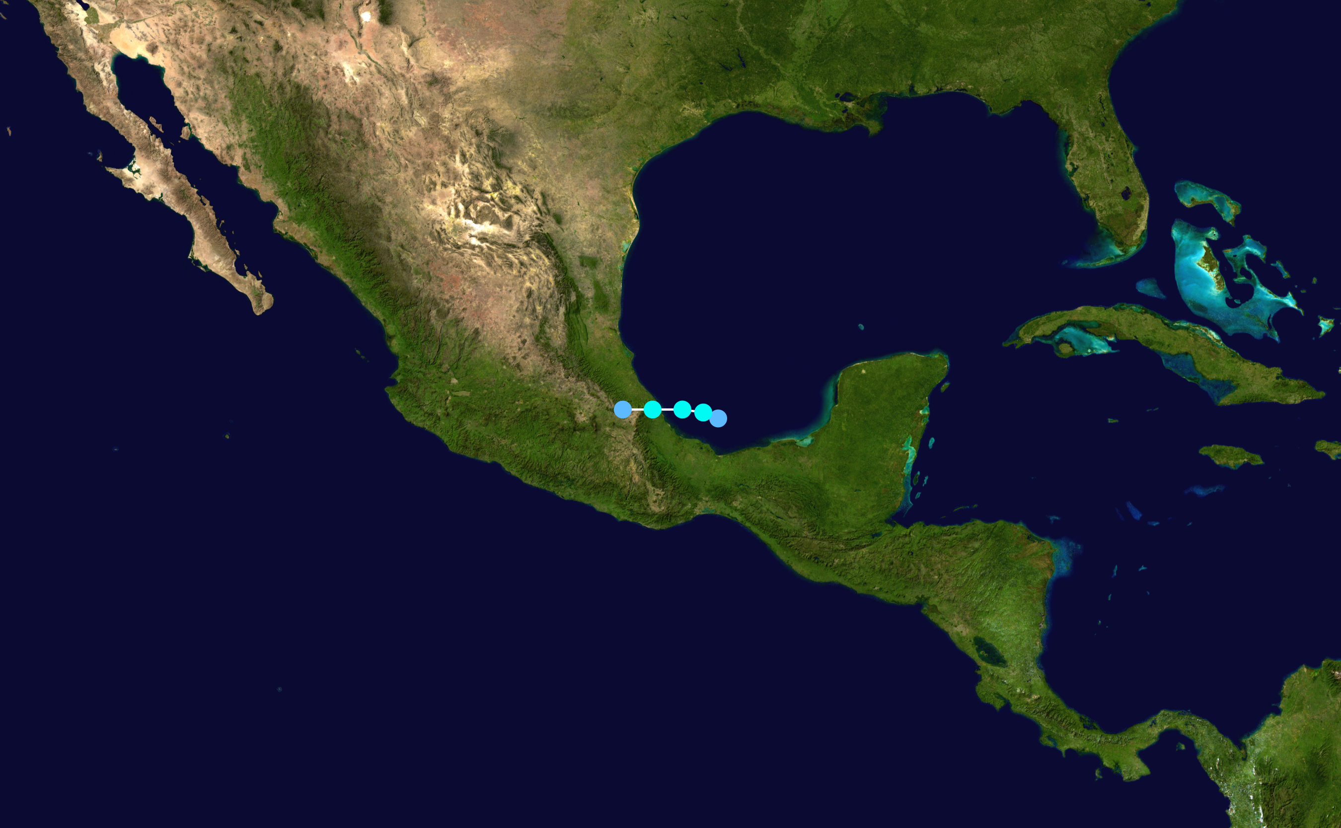
English: Track map of Tropical Storm Jose of the 2005 Atlantic hurricane season. The points show the location of the storm at 6-hour intervals. The colour represents the storm's maximum sustained wind speeds as classified in the (see below), and the shape of the data points represent the nature of the storm, according to the legend below. Tropical depression (≤38 mph, ≤62 km/h)
Tropical storm (39–73 mph, 63–118 km/h)
Category 1 (74–95 mph, 119–153 km/h)
Category 2 (96–110 mph, 154–177 km/h)
Category 3 (111–129 mph, 178–208 km/h)
Category 4 (130–156 mph, 209–251 km/h)
Category 5 (≥157 mph, ≥252 km/h)
Unknown
Storm type |
||
| Data | 2005-08-22–2005-08-23 | ||
| Font | Created by Supportstorm using Wikipedia:WikiProject Tropical cyclones/Tracks. The background image is from NASA. Tracking data is from the National Hurricane Center[1]. | ||
| Autor | Supportstorm | ||
| Source code | Track map data table, if present below, is in HURDAT2 or ATCF format. See format details in [2] and [3], respectively.
|
Llicència
| S'ha alliberat aquesta obra al domini públic pel seu autor Supportstorm. Això s'aplica a tot el món. En alguns països això pot no ser legalment possible, en tal cas: Supportstorm concedeix a tothom el dret d'usar aquesta obra per a qualsevol propòsit, sense cap condició llevat d'aquelles requerides per la llei. |
Historial del fitxer
Cliqueu una data/hora per veure el fitxer tal com era aleshores.
| Data/hora | Miniatura | Dimensions | Usuari/a | Comentari | |
|---|---|---|---|---|---|
| actual | 18:51, 28 nov 2019 | | 2.700 × 1.669 (2,78 Mo) | Supportstorm | 2700 px |
| 00:54, 13 jul 2006 |  | 1.024 × 633 (483 Ko) | Nilfanion | ||
| 20:43, 10 jul 2006 |  | 1.024 × 633 (483 Ko) | Nilfanion | {{Hurricane auto track map|Tropical Storm Jose (2005)}} | |
| 22:31, 24 gen 2006 |  | 1.024 × 633 (483 Ko) | Jdorje~commonswiki | {{Hurricane auto track map|Tropical Storm Jose (2005)}} | |
| 06:55, 14 nov 2005 |  | 1.024 × 633 (493 Ko) | Jdorje~commonswiki | {{Hurricane auto track map|Tropical Storm Jose (2005)}} | |
| 09:23, 11 nov 2005 |  | 1.024 × 633 (493 Ko) | Jdorje~commonswiki | ||
| 03:10, 10 nov 2005 |  | 1.024 × 805 (565 Ko) | Jdorje~commonswiki | {{Hurricane auto track map|Tropical Storm Jose (2005)}} Jose Jose Jose |
Ús del fitxer
La pàgina següent utilitza aquest fitxer:
Ús global del fitxer
Utilització d'aquest fitxer en altres wikis:
- Utilització a de.wikipedia.org
- Utilització a en.wikipedia.org
- Utilització a es.wikipedia.org
- Utilització a eu.wikipedia.org
- Utilització a fr.wikipedia.org
- Utilització a pt.wikipedia.org
- Utilització a simple.wikipedia.org
- Utilització a www.wikidata.org
- Utilització a zh.wikipedia.org