
Fitxer:Jungfraubahn Plan 1903.jpg
Fitxer original (1.166 × 1.884 píxels, mida del fitxer: 717 Ko, tipus MIME: image/jpeg)
| Aquest fitxer i la informació mostrada a continuació provenen del dipòsit multimèdia lliure Wikimedia Commons. |
Resum
| Descripció |
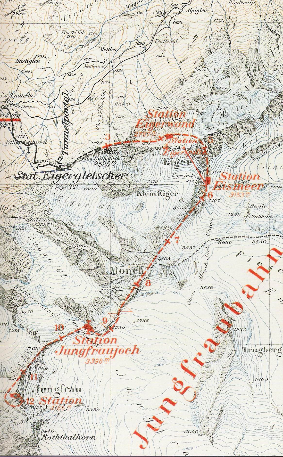
English: Map showing plans for the route of the Jungfraubahn and a gondola lift on the top of Eiger. mountain "Mönch".
Deutsch: Die Karte zeigt Pläne des Verlaufes der Jungfraubahn und einer Seilbahn von der Station Eismeer auf den Eiger. |
| Data | Data desconeguda, vor 1903 (evtl. um 1899 da erst die Strecke bis zur Station Rotstock fertiggestellt scheint) |
| Font | Scan aus Daniel Anker: Eiger - Die vertikale Arena. 2008 (S.39) |
| Autor | Schweizerisches Bundesarchiv |
Llicència
|
Aquest material està en domini públic als Estats Units i als altres països on el dret d'autor s'estén per 70 anys (o menys) després de la mort de l'autor.
| |
| Aquest fitxer està identificat com a lliure de restriccions conegudes sota la llei de drets d'autor, inclosos els drets veïns. | |
Historial del fitxer
Cliqueu una data/hora per veure el fitxer tal com era aleshores.
| Data/hora | Miniatura | Dimensions | Usuari/a | Comentari | |
|---|---|---|---|---|---|
| actual | 21:00, 14 gen 2009 | | 1.166 × 1.884 (717 Ko) | Kauk0r | {{Information |Description={{en|1=Map showing plans for the route of the Jungfraubahn and a gondola lift on the top of eiger.}} {{de|1=Die Karte zeigt Pläne des Verlaufes der Jungfraubahn und einer Seilbahn von der Station Eismeer auf den Eiger.}} |Sourc |
Ús del fitxer
Les 2 pàgines següents utilitzen aquest fitxer:
Ús global del fitxer
Utilització d'aquest fitxer en altres wikis:
- Utilització a cs.wikipedia.org
- Utilització a de.wikipedia.org
- Utilització a en.wikipedia.org
- Utilització a eo.wikipedia.org
- Utilització a fr.wikipedia.org
- Utilització a hu.wikipedia.org
- Utilització a it.wikipedia.org
- Utilització a it.wikivoyage.org
- Utilització a pl.wikipedia.org
- Utilització a ru.wikipedia.org
- Utilització a sl.wikipedia.org
- Utilització a uk.wikipedia.org
- Utilització a www.wikidata.org
- Utilització a zh.wikipedia.org