
Fitxer:Lake turkana satellite.jpg
Mida d'aquesta previsualització: 800 × 593 píxels. Altres resolucions: 320 × 237 píxels | 640 × 474 píxels | 992 × 735 píxels.
Fitxer original (992 × 735 píxels, mida del fitxer: 618 Ko, tipus MIME: image/jpeg)
| Aquest fitxer i la informació mostrada a continuació provenen del dipòsit multimèdia lliure Wikimedia Commons. |
Resum
| Descripció |
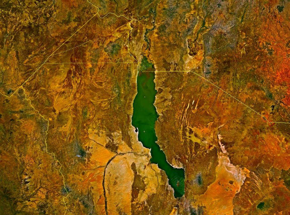
Deutsch: Satellitenbild des Turkana-Sees auf den Staatsgebieten von Kenia und Äthiopien. Die Staatsgrenzen sind als gelbe Linien eingezeichnet. Im Nordwesten befindet sich das sowohl von Äthiopien und Kenia, mindestens bis zur Unabhängigkeit des Südsudan auch vom Sudan, beanspruchte Ilemi-Dreieck.
English: Lake Turkana, Kenya and Ethiopia. satellite image. The yellow lines denote the borders. |
| Font | NASA World Wind |
| Autor | Fotografia: NASA |
Llicència
| This image is in the public domain because it is a screenshot from NASA’s globe software World Wind using a public domain layer, such as Blue Marble, MODIS, Landsat, SRTM, USGS or GLOBE.
|
 |
Historial del fitxer
Cliqueu una data/hora per veure el fitxer tal com era aleshores.
| Data/hora | Miniatura | Dimensions | Usuari/a | Comentari | |
|---|---|---|---|---|---|
| actual | 16:23, 18 ago 2017 | | 992 × 735 (618 Ko) | Mélomène | According with [https://en.wikipedia.org/wiki/Ilemi_Triangle] |
| 02:09, 24 març 2006 |  | 992 × 735 (166 Ko) | Roke~commonswiki | Lake Turkana, Kenya and Ethiopia. satellite image {{PD-WorldWind}} Category: Kenya |
Ús del fitxer
Les 2 pàgines següents utilitzen aquest fitxer:
Ús global del fitxer
Utilització d'aquest fitxer en altres wikis:
- Utilització a af.wikipedia.org
- Utilització a ar.wikipedia.org
- Utilització a ast.wikipedia.org
- Utilització a avk.wikipedia.org
- Utilització a az.wikipedia.org
- Utilització a ba.wikipedia.org
- Utilització a bn.wikipedia.org
- Utilització a cs.wikipedia.org
- Utilització a de.wikipedia.org
- Utilització a en.wikipedia.org
- Utilització a eo.wikipedia.org
- Utilització a es.wikipedia.org
- Utilització a fa.wikipedia.org
- Utilització a fi.wikipedia.org
- Utilització a fr.wikipedia.org
- Utilització a fr.wikivoyage.org
- Utilització a gl.wikipedia.org
- Utilització a he.wikipedia.org
- Utilització a hr.wikipedia.org
- Utilització a hu.wikipedia.org
- Utilització a hy.wikipedia.org
- Utilització a it.wikipedia.org
- Utilització a ja.wikipedia.org
- Utilització a ko.wikipedia.org
- Utilització a la.wikipedia.org
- Utilització a lv.wikipedia.org
- Utilització a nl.wikipedia.org
- Utilització a nn.wikipedia.org
- Utilització a no.wikipedia.org
- Utilització a pl.wikipedia.org
- Utilització a pt.wikipedia.org
Vegeu més usos globals d'aquest fitxer.