
Fitxer:Map of Hawaii highlighting Hawaii (island).svg

Mida d'aquesta previsualització PNG del fitxer SVG: 800 × 538 píxels. Altres resolucions: 320 × 215 píxels | 640 × 431 píxels | 1.024 × 689 píxels | 1.280 × 862 píxels | 2.560 × 1.723 píxels | 6.063 × 4.081 píxels.
Fitxer original (fitxer SVG, nominalment 6.063 × 4.081 píxels, mida del fitxer: 12 Ko)
| Aquest fitxer i la informació mostrada a continuació provenen del dipòsit multimèdia lliure Wikimedia Commons. |
.svg?uselang=ca)
Resum
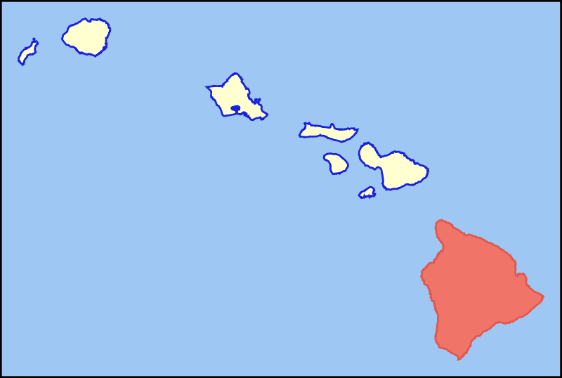
| Descripció | Colored locator map for the island of Hawaii |
| Data | |
| Font | Based on the SVG file that was released to the public domain by David Benbennick at Wikipedia: Image:Map_of_Hawaii_highlighting_Kalawao_County.svg |
| Autor | MattWright |
Llicència
| S'ha alliberat aquesta obra al domini públic pel seu autor I, MattWright. Això s'aplica a tot el món. En alguns països això pot no ser legalment possible, en tal cas: I, MattWright concedeix a tothom el dret d'usar aquesta obra per a qualsevol propòsit, sense cap condició llevat d'aquelles requerides per la llei. |
Historial del fitxer
Cliqueu una data/hora per veure el fitxer tal com era aleshores.
| Data/hora | Miniatura | Dimensions | Usuari/a | Comentari | |
|---|---|---|---|---|---|
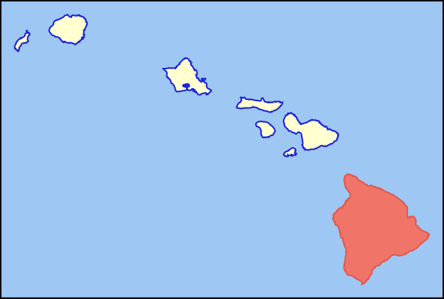
| actual | 10:33, 30 jul 2007 | | 6.063 × 4.081 (12 Ko) | MattWright | == Summary == {{Information |Description=Colored locator map for the island of Kauai |Source=Based on the SVG file that was released to the public domain by [http://commons.wikimedia.org/wiki/User:Dbenbenn David Benbennick] at [http://en.wikipedia.org/wik |
Ús del fitxer
La pàgina següent utilitza aquest fitxer:
Ús global del fitxer
Utilització d'aquest fitxer en altres wikis:
- Utilització a af.wikipedia.org
- Utilització a als.wikipedia.org
- Utilització a ar.wikipedia.org
- Utilització a az.wiktionary.org
- Utilització a bg.wikipedia.org
- Utilització a br.wikipedia.org
- Utilització a de.wikipedia.org
- Utilització a de.wikivoyage.org
- Utilització a el.wikipedia.org
- Utilització a en.wikipedia.org
- Utilització a eo.wikipedia.org
- Utilització a es.wikipedia.org
- Utilització a fr.wiktionary.org
- Utilització a fy.wikipedia.org
- Utilització a ga.wikipedia.org
- Utilització a haw.wikipedia.org
- Utilització a hi.wikipedia.org
- Utilització a hu.wikipedia.org
- Utilització a ia.wikipedia.org
- Utilització a id.wikipedia.org
- Utilització a is.wikipedia.org
- Utilització a it.wikivoyage.org
- Utilització a ja.wikipedia.org
- Utilització a lt.wikipedia.org
- Utilització a ms.wikipedia.org
- Utilització a pt.wikipedia.org
- Utilització a ro.wikipedia.org
- Utilització a sk.wikipedia.org
- Utilització a sv.wikipedia.org
- Utilització a tg.wikipedia.org
- Utilització a th.wikipedia.org
- Utilització a ur.wikipedia.org
- Utilització a vi.wikipedia.org
Vegeu més usos globals d'aquest fitxer.
.svg)
.svg)