
Fitxer:Mozambique relief location map.jpg

Mida d'aquesta previsualització: 398 × 599 píxels. Altres resolucions: 159 × 240 píxels | 319 × 480 píxels | 510 × 768 píxels | 680 × 1.024 píxels | 1.329 × 2.000 píxels.
Fitxer original (1.329 × 2.000 píxels, mida del fitxer: 1,23 Mo, tipus MIME: image/jpeg)
| Aquest fitxer i la informació mostrada a continuació provenen del dipòsit multimèdia lliure Wikimedia Commons. |
| Descripció |
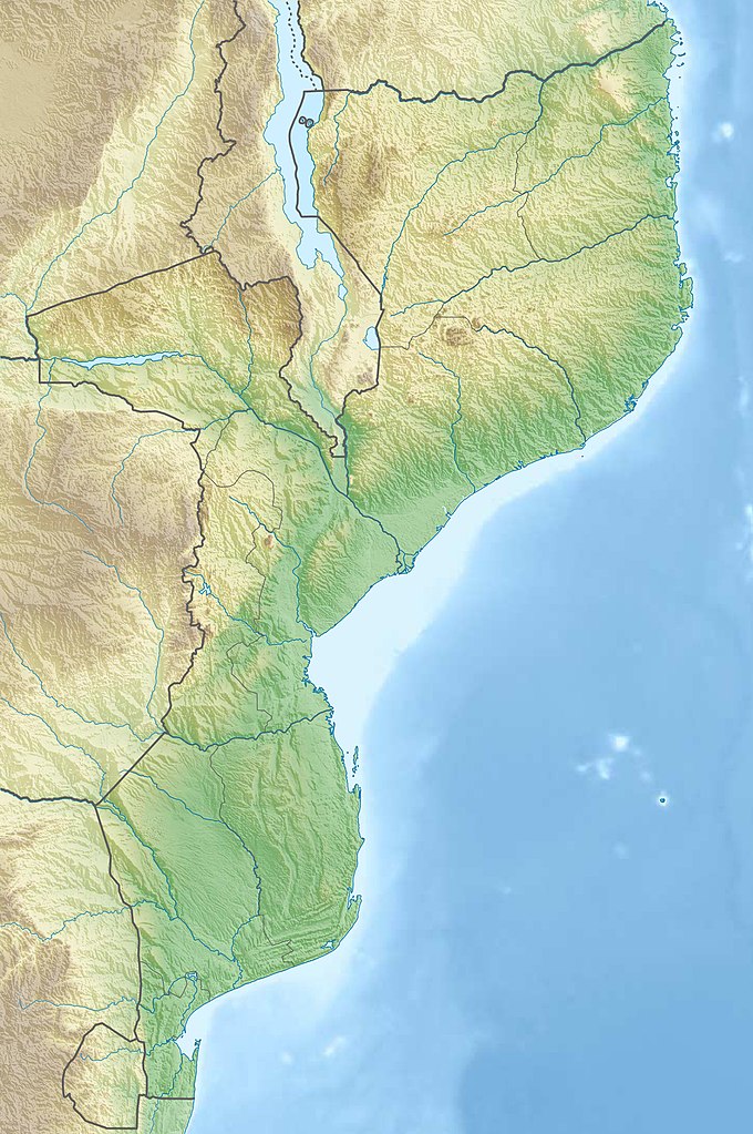
Deutsch: Physische Positionskarte von Mosambik
Quadratische Plattkarte, N-S-Streckung 105 %. Geographische Begrenzung der Karte:
English: Physical location map of Mozambique
Equirectangular projection, N/S stretching 105 %. Geographic limits of the map:
|
| Data | |
| Font |
Treball propi, using
|
| Autor | Carport |
| Permís (Com reutilitzar aquest fitxer) |
Aquest fitxer està subjecte a la llicència de Creative Commons Reconeixement i Compartir Igual 3.0 No adaptada.
|
| Altres versions |
|

Historial del fitxer
Cliqueu una data/hora per veure el fitxer tal com era aleshores.
| Data/hora | Miniatura | Dimensions | Usuari/a | Comentari | |
|---|---|---|---|---|---|
| actual | 22:31, 3 març 2020 | | 1.329 × 2.000 (1,23 Mo) | Sémhur | Adding Tanzanian border claim (from https://www.nbs.go.tz/index.php/en/census-surveys/gis/385-2012-phc-shapefiles-level-one-and-two) |
| 23:30, 15 des 2012 |  | 1.329 × 2.000 (1,11 Mo) | Carport | {{Information |Description= {{de|Physische Positionskarte von Mosambik}} Quadratische Plattkarte, N-S-Streckung 105 %. Geographische Begrenzung der Karte: * N: 10.2° S * S: 27.4° S * W: 29.8° O * O: 41.8° O {{en|Location map of [[:... |
Ús del fitxer
Les 4 pàgines següents utilitzen aquest fitxer:
Ús global del fitxer
Utilització d'aquest fitxer en altres wikis:
- Utilització a af.wikipedia.org
- Utilització a ar.wikipedia.org
- Utilització a az.wikipedia.org
- Utilització a ban.wikipedia.org
- Utilització a bg.wikipedia.org
- Utilització a bn.wikipedia.org
- Utilització a bs.wikipedia.org
- Utilització a ceb.wikipedia.org
- Utilització a ce.wikipedia.org
- Utilització a da.wikipedia.org
- Utilització a de.wikipedia.org
- Mosambik
- Cahora-Bassa-Talsperre
- Ilha de Moçambique
- Monte Binga
- Bazaruto
- Maputo-Bucht
- Vorlage:Positionskarte Mosambik
- Monte Namuli
- Wikipedia:Kartenwerkstatt/Positionskarten/Afrika
- Quirimbas
- Inhaca
- Ibo (Insel)
- Monte Mabu
- Amaramba-See
- Angoche (Insel)
- Grande Hotel Beira
- Massingir-Talsperre
- Liste von Kraftwerken in Mosambik
- Benguerra
- Bucht von Tungue
- Utilització a de.wikivoyage.org
- Utilització a dsb.wikipedia.org
- Utilització a el.wikipedia.org
- Utilització a en.wikipedia.org
Vegeu més usos globals d'aquest fitxer.