
Fitxer:Muskegon Michigan harbor entrance.jpg
Mida d'aquesta previsualització: 800 × 530 píxels. Altres resolucions: 320 × 212 píxels | 640 × 424 píxels | 1.024 × 678 píxels | 1.500 × 993 píxels.
Fitxer original (1.500 × 993 píxels, mida del fitxer: 516 Ko, tipus MIME: image/jpeg)
| Aquest fitxer i la informació mostrada a continuació provenen del dipòsit multimèdia lliure Wikimedia Commons. |
| Descripció |
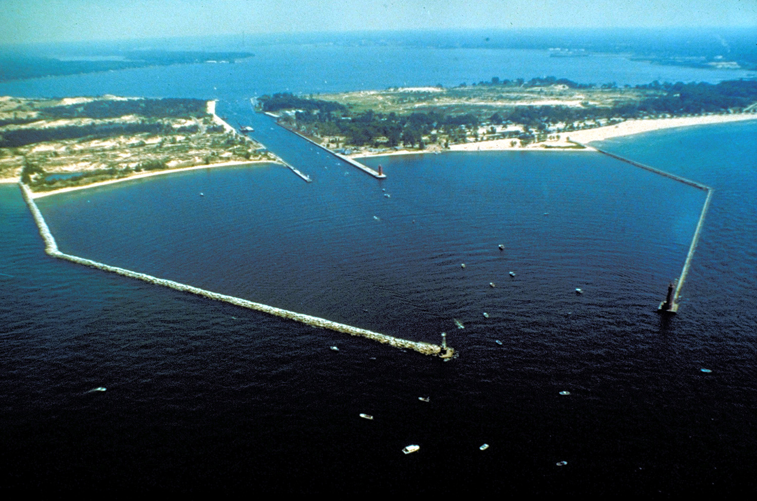
English: The breakwaters and harbor entrance on Lake Michigan at Muskegon, Muskegon County, Michigan, USA. The harbor entrance opens into Muskegon Lake, on which the city is situated. |
|||
| Data | not specified or unknown | |||
| Font |
U.S. Army Corps of Engineers Digital Visual Library Image page Image description page Digital Visual Library home page |
|||
| Autor | U.S. Army Corps of Engineers, photographer not specified or unknown | |||
| Permís (Com reutilitzar aquest fitxer) |
|
|||
| Localització | Muskegon, Michigan, USA |
| Posició de la càmera | | Aquesta i altres imatges properes a: OpenStreetMap |
|---|
Historial del fitxer
Cliqueu una data/hora per veure el fitxer tal com era aleshores.
| Data/hora | Miniatura | Dimensions | Usuari/a | Comentari | |
|---|---|---|---|---|---|
| actual | 03:24, 29 març 2007 | | 1.500 × 993 (516 Ko) | DanMS | {{Information | Description = {{en|The breakwaters and harbor entrance on Lake Michigan at Muskegon, Muskegon County, Michigan, USA. The harbor entrance opens into Muskegon Lake, on which the city is situated.}} | Source = U.S. Army Corps of En |
Ús del fitxer
La pàgina següent utilitza aquest fitxer:
Ús global del fitxer
Utilització d'aquest fitxer en altres wikis:
- Utilització a ar.wikipedia.org
- Utilització a arz.wikipedia.org
- Utilització a be.wikipedia.org
- Utilització a ceb.wikipedia.org
- Utilització a ce.wikipedia.org
- Utilització a cs.wikipedia.org
- Utilització a cy.wikipedia.org
- Utilització a dag.wikipedia.org
- Utilització a da.wikipedia.org
- Utilització a en.wikipedia.org
- Utilització a en.wikivoyage.org
- Utilització a eo.wikipedia.org
- Utilització a es.wikipedia.org
- Utilització a eu.wikipedia.org
- Utilització a fr.wikipedia.org
- Utilització a hu.wikipedia.org
- Utilització a ia.wikipedia.org
- Utilització a it.wikipedia.org
- Utilització a ja.wikipedia.org
- Utilització a ko.wikipedia.org
- Utilització a ky.wikipedia.org
- Utilització a lld.wikipedia.org
- Utilització a no.wikipedia.org
- Utilització a pl.wikipedia.org
- Utilització a pt.wikipedia.org
- Utilització a sr.wikipedia.org
- Utilització a tr.wikipedia.org
- Utilització a tt.wikipedia.org
- Utilització a uk.wikipedia.org
- Utilització a uz.wikipedia.org
- Utilització a vo.wikipedia.org
- Utilització a www.wikidata.org
- Utilització a zh-min-nan.wikipedia.org