
Fitxer:Obcine Slovenija 2006 Kranj.svg

Mida d'aquesta previsualització PNG del fitxer SVG: 800 × 522 píxels. Altres resolucions: 320 × 209 píxels | 640 × 418 píxels | 1.024 × 668 píxels | 1.280 × 835 píxels | 2.560 × 1.670 píxels | 2.613 × 1.705 píxels.
Fitxer original (fitxer SVG, nominalment 2.613 × 1.705 píxels, mida del fitxer: 2,36 Mo)
| Aquest fitxer i la informació mostrada a continuació provenen del dipòsit multimèdia lliure Wikimedia Commons. |
Resum
| Descripció |
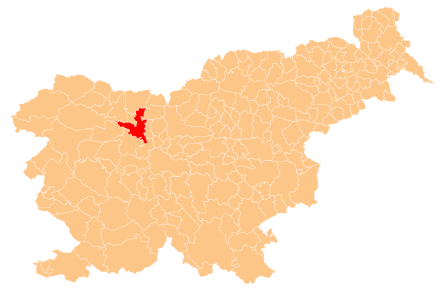
English: Občina Kranj (marked red) on map of the municipalities (občine) of the Republic of Slovenia, as since May 2006 (210 units). |
| Data | |
| Font | Manipulated Image:Obcine Slovenija 2006.svg in text editor. |
| Autor | Source of the public data is GURS (Geodetska uprava Republike Slovenije or Surveying and Mapping Authority of the Republic of Slovenia). Converted from Shapefile to SVG with shp2svg and prepared for Wikipedia by romanm (talk). |
| Permís (Com reutilitzar aquest fitxer) |
Public domain. See Image:Obcine Slovenija 2006.svg for an explanation. |
Llicència
| Jo, el titular del copyright d'aquesta obra, l'allibero al domini públic. Això s'aplica a tot el món. En alguns països això pot no ser legalment possible, en tal cas: Jo faig concessió a tothom del dret d'usar aquesta obra per a qualsevol propòsit, sense cap condició llevat d'aquelles requerides per la llei. |
Historial del fitxer
Cliqueu una data/hora per veure el fitxer tal com era aleshores.
| Data/hora | Miniatura | Dimensions | Usuari/a | Comentari | |
|---|---|---|---|---|---|
| actual | 01:00, 1 juny 2009 | | 2.613 × 1.705 (2,36 Mo) | Romanm | {{Information |Description={{en|1=''Občina Kranj'' (marked red) on map of the municipalities (''občine'') of the Republic of Slovenia, as since May 2006 (210 units).}} |Source=Manipulated Image:Obcine Slovenija 2006.svg in text editor. |Author=Sour |
Ús del fitxer
No hi ha pàgines que utilitzin aquest fitxer.
Ús global del fitxer
Utilització d'aquest fitxer en altres wikis:
- Utilització a ceb.wikipedia.org
- Utilització a de.wikipedia.org
- Utilització a en.wikipedia.org
- Utilització a fa.wikipedia.org
- Utilització a it.wikipedia.org
- Utilització a ja.wikipedia.org
- Utilització a mk.wikipedia.org
- Utilització a pl.wikipedia.org
- Utilització a pnb.wikipedia.org
- Utilització a pt.wikipedia.org
- Utilització a ru.wikipedia.org
- Utilització a sh.wikipedia.org
- Utilització a sl.wikipedia.org
- Utilització a smn.wikipedia.org