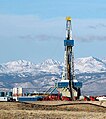
Fitxer:Rig wind river.jpg

Mida d'aquesta previsualització: 532 × 599 píxels. Altres resolucions: 213 × 240 píxels | 426 × 480 píxels | 741 × 835 píxels.
Fitxer original (741 × 835 píxels, mida del fitxer: 298 Ko, tipus MIME: image/jpeg)
Historial del fitxer
Cliqueu una data/hora per veure el fitxer tal com era aleshores.
| Data/hora | Miniatura | Dimensions | Usuari/a | Comentari | |
|---|---|---|---|---|---|
| actual | 06:38, 11 gen 2024 |  | 741 × 835 (298 Ko) | RodRabelo7 | Reverted to version as of 12:04, 28 March 2017 (UTC) as per Commons:Overwriting existing files#DO NOT overwrite: “✘ Artificially upscaling or enlarging using any tool, including AI-based or deep learning services” |
| 13:40, 16 nov 2023 |  | 1.482 × 1.670 (847 Ko) | Hike395 | AI upscaling | |
| 14:04, 28 març 2017 |  | 741 × 835 (298 Ko) | Hike395 | from original source, better crop and removal of text | |
| 21:51, 10 des 2015 |  | 1.530 × 1.456 (456 Ko) | Ras67 | losslessly cropped with Jpegcrop | |
| 09:26, 24 jul 2012 |  | 1.540 × 1.456 (459 Ko) | Hike395 | slightly nicer touchup | |
| 09:18, 24 jul 2012 |  | 1.540 × 1.456 (462 Ko) | Hike395 | higher-resolution image from DSEIS cover. Used GIMP to remove title text | |
| 18:32, 13 set 2007 |  | 374 × 270 (52 Ko) | BetacommandBot | Transwiki approved by: w:en:User:Dmcdevit This image was copied from wikipedia:en. The original description was: The Photo depicts a w:en:natural gas w:en:drilling rig on the Pinedale Anticline, just west of [[w:en |
Ús del fitxer
Les 2 pàgines següents utilitzen aquest fitxer:
Ús global del fitxer
Utilització d'aquest fitxer en altres wikis:
- Utilització a ar.wikipedia.org
- Utilització a as.wikipedia.org
- Utilització a az.wikipedia.org
- Utilització a be.wikipedia.org
- Utilització a bg.wikipedia.org
- Utilització a bo.wikipedia.org
- Utilització a cs.wikipedia.org
- Utilització a cy.wikipedia.org
- Utilització a de.wikipedia.org
- Utilització a de.wikinews.org
- Utilització a en.wikipedia.org
- Utilització a eo.wikipedia.org
- Utilització a es.wikipedia.org
- Utilització a fr.wikipedia.org
- Utilització a fy.wikipedia.org
- Utilització a hr.wikipedia.org
- Utilització a hy.wikipedia.org
- Utilització a ja.wikipedia.org
- Utilització a ko.wikipedia.org
- Utilització a nl.wikipedia.org
- Utilització a pl.wikipedia.org
- Utilització a pt.wikipedia.org
- Utilització a ru.wikipedia.org
- Utilització a sk.wikipedia.org
- Utilització a tr.wikipedia.org
- Utilització a uk.wikipedia.org
- Utilització a zh.wikipedia.org


