
Fitxer:Roosevelt National Forest location in Colorado.png
Fitxer original (2.000 × 1.447 píxels, mida del fitxer: 1,74 Mo, tipus MIME: image/png)
| Aquest fitxer i la informació mostrada a continuació provenen del dipòsit multimèdia lliure Wikimedia Commons. |
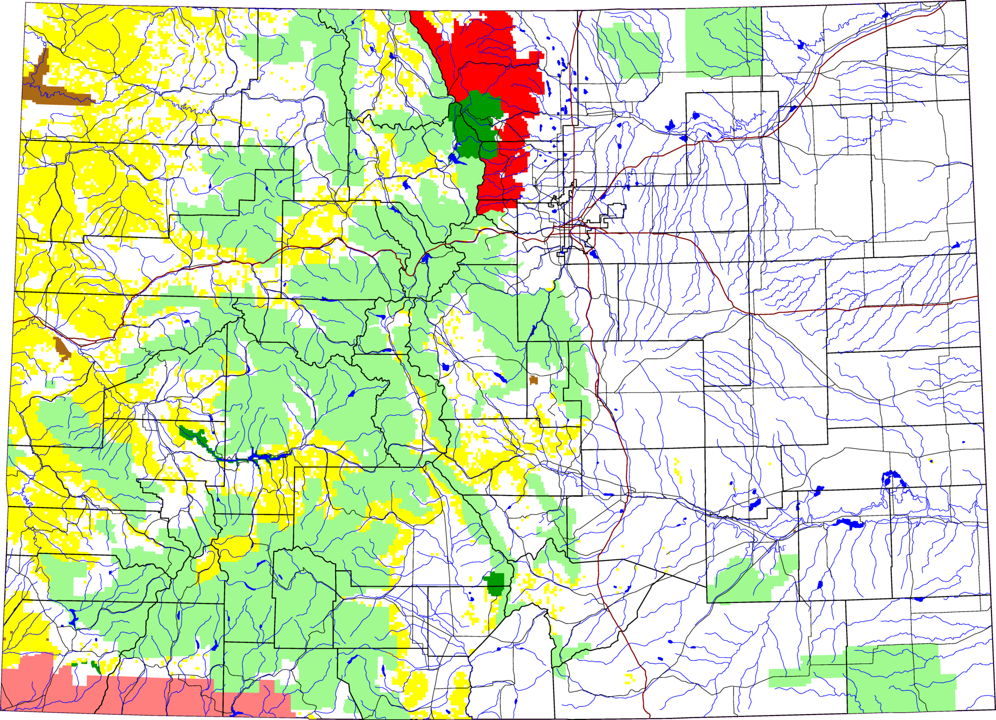
A map of Colorado, with Roosevelt National Forest highlighted in red. The light green is other Forest Service land, yellow is BLM land, dark green is National Park, brown is National Monument or National Historic Site, pink is Indian reservation. The reddish lines are Interstate Highways.
David Benbennick made this map with data from nationalatlas.gov.
The map uses the azimuthal equidistant projection, centered on (-105.7167, 39.1333) (degrees latitude, longitude). The area outside Colorado is transparent, so it should look nice on non-white backgrounds.
Eventually, I will upload the 4 megabyte Metapost script I used to make this map. In the mean time, see map.mp.
| Jo, el titular del copyright d'aquesta obra, l'allibero al domini públic. Això s'aplica a tot el món. En alguns països això pot no ser legalment possible, en tal cas: Jo faig concessió a tothom del dret d'usar aquesta obra per a qualsevol propòsit, sense cap condició llevat d'aquelles requerides per la llei. |
Historial del fitxer
Cliqueu una data/hora per veure el fitxer tal com era aleshores.
| Data/hora | Miniatura | Dimensions | Usuari/a | Comentari | |
|---|---|---|---|---|---|
| actual | 21:46, 8 març 2006 | | 2.000 × 1.447 (1,74 Mo) | Dbenbenn | thumbnail, since MediaWiki can't scale PNG images larger than 12.5 megapixels |
| 15:12, 8 ago 2005 |  | 6.235 × 4.511 (652 Ko) | Dbenbenn | by me, PD |
Ús del fitxer
La pàgina següent utilitza aquest fitxer:
Ús global del fitxer
Utilització d'aquest fitxer en altres wikis:
- Utilització a en.wikipedia.org
- Utilització a es.wikipedia.org
- Utilització a fa.wikipedia.org
- Utilització a zh.wikipedia.org