
Fitxer:Sëlva Wolkenstein Selva di Val Gardena Sella.jpg

Mida d'aquesta previsualització: 800 × 415 píxels. Altres resolucions: 320 × 166 píxels | 640 × 332 píxels | 1.024 × 531 píxels | 1.280 × 664 píxels | 2.560 × 1.327 píxels | 11.723 × 6.078 píxels.
Fitxer original (11.723 × 6.078 píxels, mida del fitxer: 51,52 Mo, tipus MIME: image/jpeg)
| Aquest fitxer i la informació mostrada a continuació provenen del dipòsit multimèdia lliure Wikimedia Commons. |
Resum
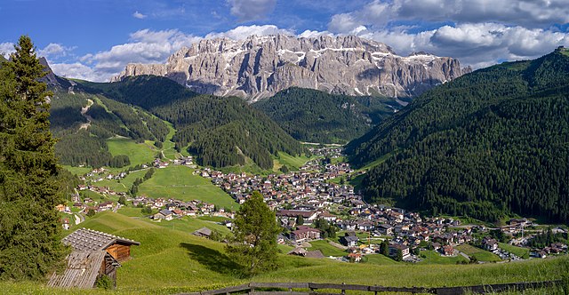
| Descripció |
English: View of the town of Sëlva with the Cir and Sella mountain groups
Deutsch: Ansicht von Wolkenstein in Gröden und die Sellagruppe in Südtirol
Italiano: Selva di Val Gardena con i gruppi montani del Cir e Sella e l'Alpe Jac visti dal monte Pic |
||||||
| Data | |||||||
| Font | Treball propi | ||||||
| Autor |
|
||||||
| Permís (Com reutilitzar aquest fitxer) |
Own work, attribution required (Multi-license with GFDL and Creative Commons CC-BY 2.5). Capture: Photo by Wolfgang Moroder | ||||||
| Altres versions |
 |


|
NOTE: This image is a panorama of 2 photos consisting of multiple frames that were merged or stitched in software. As a result, this image necessarily underwent some form of digital manipulation. These manipulations may include blending, blurring, cloning, and colour and perspective adjustments. As a result of these adjustments, the image content may be slightly different from reality at the points where multiple images were combined. This manipulation is often required due to lens, perspective, and parallax distortions.
|
| Posició de la càmera | | Aquesta i altres imatges properes a: OpenStreetMap |
|---|
Llicència
Jo, el titular dels drets d'autor d'aquest treball, el public sota la següent llicència:
Aquest fitxer està subjecte a la llicència de Creative Commons Reconeixement i Compartir Igual 3.0 No adaptada.
- Sou lliure de:
- compartir – copiar, distribuir i comunicar públicament l'obra
- adaptar – fer-ne obres derivades
- Amb les condicions següents:
- reconeixement – Heu de donar la informació adequada sobre l'autor, proporcionar un enllaç a la llicència i indicar si s'han realitzat canvis. Podeu fer-ho amb qualsevol mitjà raonable, però de cap manera no suggereixi que l'autor us dóna suport o aprova l'ús que en feu.
- compartir igual – Si modifiqueu, transformeu, o generareu amb el material, haureu de distribuir les vostres contribucions sota una llicència similar o una de compatible com l'original
Aquest imatge ha estat examinada usant la guia per a les imatges de qualitat i és considerada com una imatge de qualitat.
|
Historial del fitxer
Cliqueu una data/hora per veure el fitxer tal com era aleshores.
| Data/hora | Miniatura | Dimensions | Usuari/a | Comentari | |
|---|---|---|---|---|---|
| actual | 08:55, 16 juny 2018 | | 11.723 × 6.078 (51,52 Mo) | Moroder | cloned sky |
| 08:45, 16 juny 2018 |  | 11.723 × 6.078 (51,4 Mo) | Moroder | =={{int:filedesc}}== {{Information |description= {{en|1=View of the town of {{w|Sëlva}} with the Cir and Sella mountain groups}} {{de|1=Ansicht von Wolkenstein in Gröden und die Sellagruppe in Südtirol}} {{it|1=Selva di Val Gardena con i gruppi montani del Cir e Sella e l'Alpe Jac visti dal monte Pic}} |date=2018-06-15 |source={{own}} |author={{User:Moroder/Template:Credits}} |Permission=Own work, attribution required (Multi-license with GFDL and Creative Commons CC-BY 2.5). Capture: ''Photo ... |
Ús del fitxer
La pàgina següent utilitza aquest fitxer:
Ús global del fitxer
Utilització d'aquest fitxer en altres wikis:
- Utilització a ar.wikipedia.org
- Utilització a azb.wikipedia.org
- Utilització a be.wikipedia.org
- Utilització a bg.wikipedia.org
- Utilització a br.wikipedia.org
- Utilització a ceb.wikipedia.org
- Utilització a ce.wikipedia.org
- Utilització a de.wikipedia.org
- Utilització a de.wikivoyage.org
- Utilització a el.wikipedia.org
- Utilització a en.wikipedia.org
- Utilització a eo.wikipedia.org
- Utilització a es.wikipedia.org
- Utilització a eu.wikipedia.org
- Utilització a fr.wikipedia.org
- Utilització a hu.wikipedia.org
- Utilització a hy.wikipedia.org
- Utilització a ia.wikipedia.org
- Utilització a it.wikipedia.org
- Utilització a it.wikivoyage.org
- Utilització a ko.wikipedia.org
- Utilització a lld.wikipedia.org
- Utilització a lmo.wikipedia.org
- Utilització a no.wikipedia.org
- Utilització a pl.wikipedia.org
- Utilització a ru.wikipedia.org
- Utilització a sr.wikipedia.org
- Utilització a tl.wikipedia.org
- Utilització a tr.wikipedia.org
- Utilització a tt.wikipedia.org
- Utilització a uk.wikipedia.org
- Utilització a uz.wikipedia.org
- Utilització a vec.wikipedia.org
Vegeu més usos globals d'aquest fitxer.