
Fitxer:Saint Kitts and Nevis-CIA WFB Map.png
No hi ha cap versió amb una resolució més gran.
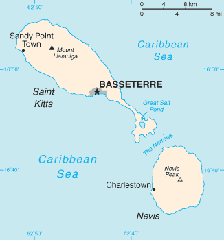
Saint_Kitts_and_Nevis-CIA_WFB_Map.png (326 × 350 píxels, mida del fitxer: 6 Ko, tipus MIME: image/png)
| Aquest fitxer i la informació mostrada a continuació provenen del dipòsit multimèdia lliure Wikimedia Commons. |
| Descripció |
English: Map of the Saint Kitts and Nevis |
| Font |
The World Factbook The Central Intelligence Agency, Langley, Virginia, USA |
| Autor | Desconegut |
| Altres versions | Image:Basseterre_Map_1.png |
This image is in the public domain because it contains materials that originally came from the United States Central Intelligence Agency's World Factbook.
|
 |
| date/time | username | edit summary |
|---|---|---|
| 01:08, 4. Nov 2004 | de:Benutzer:Zenogantner | |
| 23:47, 20. Okt 2003 | de:Benutzer:Head | (Karte Saint Kitts und Nevis, public domain aus dem CIA World Factbook: https://www.cia.gov/library/publications/the-world-factbook/geos/sc.html) |
Registre original de càrregues
Legende: (Aktuell) = dies ist das aktuelle Bild, (Löschen) = lösche diese alte Version, (Zurücksetzen) = verwende wieder diese alte Version.
- (Löschen) (Aktuell) 18:13, 1. Mär 2004 . . de:Benutzer:Raymond Raymond ( de:Benutzer_Diskussion:Raymond Diskussion) . . 330 x 355 (5252 Byte) (Karte ins Deutsche übersetzt)
- (Löschen) (Zurücksetzen) 23:47, 20. Okt 2003 . . de:Benutzer:Head Head ( de:Benutzer_Diskussion:Head Diskussion) . . 330 x 355 (6028 Byte) (Karte Saint Kitts und Nevis, public domain aus dem CIA World Factbook: https://www.cia.gov/library/publications/the-world-factbook/geos/sc.html archive copy at the Wayback Machine)
Historial del fitxer
Cliqueu una data/hora per veure el fitxer tal com era aleshores.
| Data/hora | Miniatura | Dimensions | Usuari/a | Comentari | |
|---|---|---|---|---|---|
| actual | 15:12, 14 ago 2010 | | 326 × 350 (6 Ko) | Ras67 | cropped |
| 04:18, 18 feb 2006 |  | 327 × 352 (8 Ko) | Hoshie | Updated map of Saint Kitts and Nevis from the CIA World Factbook, 10 Jan 06 rev: http://www.cia.gov/cia/publications/factbook/maps/sc-map.gif | |
| 11:17, 27 març 2005 |  | 330 × 355 (6 Ko) | Wolfman~commonswiki | {{CIA-map}} |
Ús del fitxer
La pàgina següent utilitza aquest fitxer:
Ús global del fitxer
Utilització d'aquest fitxer en altres wikis:
- Utilització a af.wikipedia.org
- Utilització a als.wikipedia.org
- Utilització a ar.wikipedia.org
- Utilització a ay.wikipedia.org
- Utilització a azb.wikipedia.org
- Utilització a az.wikipedia.org
- Utilització a be-tarask.wikipedia.org
- Utilització a bg.wikipedia.org
- Utilització a bn.wikipedia.org
- Utilització a br.wikipedia.org
- Utilització a da.wikipedia.org
- Utilització a de.wikipedia.org
- Utilització a de.wiktionary.org
- Utilització a el.wikipedia.org
- Utilització a en.wikipedia.org
- Saint Kitts and Nevis
- Sandy Point Town
- The Narrows (Saint Kitts and Nevis)
- User:Jannizz/SKN
- Great Salt Pond
- Pinney's Beach
- Outline of Saint Kitts and Nevis
- Index of Saint Kitts and Nevis–related articles
- Module:Location map/data/Saint Kitts and Nevis/doc
- Module:Location map/data/Saint Kitts and Nevis
- COVID-19 pandemic in Saint Kitts and Nevis
- Utilització a en.wikisource.org
- Utilització a eo.wikipedia.org
- Utilització a es.wikipedia.org
- Utilització a eu.wikipedia.org
- Utilització a fa.wikipedia.org
- Utilització a fi.wikipedia.org
- Utilització a fr.wikipedia.org
- Utilització a fy.wikipedia.org
- Utilització a gl.wikipedia.org
Vegeu més usos globals d'aquest fitxer.