
Fitxer:SeaHebrides TheMinch map-fr.svg

Mida d'aquesta previsualització PNG del fitxer SVG: 334 × 599 píxels. Altres resolucions: 134 × 240 píxels | 268 × 480 píxels | 428 × 768 píxels | 571 × 1.024 píxels | 1.142 × 2.048 píxels | 1.060 × 1.900 píxels.
Fitxer original (fitxer SVG, nominalment 1.060 × 1.900 píxels, mida del fitxer: 914 Ko)
| Aquest fitxer i la informació mostrada a continuació provenen del dipòsit multimèdia lliure Wikimedia Commons. |
Resum
| Descripció | |||
| Data | |||
| Font | travail personnel, extrait de la carte Image:Scotland topographic map-fr.svg de Sting, sous licences GFDL et CC-BY-SA. | ||
| Autor | Sémhur | ||
| Altres versions | |||
| Reconeixement (required by the license) | © Sémhur / Wikimedia Commons / | ||
| SVG | W3C-validity not checked. Aquesta imatge vectorial ha estat creada amb Inkscape .
|
||
| Graphic Lab |

| Posició de la càmera | | Aquesta i altres imatges properes a: OpenStreetMap |
|---|
Llicència
Jo, el titular dels drets d'autor d'aquest treball, el public sota les següents llicències:
| Copyleft: Aquesta és una obra d'art lliure: Podeu redistribuir-la i modificar-la sota els termes de la Llicència d'Art Lliure. Trobareu una còpia d'aquesta llicència al web Copyleft Attitude, així com en altres llocs web. |
This file is licensed under the Creative Commons Attribution-Share Alike 4.0 International, 3.0 Unported, 2.5 Generic, 2.0 Generic and 1.0 Generic license.
- Sou lliure de:
- compartir – copiar, distribuir i comunicar públicament l'obra
- adaptar – fer-ne obres derivades
- Amb les condicions següents:
- reconeixement – Heu de donar la informació adequada sobre l'autor, proporcionar un enllaç a la llicència i indicar si s'han realitzat canvis. Podeu fer-ho amb qualsevol mitjà raonable, però de cap manera no suggereixi que l'autor us dóna suport o aprova l'ús que en feu.
- compartir igual – Si modifiqueu, transformeu, o generareu amb el material, haureu de distribuir les vostres contribucions sota una llicència similar o una de compatible com l'original
Podeu seleccionar la llicència que vulgueu.
Historial del fitxer
Cliqueu una data/hora per veure el fitxer tal com era aleshores.
| Data/hora | Miniatura | Dimensions | Usuari/a | Comentari | |
|---|---|---|---|---|---|
| actual | 13:45, 1 set 2009 | | 1.060 × 1.900 (914 Ko) | Sémhur | Fonts : Arial => DejaVu Sans Condensed, Times New Roman => DejaVu Serif Condensed. |
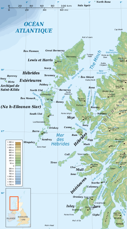
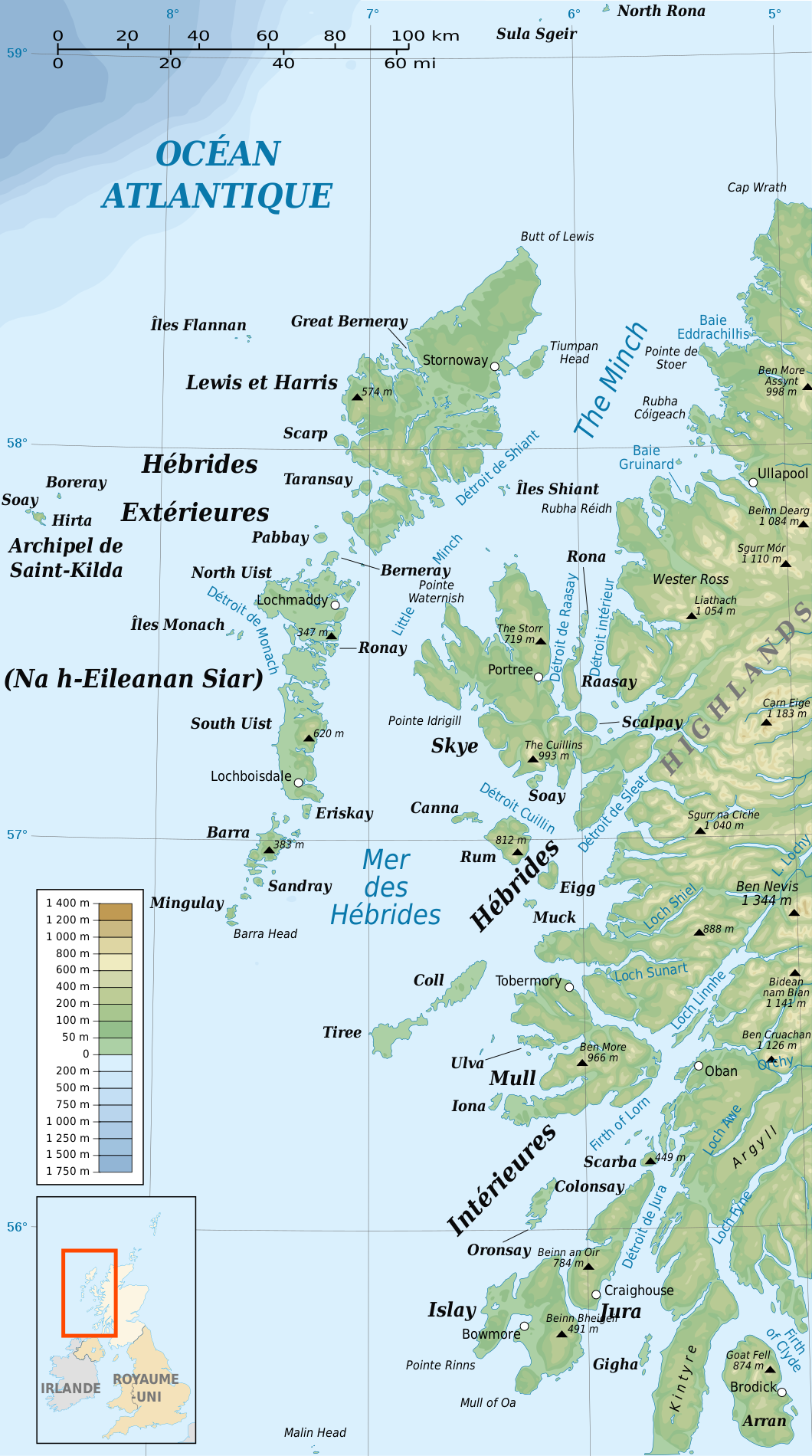
| 21:51, 24 gen 2008 |  | 1.060 × 1.900 (936 Ko) | Sémhur | {{Information |Description= {{en|French map of the Sea of the Hebrides and The Minch}} {{en|Carte de la Mer des Hébrides et de The Minch}} |Source=travail personnel |
Ús del fitxer
La pàgina següent utilitza aquest fitxer:
Ús global del fitxer
Utilització d'aquest fitxer en altres wikis:
- Utilització a br.wikipedia.org
- Utilització a cs.wikipedia.org
- Utilització a es.wikipedia.org
- Utilització a fr.wikipedia.org
- Utilització a gl.wikipedia.org
- Utilització a it.wikipedia.org
- Utilització a pl.wikipedia.org
- Utilització a pl.wiktionary.org
- Utilització a pt.wikipedia.org
- Utilització a sk.wikipedia.org