
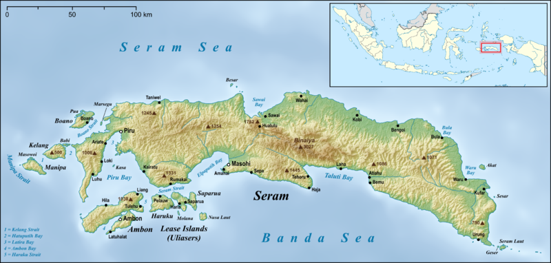
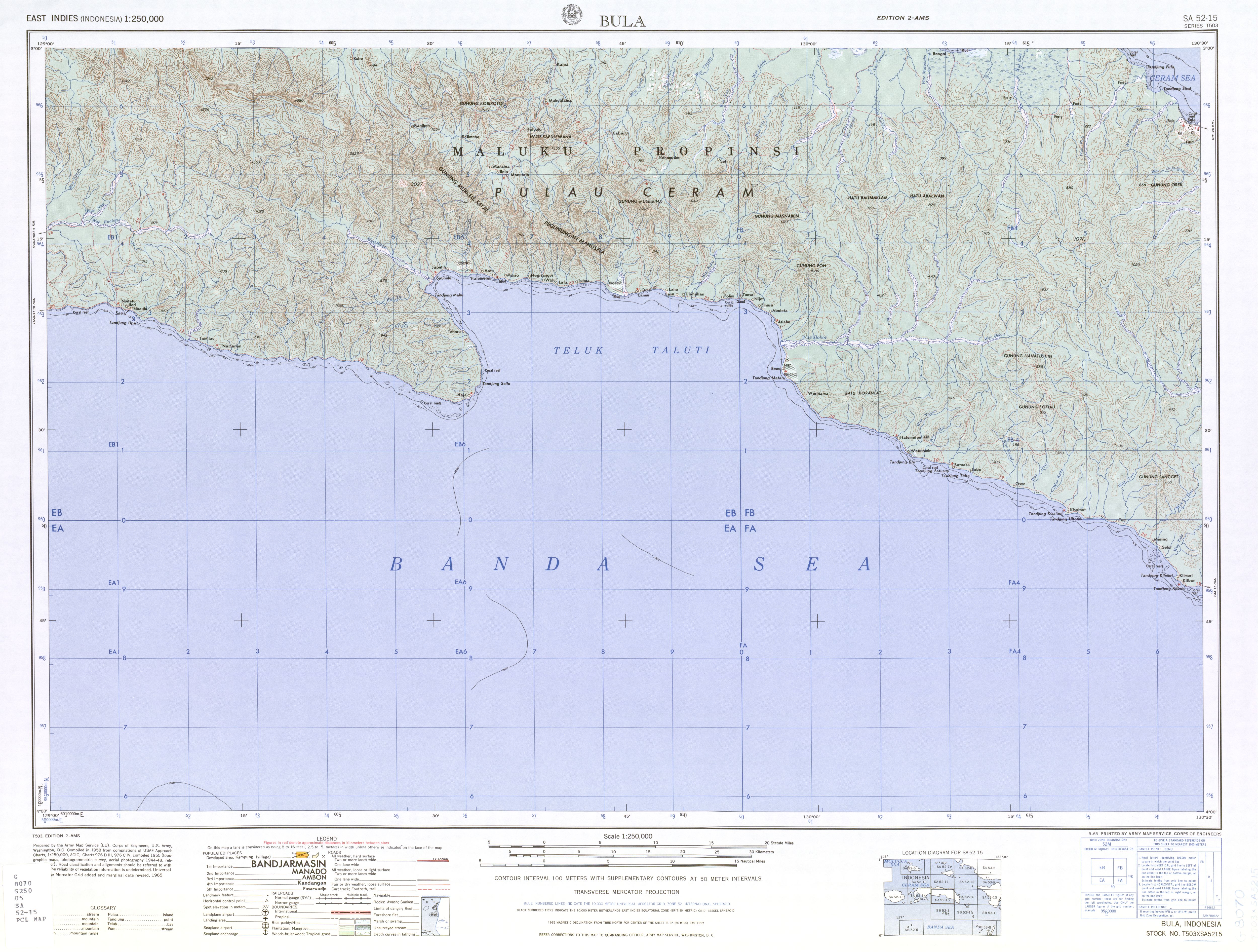
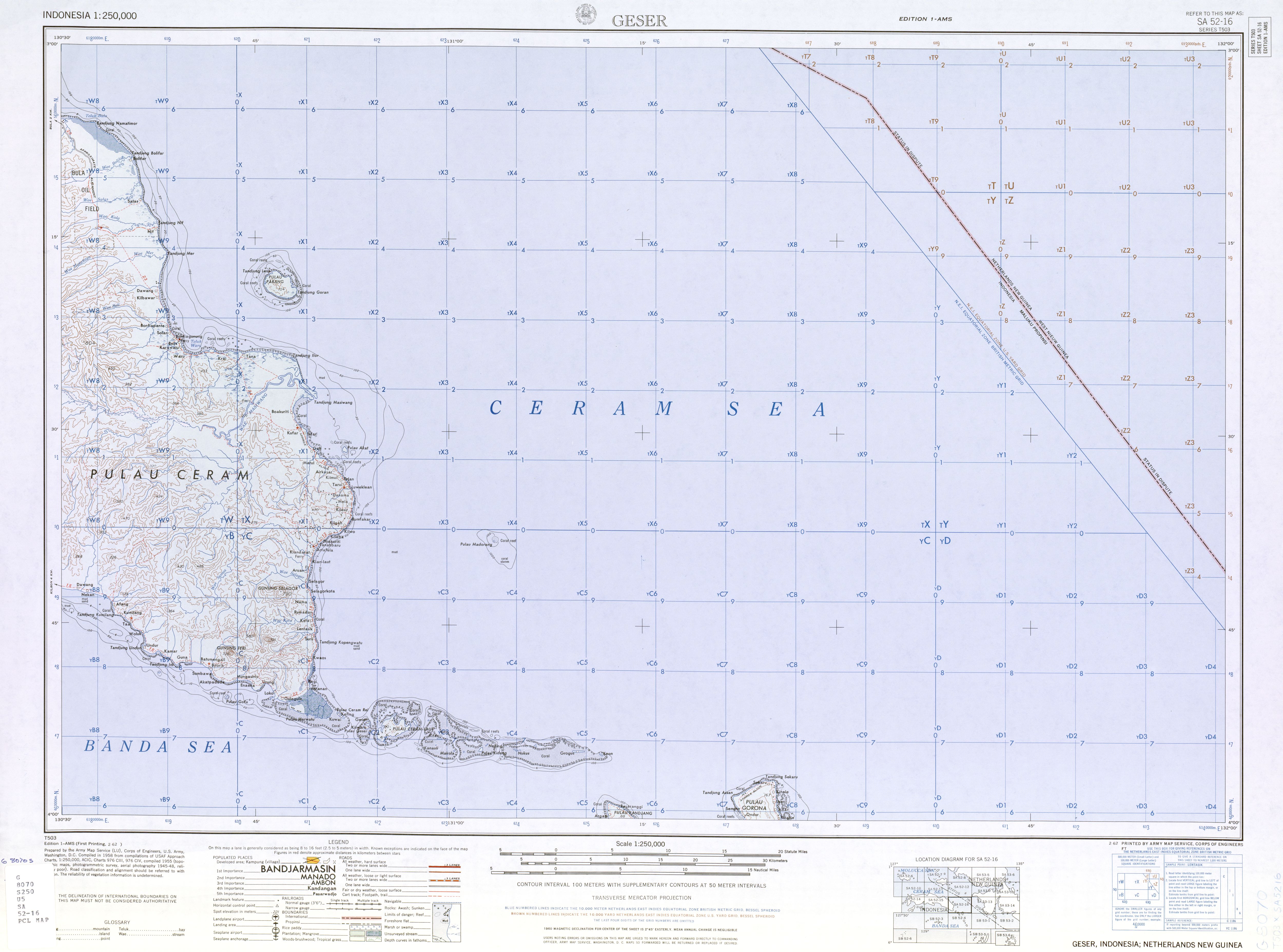
Fitxer:Seram en.png

Mida d'aquesta previsualització: 800 × 382 píxels. Altres resolucions: 320 × 153 píxels | 640 × 306 píxels | 1.024 × 489 píxels | 1.280 × 612 píxels | 2.756 × 1.317 píxels.
Fitxer original (2.756 × 1.317 píxels, mida del fitxer: 2,59 Mo, tipus MIME: image/png)
| Aquest fitxer i la informació mostrada a continuació provenen del dipòsit multimèdia lliure Wikimedia Commons. |
Resum
| Descripció | |
| Data | |
| Font |
own work, used:
|
| Autor | Lencer |
| Altres versions |
|


|
This map has been made or improved in the German Kartenwerkstatt (Map Lab). You can propose maps to improve as well.
|
Llicència
Jo, el titular dels drets d'autor d'aquest treball, el public sota la següent llicència:
Aquest fitxer està subjecte a la llicència de Creative Commons Reconeixement i Compartir Igual 3.0 No adaptada.
- Sou lliure de:
- compartir – copiar, distribuir i comunicar públicament l'obra
- adaptar – fer-ne obres derivades
- Amb les condicions següents:
- reconeixement – Heu de donar la informació adequada sobre l'autor, proporcionar un enllaç a la llicència i indicar si s'han realitzat canvis. Podeu fer-ho amb qualsevol mitjà raonable, però de cap manera no suggereixi que l'autor us dóna suport o aprova l'ús que en feu.
- compartir igual – Si modifiqueu, transformeu, o generareu amb el material, haureu de distribuir les vostres contribucions sota una llicència similar o una de compatible com l'original
Historial del fitxer
Cliqueu una data/hora per veure el fitxer tal com era aleshores.
| Data/hora | Miniatura | Dimensions | Usuari/a | Comentari | |
|---|---|---|---|---|---|
| actual | 07:05, 18 juny 2015 | | 2.756 × 1.317 (2,59 Mo) | Lencer | small fix |
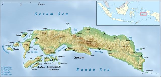
| 08:22, 17 juny 2015 |  | 2.756 × 1.317 (2,59 Mo) | Lencer | small fixes | |
| 07:42, 17 juny 2015 |  | 2.756 × 1.317 (2,59 Mo) | Lencer | == {{int:filedesc}} == {{Information |Description= {{en|Map of Seram Island and also Ambon Island and Lease Islands}} {{de|Karte der Insel Seram, sowie [[:de:Ambon (Insel)|Am... |
Ús del fitxer
Les 2 pàgines següents utilitzen aquest fitxer:
Ús global del fitxer
Utilització d'aquest fitxer en altres wikis:
- Utilització a af.wikipedia.org
- Utilització a ar.wikipedia.org
- Utilització a ast.wikipedia.org
- Utilització a be.wikipedia.org
- Utilització a bg.wikipedia.org
- Utilització a bn.wikipedia.org
- Utilització a ceb.wikipedia.org
- Utilització a cs.wikipedia.org
- Utilització a cy.wikipedia.org
- Utilització a da.wikipedia.org
- Utilització a de.wikipedia.org
- Utilització a el.wikipedia.org
- Utilització a en.wikipedia.org
- Seram Island
- Pattimura International Airport
- Streak-breasted fantail
- Central Maluku Regency
- West Seram Regency
- East Seram Regency
- Masohi
- Tehoru
- Boano
- Masiwang River
- Kawa River
- Sapalewa River
- Tala River
- Salawai River
- Bengoi
- Bula, Indonesia
- Taniwel
- Piru, Indonesia
- Kairatu
- Ariate
- Luhu, Indonesia
- Kulur, Indonesia
- Loki, Indonesia
- Module:Location map/data/Indonesia Seram/doc
- Amahai
- Atiahu
- Bemu
- Wikipedia:Graphics Lab/Map workshop/Archive/Jun 2015
- Tulehu
- Niwelehu
Vegeu més usos globals d'aquest fitxer.