
Fitxer:Shropshire UK location map.svg

Mida d'aquesta previsualització PNG del fitxer SVG: 550 × 599 píxels. Altres resolucions: 220 × 240 píxels | 441 × 480 píxels | 705 × 768 píxels | 940 × 1.024 píxels | 1.880 × 2.048 píxels | 1.198 × 1.305 píxels.
Fitxer original (fitxer SVG, nominalment 1.198 × 1.305 píxels, mida del fitxer: 2,13 Mo)
| Aquest fitxer i la informació mostrada a continuació provenen del dipòsit multimèdia lliure Wikimedia Commons. |
| Descripció |
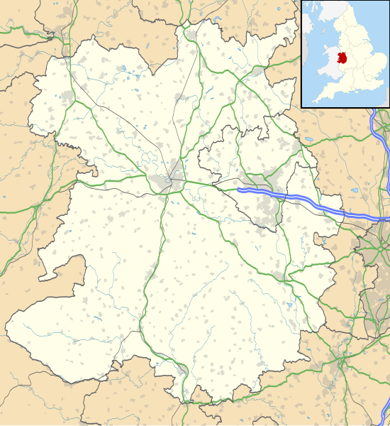
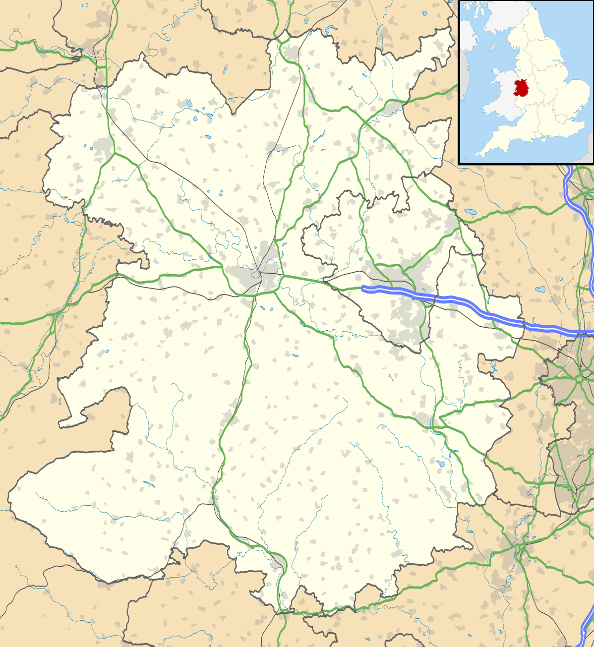
Map of Shropshire, UK with the following information shown:
Equirectangular map projection on WGS 84 datum, with N/S stretched 165% Geographic limits:
|
| Data | |
| Font |
|
| Autor | Nilfanion, created using Ordnance Survey data |
| Permís (Com reutilitzar aquest fitxer) |
Aquest fitxer està subjecte a la llicència de Creative Commons Reconeixement i Compartir Igual 3.0 No adaptada. Reconeixement: Contains Ordnance Survey data © Crown copyright and database right
|
| Altres versions | File:Shropshire UK district map (blank).svg - Blank map |
.svg)
Historial del fitxer
Cliqueu una data/hora per veure el fitxer tal com era aleshores.
| Data/hora | Miniatura | Dimensions | Usuari/a | Comentari | |
|---|---|---|---|---|---|
| actual | 21:51, 16 oct 2010 | | 1.198 × 1.305 (2,13 Mo) | Nilfanion | fix to A442 |
| 21:11, 26 set 2010 |  | 1.198 × 1.305 (2,12 Mo) | Nilfanion | {{Information |Description=Map of Shropshire, UK with the following information shown: *Administrative borders *Coastline, lakes and rivers *Roads and railways *Urban areas Equirectangular map projection on WGS 84 datum, with N/S stretch |
Ús del fitxer
No hi ha pàgines que utilitzin aquest fitxer.
Ús global del fitxer
Utilització d'aquest fitxer en altres wikis:
- Utilització a ar.wikipedia.org
- Utilització a azb.wikipedia.org
- Utilització a bg.wikipedia.org
- Utilització a ceb.wikipedia.org
- Utilització a cy.wikipedia.org
- Utilització a en.wikipedia.org
- Ludlow
- Ironbridge
- Stokesay Castle
- Telford
- Ludlow Castle
- Church Stretton
- Newport, Shropshire
- Oswestry
- Old Oswestry
- Whitchurch, Shropshire
- Market Drayton
- Bishop's Castle
- Bridgnorth
- Ellesmere, Shropshire
- Alveley
- Baschurch
- Woore
- Ruyton-XI-Towns
- Viroconium Cornoviorum
- Sheriffhales
- Weston Lullingfields
- Wroxeter
- Hampton Loade
- Clun
- Coalbrookdale
- Atcham
- Clun Castle
- Shawbury
- Shrewsbury Castle
- Attingham Park
- Wellington, Shropshire
- Oakengates
- Donnington, Telford
- Wem
- RAF Shawbury
- Much Wenlock
- Hopton Heath
- Sundorne
- Harlescott
- Ditherington
- Nesscliffe
- Cleobury Mortimer
- Hay Inclined Plane
- Snailbeach
- Pontesbury
Vegeu més usos globals d'aquest fitxer.