
Fitxer:US-IN-Columbia City.png

Mida d'aquesta previsualització: 384 × 600 píxels. Altres resolucions: 153 × 240 píxels | 512 × 800 píxels.
Fitxer original (512 × 800 píxels, mida del fitxer: 33 Ko, tipus MIME: image/png)
| Aquest fitxer i la informació mostrada a continuació provenen del dipòsit multimèdia lliure Wikimedia Commons. |
Resum
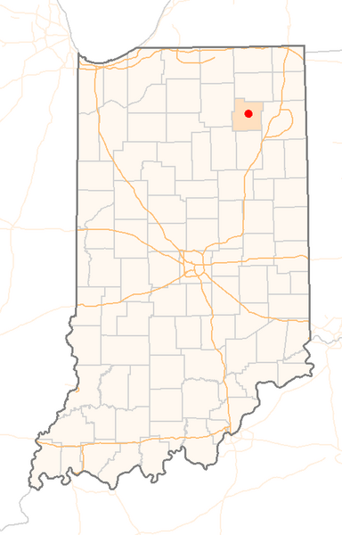
| Descripció | Red Dot map of Indiana, showing the location of Columbia_City |
| Data | (UTC) |
| Font | Self-made with a custom-made GIS application from public data sources |
| Autor | Sean Baker ( Marvin01 | talk ) |
| Permís (Com reutilitzar aquest fitxer) |
Free use, with attribution, under the Cc-by-2.0 license (see below). If you copy this image to modify it for another purpose, please respect the terms of this license and add a link back to the original image on the description page, or contact me to waive this restriction. |
| Altres versions | none |
Llicència
Aquest fitxer està disponible sota la llicència Creative Commons Reconeixement 2.0 Genèrica.
- Sou lliure de:
- compartir – copiar, distribuir i comunicar públicament l'obra
- adaptar – fer-ne obres derivades
- Amb les condicions següents:
- reconeixement – Heu de donar la informació adequada sobre l'autor, proporcionar un enllaç a la llicència i indicar si s'han realitzat canvis. Podeu fer-ho amb qualsevol mitjà raonable, però de cap manera no suggereixi que l'autor us dóna suport o aprova l'ús que en feu.
Historial del fitxer
Cliqueu una data/hora per veure el fitxer tal com era aleshores.
| Data/hora | Miniatura | Dimensions | Usuari/a | Comentari | |
|---|---|---|---|---|---|
| actual | 08:19, 22 oct 2005 | | 512 × 800 (33 Ko) | Marvin01 | {{User:Marvin01/Template:US-IN-Information|city=Columbia_City|date=~~~~~}} Category:Locator_maps_of_cities_in_Indiana |
Ús del fitxer
No hi ha pàgines que utilitzin aquest fitxer.
Ús global del fitxer
Utilització d'aquest fitxer en altres wikis:
- Utilització a ceb.wikipedia.org
- Utilització a fa.wikipedia.org
- Utilització a zh-min-nan.wikipedia.org