
Fitxer:Historical and current boundaries of Lancashire.png
Mida d'aquesta previsualització: 411 × 600 píxels. Altres resolucions: 164 × 240 píxels | 329 × 480 píxels | 847 × 1.236 píxels.
Fitxer original (847 × 1.236 píxels, mida del fitxer: 191 Ko, tipus MIME: image/png)
| Aquest fitxer i la informació mostrada a continuació provenen del dipòsit multimèdia lliure Wikimedia Commons. |
Resum
| Descripció |
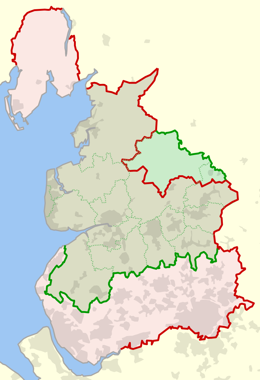
English: The historical boundary of the county of Lancashire, England, shown in red, and the modern-day boundary (since 1974), shown in green. Also shown in dotted green are the modern-day local government districts and unitary authorities of ceremonial Lancashire. |
| Data | |
| Font | Treball propi |
| Autor | Dr Greg |
References
- (1929) Combined index shewing civil parishes and the Ordnance Survey of Lancashire archive copy at the Wayback Machine, Ordnance Survey, accessed 2010-06-12
- MARIO: Maps & Related Information Online, Lancashire County Council website, accessed 2010-06-12
- OS OpenData, Ordnance Survey website, accessed 2010-06-12
Llicència
| Jo, el titular del copyright d'aquesta obra, l'allibero al domini públic. Això s'aplica a tot el món. En alguns països això pot no ser legalment possible, en tal cas: Jo faig concessió a tothom del dret d'usar aquesta obra per a qualsevol propòsit, sense cap condició llevat d'aquelles requerides per la llei. |
Historial del fitxer
Cliqueu una data/hora per veure el fitxer tal com era aleshores.
| Data/hora | Miniatura | Dimensions | Usuari/a | Comentari | |
|---|---|---|---|---|---|
| actual | 00:14, 13 juny 2010 | | 847 × 1.236 (191 Ko) | Dr Greg | {{Information |Description={{en|1=The historical boundary of the county of en:Lancashire, England, shown in red, and the modern-day boundary (since 1974), shown in green. Also shown in dotted green are the modern-day local government districts and u |
Ús del fitxer
La pàgina següent utilitza aquest fitxer:
Ús global del fitxer
Utilització d'aquest fitxer en altres wikis:
- Utilització a en.wikipedia.org
- Utilització a fr.wikipedia.org
- Utilització a hu.wikipedia.org
- Utilització a lt.wikipedia.org
- Utilització a pt.wikipedia.org