
Fitxer:20180924-OSEC-LSC-1160 (43110332950).jpg
Mida d'aquesta previsualització: 800 × 533 píxels. Altres resolucions: 320 × 213 píxels | 640 × 427 píxels | 1.024 × 683 píxels | 1.280 × 853 píxels | 2.560 × 1.707 píxels | 5.266 × 3.511 píxels.
Fitxer original (5.266 × 3.511 píxels, mida del fitxer: 22,54 Mo, tipus MIME: image/jpeg)
| Aquest fitxer i la informació mostrada a continuació provenen del dipòsit multimèdia lliure Wikimedia Commons. |
.jpg?uselang=ca)
Resum
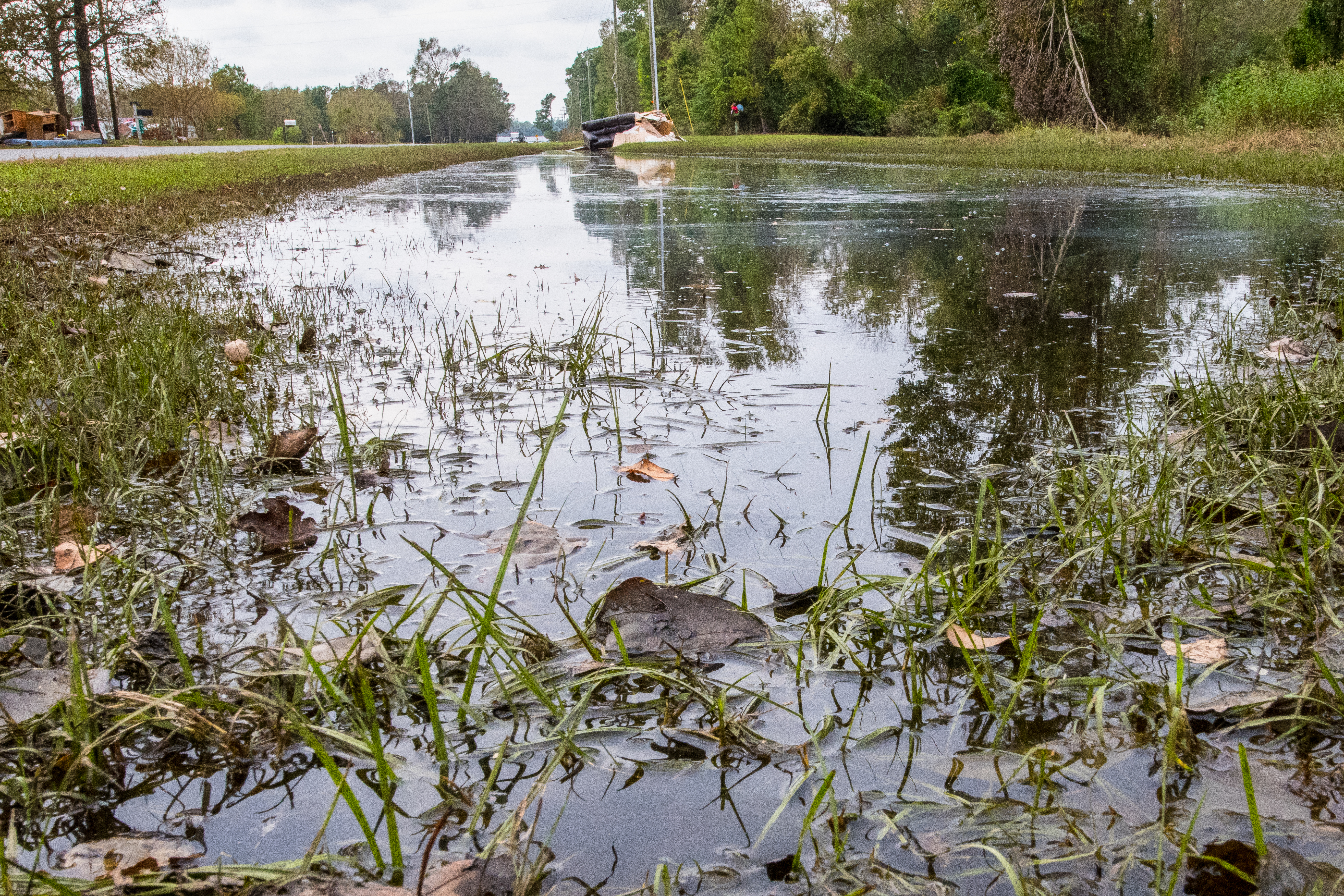
| Descripció | Signs of the effect that Hurricane Florence had on the farms, producers, cities, towns, communities, and people of Duplin County, NC, on Monday, September 24, 2018. USDA photo by Lance Cheung. |
| Data | |
| Font | 20180924-OSEC-LSC-1160 |
| Autor | U.S. Department of Agriculture |
| Posició de la càmera | | Aquesta i altres imatges properes a: OpenStreetMap |
|---|
.jpg¶ms=034.864044_N_-077.881634_E_globe:Earth_type:camera_source:Flickr_&language=ca)
Llicència
This image or file is a work of a United States Department of Agriculture employee, taken or made as part of that person's official duties. As a work of the U.S. federal government, the image is in the public domain.
|
 |
| This image was originally posted to Flickr by USDAgov at https://flickr.com/photos/41284017@N08/43110332950 (archive). It was reviewed on 12 d'octubre de 2018 by FlickreviewR 2 and was confirmed to be licensed under the terms of the Public Domain Mark. |
Historial del fitxer
Cliqueu una data/hora per veure el fitxer tal com era aleshores.
| Data/hora | Miniatura | Dimensions | Usuari/a | Comentari | |
|---|---|---|---|---|---|
| actual | 10:09, 12 oct 2018 | | 5.266 × 3.511 (22,54 Mo) | A1Cafel | Transferred from Flickr via #flickr2commons |
Ús del fitxer
La pàgina següent utilitza aquest fitxer:
Ús global del fitxer
Utilització d'aquest fitxer en altres wikis:
- Utilització a en.wikipedia.org
- Utilització a pt.wikipedia.org
.jpg)