
Fitxer:Asia Menor y Estados Cruzados - 1140.jpg
Fitxer original (1.097 × 1.185 píxels, mida del fitxer: 441 Ko, tipus MIME: image/jpeg)
| Aquest fitxer i la informació mostrada a continuació provenen del dipòsit multimèdia lliure Wikimedia Commons. |

|
File:Asia Minor and the States of the Crusaders.svg és una versió vectorial (SVG) d'aquest fitxer. En cas de ser millor, hauria de ser emprada en lloc d'aquesta imatge tramada.
File:Asia Menor y Estados Cruzados - 1140.jpg → File:Asia Minor and the States of the Crusaders.svg
Per a més informació pel que fa als gràfics vectorials, llegiu la transició a SVG en Commons. També hi ha informació quant a la compatibilitat del MediaWiki amb les imatges SVG. |
 |
Resum
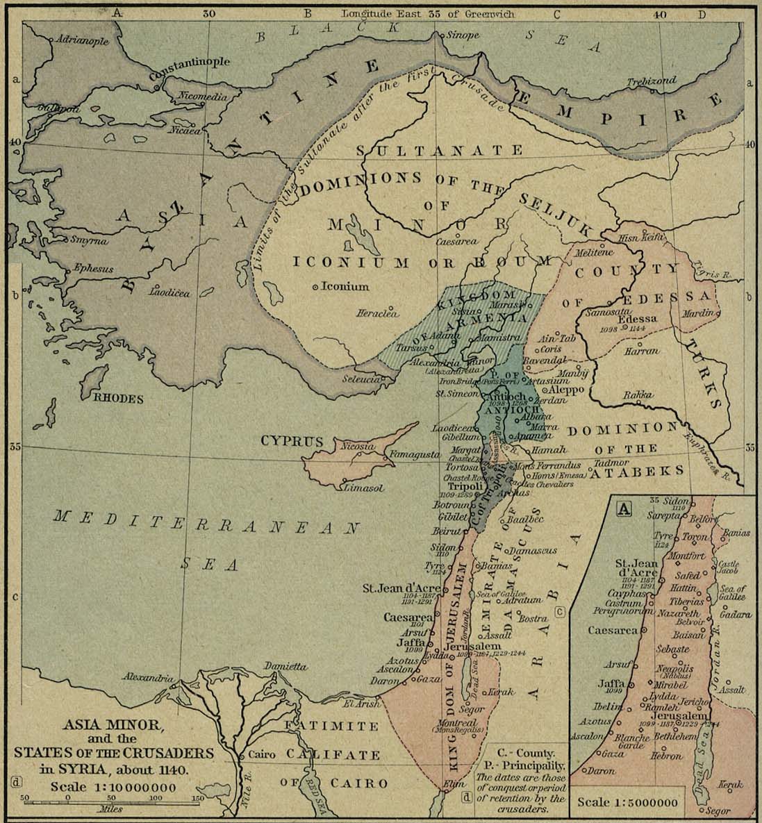
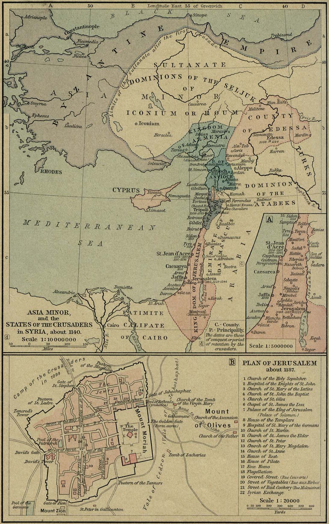
| Descripció | Asia Minor at the time of the First Mithridatical War. |
| Data | |
| Font |
The Historical Atlas, by William R. Shepherd, 1911. Original image at the Perry-Castañeda Library Map Collection at the University of Texas at Austin website: http://www.lib.utexas.edu/maps/historical/shepherd/asia_minor_1140.jpg
|
| Autor |
William Robert Shepherd |
Llicència
|
Aquest material està en domini públic als Estats Units i als altres països on el dret d'autor s'estén per 70 anys (o menys) després de la mort de l'autor.
| |
| Aquest fitxer està identificat com a lliure de restriccions conegudes sota la llei de drets d'autor, inclosos els drets veïns. | |
Historial del fitxer
Cliqueu una data/hora per veure el fitxer tal com era aleshores.
| Data/hora | Miniatura | Dimensions | Usuari/a | Comentari | |
|---|---|---|---|---|---|
| actual | 01:33, 8 nov 2006 | | 1.097 × 1.185 (441 Ko) | Bertie Wooster | Mapa de Asia Menor y los Estados cruzados en 1140 - Historical Atlas by William R. Shepherd, 1923. |
Ús del fitxer
La pàgina següent utilitza aquest fitxer:
Ús global del fitxer
Utilització d'aquest fitxer en altres wikis:
- Utilització a tr.wikipedia.org