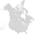
Fitxer:BlankMap-USA-states-Canada-provinces, HI closer.svg
Aparença

Mida d'aquesta previsualització PNG del fitxer SVG: 512 × 512 píxels. Altres resolucions: 240 × 240 píxels | 480 × 480 píxels | 768 × 768 píxels | 1.024 × 1.024 píxels | 2.048 × 2.048 píxels.
Fitxer original (fitxer SVG, nominalment 512 × 512 píxels, mida del fitxer: 104 Ko)
Historial del fitxer
Cliqueu una data/hora per veure el fitxer tal com era aleshores.
| Data/hora | Miniatura | Dimensions | Usuari/a | Comentari | |
|---|---|---|---|---|---|
| actual | 02:48, 23 nov 2020 |  | 512 × 512 (104 Ko) | Ponderosapine210 | Accidentally uploaded wrong version. Here is the correct one. |
| 02:38, 23 nov 2020 |  | 512 × 596 (132 Ko) | Ponderosapine210 | Added the prominent islands of Manitoulin (Ontario) and Isle Royale (Michigan) to the Great Lakes. | |
| 23:59, 1 juny 2019 |  | 512 × 512 (99 Ko) | Fluffy89502 | added territories | |
| 22:18, 8 des 2007 |  | 1.730 × 1.730 (212 Ko) | Lokal Profil | Code trimming | |
| 05:21, 3 jul 2007 |  | 1.730 × 1.730 (213 Ko) | Lokal Profil | {{Information |Description={{en|Blank SVG map of USA and Canada with state and province borders. Hawaii has been moved closer to the mainland USA to reduce width of image.}} Non-contiguous parts of a states/provinces are "grouped" together with the main a |
Ús del fitxer
No hi ha pàgines que utilitzin aquest fitxer.
Ús global del fitxer
Utilització d'aquest fitxer en altres wikis:
- Utilització a en.wikipedia.org
- Utilització a fr.wikipedia.org

