
Fitxer:Castle Hills - geograph.org.uk - 975629.jpg
No hi ha cap versió amb una resolució més gran.
Castle_Hills_-_geograph.org.uk_-_975629.jpg (640 × 427 píxels, mida del fitxer: 82 Ko, tipus MIME: image/jpeg)
| Aquest fitxer i la informació mostrada a continuació provenen del dipòsit multimèdia lliure Wikimedia Commons. |
Resum
| Descripció |
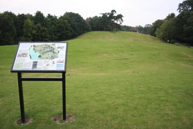
English: Castle Hills The display board shows that the mound was the site of a motte and bailey castle following the Norman invasion, and was used by Vikings before and in the Civil War later as a stronghold. The A14 flyover now runs perilously close to the south of the site (behind the trees on the left of this picture) |
| Data | |
| Font | From geograph.org.uk |
| Autor | Duncan Grey |
| Reconeixement (required by the license) | Duncan Grey / Castle Hills / |
| Posició de la càmera | | Aquesta i altres imatges properes a: OpenStreetMap |
|---|
_heading:270.00&language=ca)
| Posició de l'objecte | | Aquesta i altres imatges properes a: OpenStreetMap |
|---|
_heading:270.00&language=ca)
Llicència

|
Aquesta imatge prové de la col·lecció del projecte Geograph British Isles. Vegeu la pàgina d'aquesta fotografia al lloc web Geograph per a més informació del fotògraf. El titular dels drets d'autor d'aquesta imatge és Duncan Grey i autoritza utilitzar-la sota la llicència Reconeixement-CompartirIgual 2.0 de Creative Commons.
|
Aquest fitxer està publicat sota la llicència de Creative Commons Reconeixement i Compartir Igual 2.0 Genèrica.
Reconeixement: Duncan Grey
- Sou lliure de:
- compartir – copiar, distribuir i comunicar públicament l'obra
- adaptar – fer-ne obres derivades
- Amb les condicions següents:
- reconeixement – Heu de donar la informació adequada sobre l'autor, proporcionar un enllaç a la llicència i indicar si s'han realitzat canvis. Podeu fer-ho amb qualsevol mitjà raonable, però de cap manera no suggereixi que l'autor us dóna suport o aprova l'ús que en feu.
- compartir igual – Si modifiqueu, transformeu, o generareu amb el material, haureu de distribuir les vostres contribucions sota una llicència similar o una de compatible com l'original
Historial del fitxer
Cliqueu una data/hora per veure el fitxer tal com era aleshores.
| Data/hora | Miniatura | Dimensions | Usuari/a | Comentari | |
|---|---|---|---|---|---|
| actual | 21:52, 22 feb 2011 | | 640 × 427 (82 Ko) | GeographBot | == {{int:filedesc}} == {{Information |description={{en|1=Castle Hills The display board shows that the mound was the site of a motte and bailey castle following the Norman invasion, and was used by Vikings before and in the Civil War later as a stronghold |
Ús del fitxer
La pàgina següent utilitza aquest fitxer:
Ús global del fitxer
Utilització d'aquest fitxer en altres wikis:
- Utilització a ceb.wikipedia.org
- Utilització a de.wikipedia.org
- Utilització a en.wikipedia.org
- Utilització a it.wikipedia.org
- Utilització a no.wikipedia.org
- Utilització a pt.wikipedia.org
- Utilització a www.wikidata.org