
Fitxer:Chapel St Leonards in 2006.jpg
Chapel_St_Leonards_in_2006.jpg (640 × 446 píxels, mida del fitxer: 111 Ko, tipus MIME: image/jpeg)
| Aquest fitxer i la informació mostrada a continuació provenen del dipòsit multimèdia lliure Wikimedia Commons. |
| Descripció |
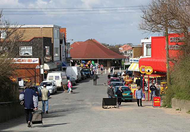
The Pullover at Chapel St Leonards, leading behind to the beach.
Original description: Chapel St Leonards |
| Data | |
| Font | From geograph.org.uk |
| Autor | Tony Atkin |
| Permís (Com reutilitzar aquest fitxer) |
Creative Commons Attribution Share-alike license 2.0 |
| Posició de la càmera | | Aquesta i altres imatges properes a: OpenStreetMap |
|---|

|
Aquesta imatge prové de la col·lecció del projecte Geograph British Isles. Vegeu la pàgina d'aquesta fotografia al lloc web Geograph per a més informació del fotògraf. El titular dels drets d'autor d'aquesta imatge és Tony Atkin i autoritza utilitzar-la sota la llicència Reconeixement-CompartirIgual 2.0 de Creative Commons.
|
- Sou lliure de:
- compartir – copiar, distribuir i comunicar públicament l'obra
- adaptar – fer-ne obres derivades
- Amb les condicions següents:
- reconeixement – Heu de donar la informació adequada sobre l'autor, proporcionar un enllaç a la llicència i indicar si s'han realitzat canvis. Podeu fer-ho amb qualsevol mitjà raonable, però de cap manera no suggereixi que l'autor us dóna suport o aprova l'ús que en feu.
- compartir igual – Si modifiqueu, transformeu, o generareu amb el material, haureu de distribuir les vostres contribucions sota una llicència similar o una de compatible com l'original
Historial del fitxer
Cliqueu una data/hora per veure el fitxer tal com era aleshores.
| Data/hora | Miniatura | Dimensions | Usuari/a | Comentari | |
|---|---|---|---|---|---|
| actual | 10:37, 17 maig 2008 | | 640 × 446 (111 Ko) | Edward | {{Information |Description=w:Chapel St Leonards Original description: '''Chapel St Leonards''' |Source=From [http://www.geograph.org.uk/photo/154851 geograph.org.uk] |Date=Monday, 17 April, 2006 |Author=[http://www.geograph.org.uk/profile/1324 Ton |
Ús del fitxer
La pàgina següent utilitza aquest fitxer:
Ús global del fitxer
Utilització d'aquest fitxer en altres wikis:
- Utilització a en.wikipedia.org
- Utilització a nl.wikipedia.org
- Utilització a pl.wikipedia.org