
Fitxer:Diehls Covered Bridge.jpg
Mida d'aquesta previsualització: 800 × 549 píxels. Altres resolucions: 320 × 220 píxels | 640 × 439 píxels | 1.024 × 703 píxels | 1.280 × 879 píxels | 2.560 × 1.758 píxels | 4.772 × 3.277 píxels.
Fitxer original (4.772 × 3.277 píxels, mida del fitxer: 1,67 Mo, tipus MIME: image/jpeg)
| Aquest fitxer i la informació mostrada a continuació provenen del dipòsit multimèdia lliure Wikimedia Commons. |
|
This is an image of a place or building that is listed on the National Register of Historic Places in the United States of America. Its reference number is 80003420. |
| Posició de la càmera | | Aquesta i altres imatges properes a: OpenStreetMap |
|---|
| Descripció |
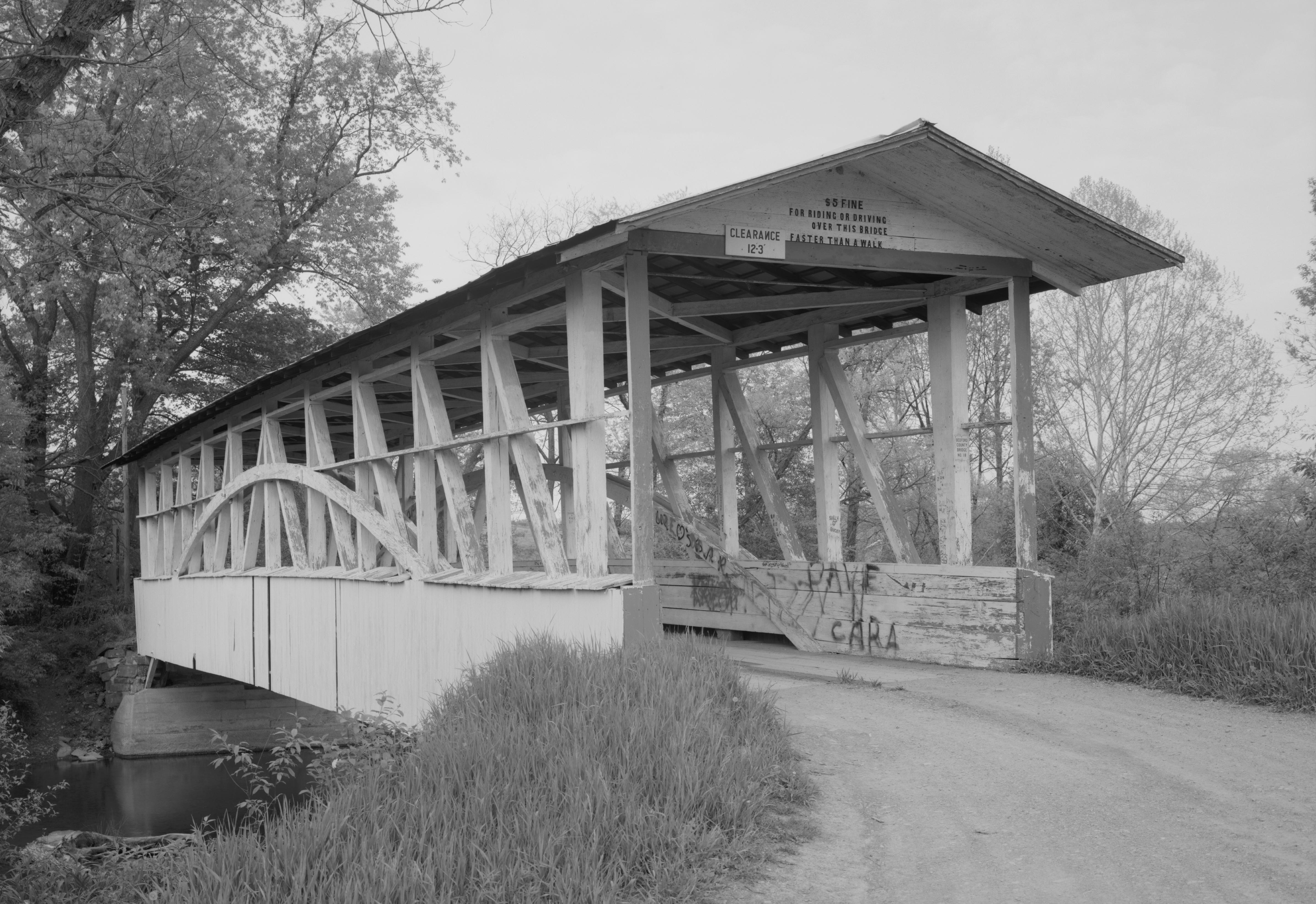
English: Southern end of the Diehls Covered Bridge, which carries Township Route 418 over the Raystown Branch of the Juniata River south of Schellsburg in Harrison and Napier Townships of Bedford County, Pennsylvania, United States. Built in 1892, this Burr arch truss bridge is listed on the National Register of Historic Places. |
|||||||||||||||||||||||
| Data | ||||||||||||||||||||||||
| Font | Library of Congress, Prints and Photograph Division HAER: PA,5-MANCH.V,1-1 | |||||||||||||||||||||||
| Autor |
|
|||||||||||||||||||||||
| Permís (Com reutilitzar aquest fitxer) |
|
|||||||||||||||||||||||
.jpg)

|
This image is available from the United States Library of Congress's Prints and Photographs division
under the digital ID hhh.pa3207. This tag does not indicate the copyright status of the attached work. A normal copyright tag is still required. See Commons:Licensing.
|
Historial del fitxer
Cliqueu una data/hora per veure el fitxer tal com era aleshores.
| Data/hora | Miniatura | Dimensions | Usuari/a | Comentari | |
|---|---|---|---|---|---|
| actual | 15:51, 21 des 2009 | | 4.772 × 3.277 (1,67 Mo) | Nyttend | {{Location|40|0|34|N|78|38|55|W}} {{Information |Description={{en|Southern end of the {{w|Diehls Covered Bridge}}, which carries Township Route 418 over the {{w|Raystown Branch Juniata River|Raystown Branch}} of the {{w|Juniata River}} south of {{w|Schell |
Ús del fitxer
La pàgina següent utilitza aquest fitxer:
Ús global del fitxer
Utilització d'aquest fitxer en altres wikis:
- Utilització a en.wikipedia.org
- Utilització a es.wikipedia.org
- Utilització a fr.wikipedia.org
- Utilització a ha.wikipedia.org
- Utilització a it.wikipedia.org
- Utilització a tl.wikipedia.org
- Utilització a uk.wikipedia.org
- Utilització a ur.wikipedia.org
- Utilització a vi.wikipedia.org
- Utilització a www.wikidata.org