
Fitxer:Ellington crater Berkel crater EW0252814064I.3band.plusmono.png
Fitxer original (1.422 × 1.423 píxels, mida del fitxer: 2,29 Mo, tipus MIME: image/png)
| Aquest fitxer i la informació mostrada a continuació provenen del dipòsit multimèdia lliure Wikimedia Commons. |
Resum
| Descripció |
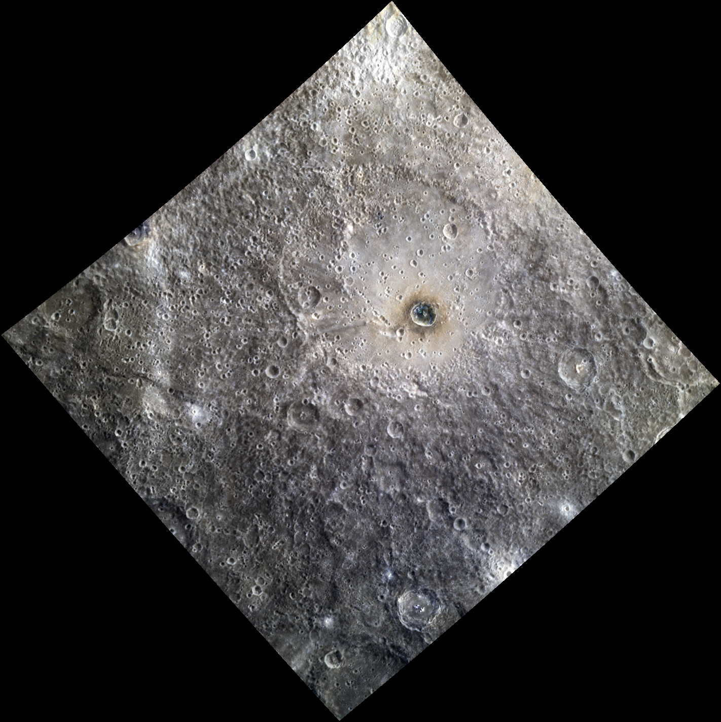
English: Date acquired: August 07, 2012 Image Mission Elapsed Time (MET): 252814064, 252814056, 252814060 Of Interest: Ellington basin, named in 2012 for American jazz legend Duke Ellington (1899-1974), is a peak ring basin covered in secondary craters. The prominent crater Berkel lies inside of the basin. Berkel's ejecta and floor exhibit differences in reflectance and color, indicating a heterogeneous local stratigraphy. This image was created by merging a color image with a monochrome image, in order to emphasize both the topography and the color of the area. The color portion of this image was acquired as part of MDIS's high-resolution 3-color imaging campaign. The 3-color campaign is a major mapping activity in MESSENGER's extended mission. It complements the 8-color base map (at an average resolution of 1 km/pixel) acquired during MESSENGER's primary mission by imaging Mercury's surface in a subset of the color filters at the highest resolution possible. The three narrow-band color filters are centered at wavelengths of 430 nm, 750 nm, and 1000 nm, and image resolutions generally range from 100 to 400 meters/pixel in the northern hemisphere. The monochrome portion of this image is part of MDIS's high-resolution surface morphology base map. The surface morphology base map covers more than 90% of Mercury's surface with an average resolution of 250 meters/pixel (0.16 miles/pixel or 820 feet/pixel). Images acquired for the surface morphology base map typically have off-vertical Sun angles (i.e., high incidence angles) and visible shadows so as to reveal clearly the topographic form of geologic features. |
| Data | |
| Font | IT DON'T MEAN A THING |
| Autor | NASA/Johns Hopkins University Applied Physics Laboratory/Carnegie Institution of Washington |
Llicència
| Aquest fitxer és en el domini públic perquè ha estat creat per la NASA. L'avís legal de la NASA diu que «el material de la NASA no està protegit per copyright si no es diu el contrari». (NASA copyright policy page o JPL Image Use Policy). | ||
 |
Atenció:
|
Historial del fitxer
Cliqueu una data/hora per veure el fitxer tal com era aleshores.
| Data/hora | Miniatura | Dimensions | Usuari/a | Comentari | |
|---|---|---|---|---|---|
| actual | 21:47, 15 ago 2020 | | 1.422 × 1.423 (2,29 Mo) | Jstuby | Uploaded a work by NASA/Johns Hopkins University Applied Physics Laboratory/Carnegie Institution of Washington from [https://messenger.jhuapl.edu/Explore/Science-Images-Database/gallery-image-1067.html IT DON'T MEAN A THING] with UploadWizard |
Ús del fitxer
La pàgina següent utilitza aquest fitxer:
Ús global del fitxer
Utilització d'aquest fitxer en altres wikis:
- Utilització a en.wikipedia.org
- Utilització a it.wikipedia.org
- Utilització a www.wikidata.org