
Fitxer:Fergana Valley map-de.svg

Mida d'aquesta previsualització PNG del fitxer SVG: 800 × 599 píxels. Altres resolucions: 320 × 240 píxels | 640 × 479 píxels | 1.024 × 767 píxels | 1.280 × 958 píxels | 2.560 × 1.917 píxels | 840 × 629 píxels.
Fitxer original (fitxer SVG, nominalment 840 × 629 píxels, mida del fitxer: 1,22 Mo)
| Aquest fitxer i la informació mostrada a continuació provenen del dipòsit multimèdia lliure Wikimedia Commons. |
Resum
| Descripció |
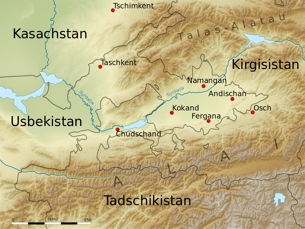
English: Map of the Fergana Valley.
Equirectangular projection. Strechted by 131.0%. Geographic limits of the map:
|
| Data | |
| Font | Treball propi |
| Autor | Uwe Dedering |
| Altres versions |
|

Llicència
Jo, el titular dels drets d'autor d'aquest treball, el public sota les següents llicències:
Aquest fitxer està subjecte a la llicència de Creative Commons Reconeixement i Compartir Igual 3.0 No adaptada.
- Sou lliure de:
- compartir – copiar, distribuir i comunicar públicament l'obra
- adaptar – fer-ne obres derivades
- Amb les condicions següents:
- reconeixement – Heu de donar la informació adequada sobre l'autor, proporcionar un enllaç a la llicència i indicar si s'han realitzat canvis. Podeu fer-ho amb qualsevol mitjà raonable, però de cap manera no suggereixi que l'autor us dóna suport o aprova l'ús que en feu.
- compartir igual – Si modifiqueu, transformeu, o generareu amb el material, haureu de distribuir les vostres contribucions sota una llicència similar o una de compatible com l'original

|
S'autoritza la còpia, la distribució i la modificació d'aquest document sota els termes de la llicència de documentació lliure GNU versió 1.2 o qualsevol altra versió posterior que publiqui la Free Software Foundation; sense seccions invariants, ni textos de portada, ni textos de contraportada. S'inclou una còpia d'aquesta llicència en la secció titulada GNU Free Documentation License. |
Podeu seleccionar la llicència que vulgueu.
Historial del fitxer
Cliqueu una data/hora per veure el fitxer tal com era aleshores.
| Data/hora | Miniatura | Dimensions | Usuari/a | Comentari | |
|---|---|---|---|---|---|
| actual | 15:48, 19 juny 2010 | | 840 × 629 (1,22 Mo) | Uwe Dedering | +Chudschand |
| 20:44, 18 juny 2010 |  | 840 × 629 (1,22 Mo) | Uwe Dedering | no text on path | |
| 20:36, 18 juny 2010 |  | 840 × 629 (1,22 Mo) | Uwe Dedering | more minor changes | |
| 19:17, 18 juny 2010 |  | 840 × 629 (1,22 Mo) | Uwe Dedering | some minor edits | |
| 17:46, 18 juny 2010 |  | 840 × 629 (1,23 Mo) | Uwe Dedering | some improvments | |
| 14:53, 17 juny 2010 |  | 840 × 629 (1,23 Mo) | Uwe Dedering | image embedded | |
| 14:47, 17 juny 2010 |  | 840 × 629 (185 Ko) | Uwe Dedering | {{Information |Description={{en|1=Map of the Fergana Valley. Equirectangular projection. Strechted by 131.0%. Geographic limits of the map: * N: 42.5° N * S: 38.5° N * W: 67.0° E * E: 74.0° E Made with Natural Earth. Free vector and raster map data |
Ús del fitxer
La pàgina següent utilitza aquest fitxer:
Ús global del fitxer
Utilització d'aquest fitxer en altres wikis:
- Utilització a de.wikipedia.org
- Utilització a et.wikipedia.org
- Utilització a fr.wikipedia.org
- Utilització a hsb.wikipedia.org
- Utilització a ky.wikipedia.org
- Utilització a lt.wikipedia.org
- Utilització a ru.wikivoyage.org